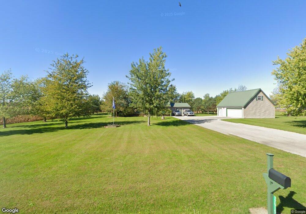
17915 Santa Fe Line Rd Waynesfield, OH 45896
Estimated Value: $340,000 - $463,000
3
Beds
2
Baths
2,847
Sq Ft
$141/Sq Ft
Est. Value
About This Home
This home is located at 17915 Santa Fe Line Rd, Waynesfield, OH 45896 and is currently estimated at $402,444, approximately $141 per square foot. 17915 Santa Fe Line Rd is a home located in Auglaize County with nearby schools including Waynesfield-Goshen Local Elementary School and Waynesfield-Goshen Local High School.
Ownership History
Date
Name
Owned For
Owner Type
Purchase Details
Closed on
Oct 26, 2012
Sold by
Shepherd Terry C and Shepherd Jolene Kay
Bought by
Shepherd Terry C and Shepherd Jolene Kay
Current Estimated Value
Home Financials for this Owner
Home Financials are based on the most recent Mortgage that was taken out on this home.
Original Mortgage
$196,000
Outstanding Balance
$135,183
Interest Rate
3.35%
Mortgage Type
New Conventional
Estimated Equity
$267,261
Purchase Details
Closed on
Mar 6, 2001
Sold by
Cross Teddy D
Bought by
Shepherd Terry C
Purchase Details
Closed on
Jun 27, 1995
Sold by
Anthony Robert J and Anthony Janet L
Bought by
Cross Teddy D
Create a Home Valuation Report for This Property
The Home Valuation Report is an in-depth analysis detailing your home's value as well as a comparison with similar homes in the area
Home Values in the Area
Average Home Value in this Area
Purchase History
| Date | Buyer | Sale Price | Title Company |
|---|---|---|---|
| Shepherd Terry C | -- | First American | |
| Shepherd Terry C | $120,000 | -- | |
| Cross Teddy D | $6,500 | -- |
Source: Public Records
Mortgage History
| Date | Status | Borrower | Loan Amount |
|---|---|---|---|
| Open | Shepherd Terry C | $196,000 |
Source: Public Records
Tax History Compared to Growth
Tax History
| Year | Tax Paid | Tax Assessment Tax Assessment Total Assessment is a certain percentage of the fair market value that is determined by local assessors to be the total taxable value of land and additions on the property. | Land | Improvement |
|---|---|---|---|---|
| 2024 | $5,966 | $95,300 | $9,670 | $85,630 |
| 2023 | $3,458 | $95,300 | $9,670 | $85,630 |
| 2022 | $2,844 | $67,240 | $9,090 | $58,150 |
| 2021 | $2,839 | $67,240 | $9,090 | $58,150 |
| 2020 | $2,842 | $67,243 | $9,090 | $58,153 |
| 2019 | $2,331 | $56,323 | $7,578 | $48,745 |
| 2018 | $2,201 | $55,714 | $7,578 | $48,136 |
| 2017 | $2,163 | $55,714 | $7,578 | $48,136 |
| 2016 | $1,968 | $52,214 | $7,214 | $45,000 |
| 2015 | $1,969 | $52,214 | $7,214 | $45,000 |
| 2014 | $1,972 | $52,214 | $7,214 | $45,000 |
| 2013 | $3,377 | $52,214 | $7,214 | $45,000 |
Source: Public Records
Map
Nearby Homes
- 18258 Graham Rd
- 202 Karen St
- 25836 Ohio 67
- 5065 Amherst Rd
- 21015 Fairmount Rd
- 8150 Amherst Rd
- 20630 State Route 67
- 4850 Bowdle Rd
- 80 Main St
- 17 E Walnut St
- 0 Ohio 67
- 7165 Faulkner Rd
- 6616 Bellefontaine Rd
- 3370 Johnston Rd
- 6480 McPheron Rd
- 6381 McPheron Rd
- 6526 Bellefontaine Rd
- 1030 Hume Rd E
- E Hanthorn Rd
- 5600 E Hanthorn Rd
- 17961 Santa Fe Line Rd
- 23897 Fairmount Rd
- 18093 Santa Fe Line Rd
- 17753 Santa Fe Line Rd
- 17693 Santa Fe Line Rd
- 23739 Fairmount Rd
- 18140 Santa Fe Line Rd
- 23691 Fairmount Rd
- 18186 Santa Fe Line Rd
- 18143 Santa Fe Line Rd
- 17613 Santa Fe Line Rd
- 17371 Santa Fe Line Rd
- 24340 Fairmount Rd
- 23524 Fairmount Rd
- 23526 Fairmount Rd
- 23526 Fairmount Rd
- 18376 Santa Fe Line Rd
- 18424 Santa Fe Line Rd
- 23481 Fairmount Rd