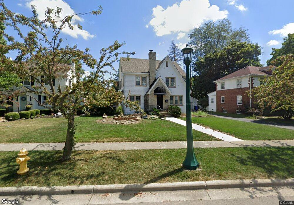
1792 Andover Rd Columbus, OH 43212
Estimated Value: $756,000 - $810,379
4
Beds
3
Baths
2,292
Sq Ft
$341/Sq Ft
Est. Value
About This Home
This home is located at 1792 Andover Rd, Columbus, OH 43212 and is currently estimated at $781,345, approximately $340 per square foot. 1792 Andover Rd is a home located in Franklin County with nearby schools including Barrington Road Elementary School, Jones Middle School, and Upper Arlington High School.
Ownership History
Date
Name
Owned For
Owner Type
Purchase Details
Closed on
Jan 31, 2000
Sold by
Huth Lowell D and Huth Courtney F
Bought by
Oconnor Patrick C and Oconnor Eileen C
Current Estimated Value
Home Financials for this Owner
Home Financials are based on the most recent Mortgage that was taken out on this home.
Original Mortgage
$175,000
Outstanding Balance
$58,315
Interest Rate
8.27%
Estimated Equity
$723,030
Purchase Details
Closed on
Apr 14, 1992
Purchase Details
Closed on
Jan 1, 1984
Create a Home Valuation Report for This Property
The Home Valuation Report is an in-depth analysis detailing your home's value as well as a comparison with similar homes in the area
Home Values in the Area
Average Home Value in this Area
Purchase History
| Date | Buyer | Sale Price | Title Company |
|---|---|---|---|
| Oconnor Patrick C | $248,600 | -- | |
| -- | $169,500 | -- | |
| -- | $75,000 | -- |
Source: Public Records
Mortgage History
| Date | Status | Borrower | Loan Amount |
|---|---|---|---|
| Open | Oconnor Patrick C | $175,000 |
Source: Public Records
Tax History Compared to Growth
Tax History
| Year | Tax Paid | Tax Assessment Tax Assessment Total Assessment is a certain percentage of the fair market value that is determined by local assessors to be the total taxable value of land and additions on the property. | Land | Improvement |
|---|---|---|---|---|
| 2024 | $15,084 | $260,550 | $121,280 | $139,270 |
| 2023 | $15,527 | $260,540 | $121,275 | $139,265 |
| 2022 | $12,992 | $183,510 | $66,150 | $117,360 |
| 2021 | $11,351 | $183,510 | $66,150 | $117,360 |
| 2020 | $11,251 | $183,510 | $66,150 | $117,360 |
| 2019 | $11,337 | $163,240 | $66,150 | $97,090 |
| 2018 | $9,890 | $163,240 | $66,150 | $97,090 |
| 2017 | $11,332 | $163,240 | $66,150 | $97,090 |
| 2016 | $8,500 | $127,060 | $51,350 | $75,710 |
| 2015 | $8,493 | $127,060 | $51,350 | $75,710 |
| 2014 | $8,403 | $127,060 | $51,350 | $75,710 |
| 2013 | $4,062 | $115,500 | $46,690 | $68,810 |
Source: Public Records
Map
Nearby Homes
- 1782 Wyandotte Rd
- 1733 Elmwood Ave
- 1661 Ashland Ave Unit 663
- 1655-1657 Ashland Ave
- 1561 Glenn Ave
- 2015 W 5th Ave Unit 211
- 2015 W 5th Ave Unit 102
- 2015 W 5th Ave Unit 108
- 1631 Roxbury Rd Unit F3
- 1631 Roxbury Rd Unit B6
- 2110 Northwest Blvd
- 1459 Elmwood Ave Unit 1459
- 1398 Lower Green Cir Unit 1398
- 1364 W 7th Ave
- 1313 Lincoln Rd
- 1535 Doone Rd
- 1869 Tewksbury Rd
- 00 W 7th Ave
- 1263 Oakland Ave
- 1475 W 3rd Ave Unit 204
- 1782 Andover Rd
- 1798 Andover Rd
- 1776 Andover Rd
- 1806 Andover Rd
- 1777 Wyandotte Rd
- 1793 Wyandotte Rd
- 1793 Andover Rd
- 1769 Wyandotte Rd
- 1770 Andover Rd
- 1803 Andover Rd
- 1785 Andover Rd
- 1814 Andover Rd
- 1801 Wyandotte Rd
- 1781 Andover Rd
- 1761 Wyandotte Rd
- 1811 Tremont Rd
- 1764 Andover Rd
- 1771 Tremont Rd
- 1773 Andover Rd
- 1755 Wyandotte Rd