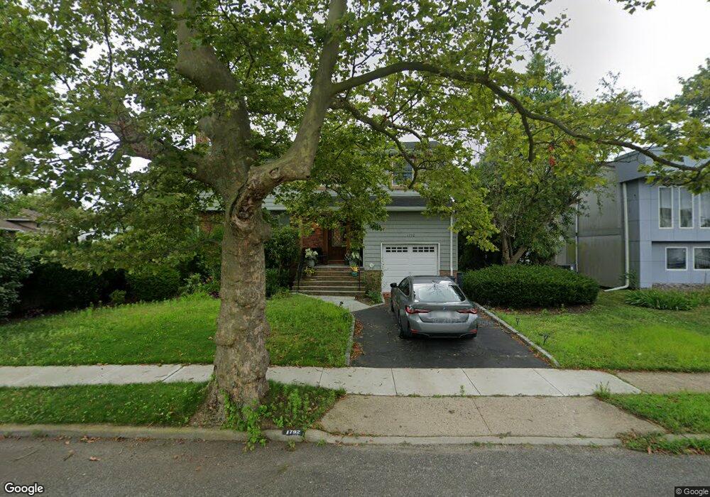
1792 Brian Ct Merrick, NY 11566
Estimated Value: $867,646 - $1,186,000
Studio
3
Baths
1,949
Sq Ft
$527/Sq Ft
Est. Value
About This Home
This home is located at 1792 Brian Ct, Merrick, NY 11566 and is currently estimated at $1,026,823, approximately $526 per square foot. 1792 Brian Ct is a home located in Nassau County with nearby schools including Merrick Avenue Middle School, John F. Kennedy High School, and Grace Christian Academy.
Ownership History
Date
Name
Owned For
Owner Type
Purchase Details
Closed on
Nov 15, 2021
Sold by
Aug Us Ten Inc
Bought by
Miller John and Itriyeva Khalida
Current Estimated Value
Home Financials for this Owner
Home Financials are based on the most recent Mortgage that was taken out on this home.
Original Mortgage
$719,000
Outstanding Balance
$658,839
Interest Rate
2.99%
Mortgage Type
New Conventional
Estimated Equity
$367,984
Purchase Details
Closed on
Mar 16, 2021
Sold by
Sack Richard and Sack Jeffrey B
Bought by
Aug Us Ten Inc
Create a Home Valuation Report for This Property
The Home Valuation Report is an in-depth analysis detailing your home's value as well as a comparison with similar homes in the area
Home Values in the Area
Average Home Value in this Area
Purchase History
| Date | Buyer | Sale Price | Title Company |
|---|---|---|---|
| Miller John | $899,000 | Advantage Title | |
| Aug Us Ten Inc | $535,000 | None Available |
Source: Public Records
Mortgage History
| Date | Status | Borrower | Loan Amount |
|---|---|---|---|
| Open | Miller John | $719,000 |
Source: Public Records
Tax History
| Year | Tax Paid | Tax Assessment Tax Assessment Total Assessment is a certain percentage of the fair market value that is determined by local assessors to be the total taxable value of land and additions on the property. | Land | Improvement |
|---|---|---|---|---|
| 2025 | $18,426 | $607 | $261 | $346 |
| 2024 | $4,165 | $607 | $261 | $346 |
Source: Public Records
Map
Nearby Homes
- 1864 Cynthia Ln
- 2812 Covered Bridge Rd
- 1903 George Ct
- 1993 Lowell Ln
- 1841 Stanley Dr
- 2970 Bond Dr
- 2988 Bond Dr
- 2688 Rosebud Ave
- 2729 Shore Dr
- 2994 Lonni Ln
- 3000 Holiday Park Dr
- 3034 Bond Dr
- 2863 Harbor Rd
- 1981 Cynthia Ln
- 1827 Glenn Ln
- 2884 Bay Dr
- 3106 Clubhouse Rd
- 3147 Denton Dr
- 212 Babylon Turnpike
- 2845 Whaleneck Dr
- 1786 Brian Ct
- 2808 Rosebud Ave
- 1797 Echo Place
- 2816 Rosebud Ave
- 1805 Echo Place
- 1791 Echo Place
- 1776 Brian Ct
- 2821 Beach Dr
- 1785 Brian Ct
- 2796 Rosebud Ave
- 1777 Brian Ct
- 2811 Rosebud Ave
- 2790 Rosebud Ave
- 1802 Echo Place
- 1796 Echo Place
- 2787 Beach Dr
- 1784 Echo Place
- 1808 Echo Place
- 2801 Rosebud Ave
- 2751 Rosebud Ave
Your Personal Tour Guide
Ask me questions while you tour the home.