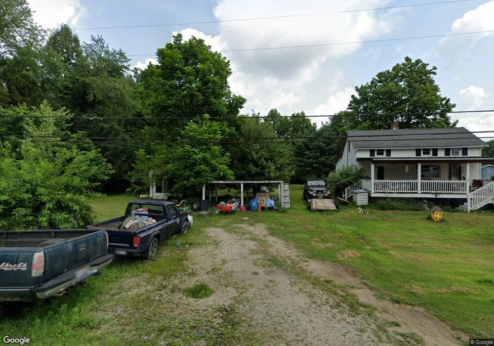
1792 Brookdale Rd SE Lancaster, OH 43130
Estimated Value: $181,792 - $232,000
2
Beds
1
Bath
936
Sq Ft
$222/Sq Ft
Est. Value
About This Home
This home is located at 1792 Brookdale Rd SE, Lancaster, OH 43130 and is currently estimated at $207,448, approximately $221 per square foot. 1792 Brookdale Rd SE is a home located in Fairfield County with nearby schools including Berne Union Elementary School and Berne Union High School.
Ownership History
Date
Name
Owned For
Owner Type
Purchase Details
Closed on
Oct 28, 2004
Sold by
Lanier Cleo M and Lanier Phyllis
Bought by
Spangler Joseph and Spangler Lorenda
Current Estimated Value
Home Financials for this Owner
Home Financials are based on the most recent Mortgage that was taken out on this home.
Original Mortgage
$80,725
Outstanding Balance
$40,338
Interest Rate
5.8%
Mortgage Type
Purchase Money Mortgage
Estimated Equity
$167,110
Purchase Details
Closed on
Dec 4, 1997
Sold by
Lanier Cleo M
Bought by
Lanier Cleo M and Lanier Tabitha L
Create a Home Valuation Report for This Property
The Home Valuation Report is an in-depth analysis detailing your home's value as well as a comparison with similar homes in the area
Home Values in the Area
Average Home Value in this Area
Purchase History
| Date | Buyer | Sale Price | Title Company |
|---|---|---|---|
| Spangler Joseph | $92,000 | -- | |
| Lanier Cleo M | $63,000 | -- |
Source: Public Records
Mortgage History
| Date | Status | Borrower | Loan Amount |
|---|---|---|---|
| Open | Spangler Joseph | $80,725 |
Source: Public Records
Tax History Compared to Growth
Tax History
| Year | Tax Paid | Tax Assessment Tax Assessment Total Assessment is a certain percentage of the fair market value that is determined by local assessors to be the total taxable value of land and additions on the property. | Land | Improvement |
|---|---|---|---|---|
| 2024 | $3,283 | $45,470 | $14,970 | $30,500 |
| 2023 | $1,562 | $45,470 | $14,970 | $30,500 |
| 2022 | $1,560 | $45,470 | $14,970 | $30,500 |
| 2021 | $1,261 | $33,520 | $11,410 | $22,110 |
| 2020 | $1,266 | $33,520 | $11,410 | $22,110 |
| 2019 | $1,269 | $33,520 | $11,410 | $22,110 |
| 2018 | $836 | $25,320 | $11,410 | $13,910 |
| 2017 | $781 | $22,570 | $8,660 | $13,910 |
| 2016 | $768 | $22,570 | $8,660 | $13,910 |
| 2015 | $759 | $21,940 | $8,660 | $13,280 |
| 2014 | $719 | $21,940 | $8,660 | $13,280 |
| 2013 | $719 | $21,940 | $8,660 | $13,280 |
Source: Public Records
Map
Nearby Homes
- 1531 Tarkiln Rd SE
- 1121 Tarkiln Rd SE Unit 109
- 509 Tarkiln Rd SE
- 513 Ross Rd SE
- 5636 Old Logan Rd SE
- 517 Ross Rd SE
- 284 Blue Valley Rd SE
- 750 McGrery Rd SE
- 1905 Sugar Grove Rd SE
- 4811 Chicken Coop Hill Road So Rd SE
- 318 East St
- 820 Pump Station Rd SE
- 3597 Country Club Rd SW
- 1406 S Broad St
- 3665 Country Club Rd SW
- 3629 Country Club Rd SW
- 0 Bis Rd SW Unit 225005143
- 0 Sugar Grove Rd SE Unit 225024434
- 959 Lane St
- 0 Hamburg Rd SW
- 1814 Brookdale Rd SE
- 1744 Brookdale Rd SE
- 1844 Brookdale Rd SE
- 1825 Brookdale Rd SE
- 1864 Brookdale Rd SE
- 1740 Brookdale Rd SE
- 1855 Brookdale Rd SE
- 1878 Brookdale Rd SE
- 1894 Brookdale Rd SE
- 4343 South St SE
- 4343 S Saint SE
- 1930 Brookdale Rd SE
- 4385 South St SE
- 1795 Brookdale Rd SE
- 1795 Brookdale Rd SE Unit 3
- 1936 Brookdale Rd SE
- 4449 South St SE
- 1970 Brookdale Rd SE
- 4410 South St SE
- 1990 Brookdale Rd SE