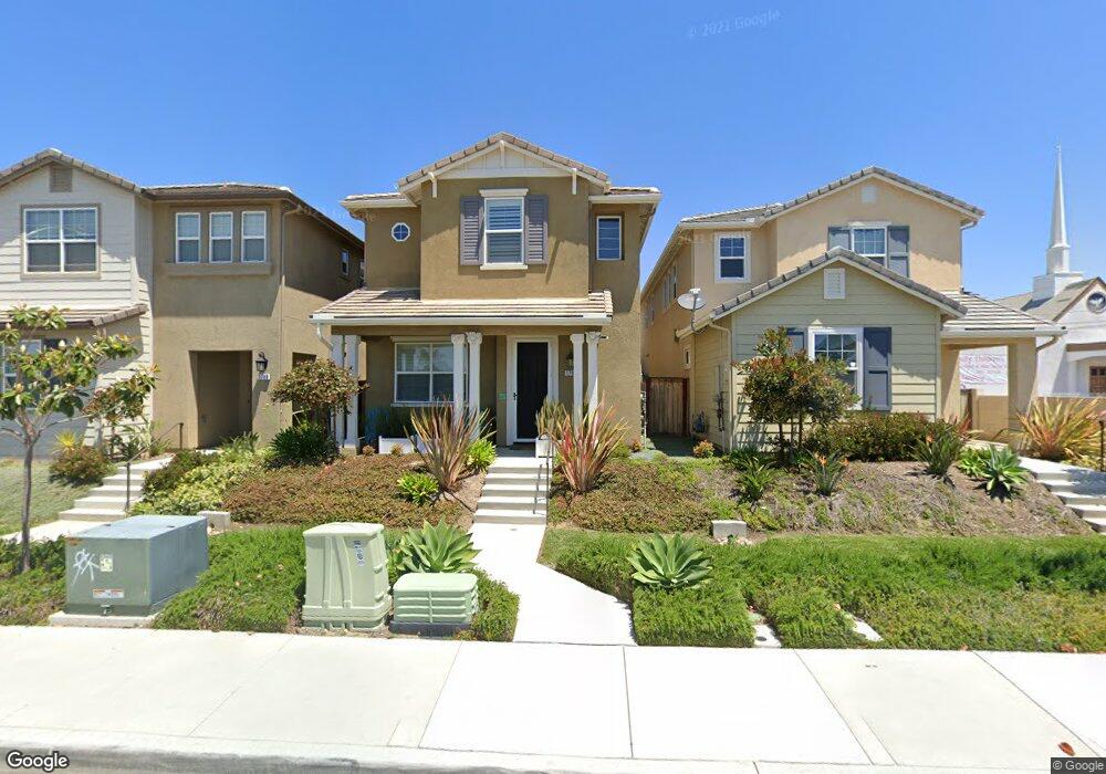
1792 Dixie St Oceanside, CA 92054
Loma Alta NeighborhoodEstimated Value: $924,373 - $1,042,000
3
Beds
3
Baths
1,974
Sq Ft
$498/Sq Ft
Est. Value
About This Home
This home is located at 1792 Dixie St, Oceanside, CA 92054 and is currently estimated at $982,843, approximately $497 per square foot. 1792 Dixie St is a home with nearby schools including Mission Elementary School, Oceanside High School, and St. Mary Star Of The Sea Elementary School.
Ownership History
Date
Name
Owned For
Owner Type
Purchase Details
Closed on
Feb 13, 2015
Sold by
Dixie Street Llc
Bought by
Wong Wallace Keau and Bagalso Leslieann Q
Current Estimated Value
Home Financials for this Owner
Home Financials are based on the most recent Mortgage that was taken out on this home.
Original Mortgage
$381,459
Interest Rate
3.7%
Mortgage Type
New Conventional
Create a Home Valuation Report for This Property
The Home Valuation Report is an in-depth analysis detailing your home's value as well as a comparison with similar homes in the area
Home Values in the Area
Average Home Value in this Area
Purchase History
| Date | Buyer | Sale Price | Title Company |
|---|---|---|---|
| Wong Wallace Keau | $402,000 | First American Title Company |
Source: Public Records
Mortgage History
| Date | Status | Borrower | Loan Amount |
|---|---|---|---|
| Previous Owner | Wong Wallace Keau | $381,459 |
Source: Public Records
Tax History
| Year | Tax Paid | Tax Assessment Tax Assessment Total Assessment is a certain percentage of the fair market value that is determined by local assessors to be the total taxable value of land and additions on the property. | Land | Improvement |
|---|---|---|---|---|
| 2025 | $5,263 | $482,576 | $168,254 | $314,322 |
| 2024 | $5,263 | $473,114 | $164,955 | $308,159 |
| 2023 | $5,099 | $463,838 | $161,721 | $302,117 |
| 2022 | $5,021 | $454,744 | $158,550 | $296,194 |
| 2021 | $5,039 | $445,829 | $155,442 | $290,387 |
| 2020 | $4,883 | $441,259 | $153,849 | $287,410 |
| 2019 | $4,740 | $432,608 | $150,833 | $281,775 |
| 2018 | $4,688 | $424,126 | $147,876 | $276,250 |
| 2017 | $4,601 | $415,811 | $144,977 | $270,834 |
| 2016 | $4,451 | $407,659 | $142,135 | $265,524 |
| 2015 | $3,570 | $325,291 | $129,291 | $196,000 |
| 2014 | -- | $116,955 | $116,955 | $0 |
Source: Public Records
Map
Nearby Homes
- 168 Carey Rd
- 1432 Buena St
- 506 Canyon Dr Unit 6
- 415 Stoney Point Way Unit 106
- 509 Rockledge St
- 1328 Buena St
- 426 Grant St
- 2721 Lomita St
- 503 505 N Nevada St
- 722 &718 N Freeman St
- 1330 Bush St
- 0 Amick St Unit 146-100-23-00, 21, 1
- 420 Stoney Point Way Unit 113
- 430 Stoney Point Way Unit 124
- 520 Grant St
- 1109 Hibiscus Way
- 1100 Civic Center Dr Unit C25
- 421 N Weitzel St
- 426 S Nevada St
- 230 Hoover St
- 1788 Dixie St
- 1796 Dixie St
- 1784 Dixie St
- 1768 Jasmine Way
- 1728 Jasmine Way
- 1770 Jasmine Way
- 0 Dixie St Unit 140045850
- 0 Dixie St Unit 140045849
- 0 Dixie St Unit NDP2209956
- 0 Dixie St Unit 148-272-46-00
- 1774 Jasmine Way
- Dixie 0 Lots
- 1780 Dixie St
- 1778 Jasmine Way
- 1776 Dixie St
- Dixie Street Dixie Lot (Apn 148-272-44) Unit Lot 44
- Dixie Street Dixie Lot (Apn 148-272-44)
- 1782 Jasmine Way
- 1775 Jasmine Way
- 1772 Dixie St
Your Personal Tour Guide
Ask me questions while you tour the home.