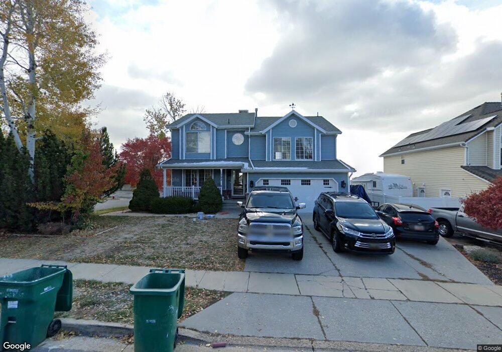
1792 E 2050 N Layton, UT 84040
Estimated Value: $577,000 - $617,000
5
Beds
4
Baths
3,382
Sq Ft
$177/Sq Ft
Est. Value
About This Home
This home is located at 1792 E 2050 N, Layton, UT 84040 and is currently estimated at $597,691, approximately $176 per square foot. 1792 E 2050 N is a home located in Davis County with nearby schools including Sarah Jane Adams Elementary School, North Layton Junior High School, and Northridge High School.
Ownership History
Date
Name
Owned For
Owner Type
Purchase Details
Closed on
Oct 1, 2018
Sold by
Stout Matthew and Stout Revocable Trust
Bought by
Wyler Heather Spring Illiary
Current Estimated Value
Home Financials for this Owner
Home Financials are based on the most recent Mortgage that was taken out on this home.
Original Mortgage
$324,950
Outstanding Balance
$282,792
Interest Rate
4.5%
Mortgage Type
New Conventional
Estimated Equity
$314,899
Purchase Details
Closed on
Feb 5, 2015
Sold by
The Stout Revocable Trust
Bought by
Stout Matthew K
Purchase Details
Closed on
Nov 5, 2013
Sold by
Stout Properties Llc
Bought by
The Stout Revocable Trust
Purchase Details
Closed on
Aug 17, 2010
Sold by
Stout Matthew K
Bought by
Stout Properties Llc
Home Financials for this Owner
Home Financials are based on the most recent Mortgage that was taken out on this home.
Original Mortgage
$240,400
Interest Rate
4.51%
Mortgage Type
New Conventional
Purchase Details
Closed on
Dec 5, 2006
Sold by
Stout Matthew K and Stout Betsey U
Bought by
Stout Properties Llc
Purchase Details
Closed on
Apr 28, 2006
Sold by
Shelton Bryan and Shelton Cinzia
Bought by
Stout Matthew K and Stout Betsey U
Home Financials for this Owner
Home Financials are based on the most recent Mortgage that was taken out on this home.
Original Mortgage
$35,000
Interest Rate
5.95%
Mortgage Type
Stand Alone Second
Purchase Details
Closed on
Jan 28, 2004
Sold by
Shelton Bryan
Bought by
Shelton Bryan and Shelton Cinzia
Home Financials for this Owner
Home Financials are based on the most recent Mortgage that was taken out on this home.
Original Mortgage
$157,600
Interest Rate
3.25%
Mortgage Type
Purchase Money Mortgage
Purchase Details
Closed on
Jan 27, 2004
Sold by
Wells Doreen L
Bought by
Shelton Bryan
Home Financials for this Owner
Home Financials are based on the most recent Mortgage that was taken out on this home.
Original Mortgage
$157,600
Interest Rate
3.25%
Mortgage Type
Purchase Money Mortgage
Purchase Details
Closed on
Mar 3, 2000
Sold by
Percell Kenneth I and Percell Kathleen R
Bought by
Wells Doreen L
Home Financials for this Owner
Home Financials are based on the most recent Mortgage that was taken out on this home.
Original Mortgage
$159,000
Interest Rate
8.38%
Purchase Details
Closed on
Jul 21, 1997
Sold by
Pearce Delores M
Bought by
Percell Kenneth I and Percell Kathleen R
Home Financials for this Owner
Home Financials are based on the most recent Mortgage that was taken out on this home.
Original Mortgage
$153,600
Interest Rate
7.7%
Create a Home Valuation Report for This Property
The Home Valuation Report is an in-depth analysis detailing your home's value as well as a comparison with similar homes in the area
Home Values in the Area
Average Home Value in this Area
Purchase History
| Date | Buyer | Sale Price | Title Company |
|---|---|---|---|
| Wyler Heather Spring Illiary | -- | Eagle Gate Title | |
| Stout Matthew K | -- | Eagle Gate Title Ins | |
| The Stout Revocable Trust | -- | Eagle Gate Title Ins A | |
| Stout Properties Llc | -- | Executive Title Ins Agency | |
| Stout Matthew K | -- | Executive Title Ins Agency | |
| Stout Properties Llc | -- | Accommodation | |
| Stout Matthew K | -- | 1St Natl Title Ins Agency | |
| Shelton Bryan | -- | First American Title Co | |
| Shelton Bryan | -- | First American Title Co | |
| Wells Doreen L | -- | Founders Title Co | |
| Percell Kenneth I | -- | Equity Title Agency |
Source: Public Records
Mortgage History
| Date | Status | Borrower | Loan Amount |
|---|---|---|---|
| Open | Wyler Heather Spring Illiary | $324,950 | |
| Previous Owner | Stout Matthew K | $240,400 | |
| Previous Owner | Stout Matthew K | $35,000 | |
| Previous Owner | Stout Matthew K | $204,000 | |
| Previous Owner | Shelton Bryan | $157,600 | |
| Previous Owner | Wells Doreen L | $159,000 | |
| Previous Owner | Percell Kenneth I | $153,600 |
Source: Public Records
Tax History
| Year | Tax Paid | Tax Assessment Tax Assessment Total Assessment is a certain percentage of the fair market value that is determined by local assessors to be the total taxable value of land and additions on the property. | Land | Improvement |
|---|---|---|---|---|
| 2025 | $3,080 | $299,200 | $114,951 | $184,249 |
| 2024 | $2,924 | $287,651 | $138,155 | $149,496 |
| 2023 | $2,882 | $504,000 | $187,554 | $316,446 |
| 2022 | $3,063 | $293,150 | $100,491 | $192,659 |
| 2021 | $2,833 | $404,000 | $152,758 | $251,242 |
| 2020 | $2,578 | $352,000 | $122,977 | $229,023 |
| 2019 | $2,542 | $342,000 | $110,009 | $231,991 |
| 2018 | $2,319 | $312,000 | $85,086 | $226,914 |
| 2016 | $2,098 | $148,280 | $44,899 | $103,381 |
| 2015 | $2,037 | $137,170 | $44,899 | $92,271 |
| 2014 | $2,010 | $139,015 | $44,899 | $94,116 |
| 2013 | -- | $122,218 | $23,913 | $98,305 |
Source: Public Records
Map
Nearby Homes
- 1540 E Primrose Ln
- 2096 N 1450 E
- 1465 E Sego Lily Ct
- 2189 N 1950 E
- 1476 Kays Creek Dr
- 1843 Hayes Dr
- 2273 N 1975 E
- 1930 N Camellia Way E Unit 407
- 1920 N Camellia Way Unit 406
- 1444 E 2400 N
- 3142 E Thorley Dr
- 2340 N 2050 E
- 1354 E Hollyhock Way
- 1305 E Larkspur Way
- 1340 E Hollyhock Way
- 1099 E 2125 N
- 1266 E Larkspur Way
- 1120 E 2200 N
- 1907 N Bridge Ct
- 2315 N 1075 E
- 1780 E 2050 N
- 1806 E 2050 N
- 1768 E 2050 N
- 1787 E 2050 N
- 2057 N 1800 E
- 1818 E 2050 N
- 41 N Sunset Dr Unit 41
- 43 N Sunset Dr
- 2062 N Sunset Dr
- 2067 N Sunset Dr
- 1756 E 2050 N
- 1771 E 2050 N
- 1985 N 1800 E
- 1828 E 2050 N
- 1819 E 2050 N
- 1777 E Beechwood Dr
- 1748 E 2050 N
- 1805 E Beechwood Dr
- 2079 N Sunset Dr
- 1755 E 2050 N
Your Personal Tour Guide
Ask me questions while you tour the home.