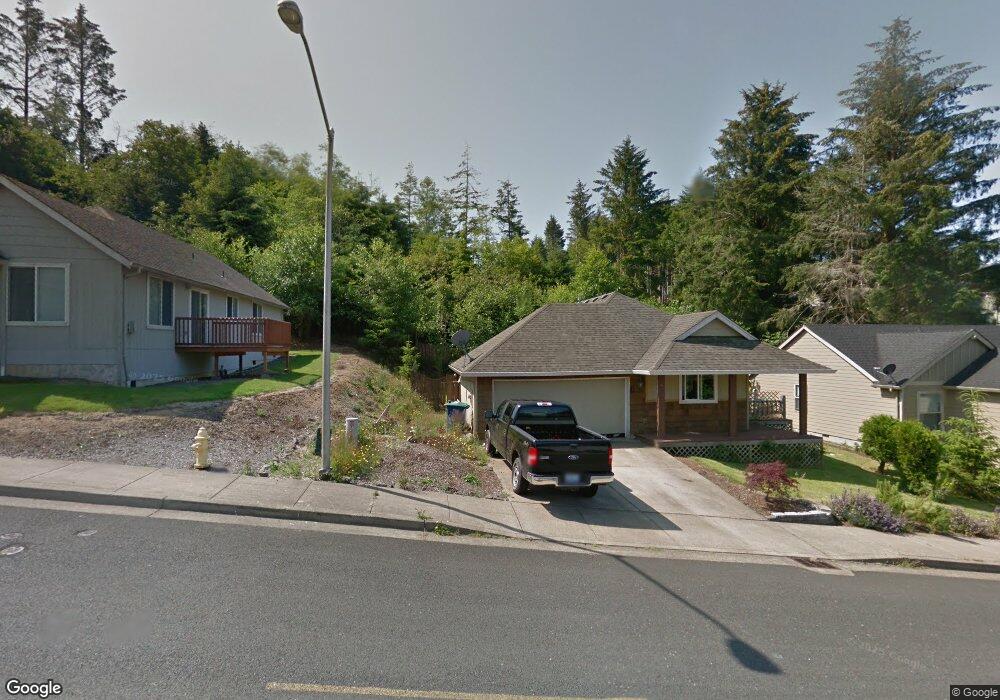
1792 SE 19th St Lincoln City, OR 97367
Estimated Value: $411,000 - $703,000
3
Beds
2
Baths
1,056
Sq Ft
$477/Sq Ft
Est. Value
About This Home
This home is located at 1792 SE 19th St, Lincoln City, OR 97367 and is currently estimated at $503,348, approximately $476 per square foot. 1792 SE 19th St is a home located in Lincoln County with nearby schools including Taft Elementary School, Oceanlake Elementary School, and Taft High School.
Ownership History
Date
Name
Owned For
Owner Type
Purchase Details
Closed on
Mar 4, 2020
Sold by
Mcbride Jame P
Bought by
Morrow Michael P and Mcbride Morrow Traci
Current Estimated Value
Home Financials for this Owner
Home Financials are based on the most recent Mortgage that was taken out on this home.
Original Mortgage
$188,237
Outstanding Balance
$168,993
Interest Rate
4.25%
Mortgage Type
FHA
Estimated Equity
$334,355
Create a Home Valuation Report for This Property
The Home Valuation Report is an in-depth analysis detailing your home's value as well as a comparison with similar homes in the area
Home Values in the Area
Average Home Value in this Area
Purchase History
| Date | Buyer | Sale Price | Title Company |
|---|---|---|---|
| Morrow Michael P | $225,000 | Western Title & Escrow |
Source: Public Records
Mortgage History
| Date | Status | Borrower | Loan Amount |
|---|---|---|---|
| Open | Morrow Michael P | $188,237 |
Source: Public Records
Tax History Compared to Growth
Tax History
| Year | Tax Paid | Tax Assessment Tax Assessment Total Assessment is a certain percentage of the fair market value that is determined by local assessors to be the total taxable value of land and additions on the property. | Land | Improvement |
|---|---|---|---|---|
| 2024 | $3,629 | $211,360 | -- | -- |
| 2023 | $3,529 | $205,210 | $0 | $0 |
| 2022 | $3,431 | $199,240 | $0 | $0 |
| 2021 | $3,269 | $193,440 | $0 | $0 |
| 2020 | $3,193 | $187,810 | $0 | $0 |
| 2019 | $3,085 | $182,340 | $0 | $0 |
| 2018 | $3,015 | $177,030 | $0 | $0 |
| 2017 | $2,886 | $171,880 | $0 | $0 |
| 2016 | $2,707 | $166,880 | $0 | $0 |
| 2015 | $2,647 | $162,020 | $0 | $0 |
| 2014 | $2,573 | $157,310 | $0 | $0 |
| 2013 | -- | $152,730 | $0 | $0 |
Source: Public Records
Map
Nearby Homes
- 1851 SE Oar Dr
- 1800 BLk SE Oar Dr Unit TL 4100
- 1502 SE Marine Ave
- 1496 SE Marine Ave
- 3400 SE Port Dr
- Lot 6 SE Marine Ave
- 6300 SE Quay Place
- 1453 SE Marine Ave
- TL 6300 SE Quay Place
- 1455 SE Marine Ave
- 0 SE Quay Ave Unit 777055144
- T/L 500 SE 14th St
- 1219 SE Oar Ave
- 1423 SE 23rd Dr
- 1218 SW 16th St
- 1966 SW Galley Ct
- 2273 SW Hwy 101
- 1111 SW 13th St
- 1115 SW Harbor Ave
- 2016 SE 8th St
- 1812 SE 19th St
- 1772 SE 19th St
- 1787 SE Mast Ave
- 1820 SE 19th St
- 1817 SE 19th St
- 1767 SE Mast Ave
- 1767 SE Mast (-1769) Ave
- 1767 SE Mast Ave
- 1844 SE 19th St
- 1837 SE 19th St
- 1776 SE Mast Ave
- 1755 SE Mast Ave
- 1900 Blk Se 19th
- 1906 SE 19th St
- 1865 SE 19th St
- 1744 SE Mast Ave
- 1875 SE 19th St
- 1720 SE Mast Ave
- 1918 SE 19th St
- 1957 SE 19th St