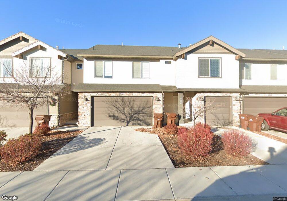
1792 W 50 N Pleasant Grove, UT 84062
Estimated Value: $403,000 - $415,257
3
Beds
3
Baths
1,609
Sq Ft
$255/Sq Ft
Est. Value
About This Home
This home is located at 1792 W 50 N, Pleasant Grove, UT 84062 and is currently estimated at $411,064, approximately $255 per square foot. 1792 W 50 N is a home located in Utah County with nearby schools including Barratt Elementary School, American Fork Junior High School, and American Fork High School.
Ownership History
Date
Name
Owned For
Owner Type
Purchase Details
Closed on
Jul 29, 2022
Sold by
Mcclellan Family Lc
Bought by
Edwards Clayton and Edwards Jennifer
Current Estimated Value
Home Financials for this Owner
Home Financials are based on the most recent Mortgage that was taken out on this home.
Original Mortgage
$345,000
Outstanding Balance
$330,149
Interest Rate
5.63%
Mortgage Type
New Conventional
Estimated Equity
$80,915
Purchase Details
Closed on
May 29, 2015
Sold by
D R Horton Inc
Bought by
Felton Devin
Home Financials for this Owner
Home Financials are based on the most recent Mortgage that was taken out on this home.
Original Mortgage
$191,717
Interest Rate
3.64%
Mortgage Type
New Conventional
Purchase Details
Closed on
May 15, 2002
Sold by
Felton Devin
Bought by
Mcclellan Family Llc
Create a Home Valuation Report for This Property
The Home Valuation Report is an in-depth analysis detailing your home's value as well as a comparison with similar homes in the area
Home Values in the Area
Average Home Value in this Area
Purchase History
| Date | Buyer | Sale Price | Title Company |
|---|---|---|---|
| Edwards Clayton | -- | None Listed On Document | |
| Felton Devin | -- | Provo Land Title Co | |
| Mcclellan Family Llc | -- | Greenbrier Ttl Ins Agcy Imc |
Source: Public Records
Mortgage History
| Date | Status | Borrower | Loan Amount |
|---|---|---|---|
| Open | Edwards Clayton | $345,000 | |
| Previous Owner | Felton Devin | $191,717 |
Source: Public Records
Tax History Compared to Growth
Tax History
| Year | Tax Paid | Tax Assessment Tax Assessment Total Assessment is a certain percentage of the fair market value that is determined by local assessors to be the total taxable value of land and additions on the property. | Land | Improvement |
|---|---|---|---|---|
| 2025 | $1,836 | $211,090 | $56,400 | $327,400 |
| 2024 | $1,836 | $218,790 | $0 | $0 |
| 2023 | $1,673 | $204,435 | $0 | $0 |
| 2022 | $1,821 | $221,320 | $0 | $0 |
| 2021 | $1,568 | $290,200 | $43,500 | $246,700 |
| 2020 | $1,451 | $263,200 | $39,500 | $223,700 |
| 2019 | $1,381 | $259,100 | $38,900 | $220,200 |
| 2018 | $1,269 | $225,100 | $33,800 | $191,300 |
| 2017 | $1,100 | $103,950 | $0 | $0 |
| 2016 | $1,140 | $103,950 | $0 | $0 |
| 2015 | $1,204 | $103,950 | $0 | $0 |
Source: Public Records
Map
Nearby Homes
- 1584 W 110 N
- 29 S 2000 W
- 1559 W 50 N
- 1542 W 110 N
- 1593 W 220 N
- 1512 W 50 N
- 1775 W 120 S Unit 54
- 1795 W 120 S Unit 52
- The Hastings Plan at Tayside Farm - Townhome
- The Henley A Plan at Tayside Farm - Single Family Home
- The Denton Plan at Tayside Farm - Townhome
- The Henley B Plan at Tayside Farm - Single Family Home
- 1541 W 250 N
- 128 S 1700 W Unit 12
- 293 N 1630 W
- 1429 W 110 N
- 1406 W 50 N
- 1525 W 300 N
- 150 N 1300 W
- 1267 W 20 S
- 1792 W 50 N Unit 115
- 1782 W 50 N
- 1796 W 50 N
- 1772 W 50 N Unit 113
- 1762 W 50 N Unit 112
- 1762 W 50 N
- 1752 W 50 N
- 1752 W 50 N Unit 111
- 1752 W 50 N
- 1797 W 50 N
- 1793 W 50 N Unit 126
- 1783 W 50 N Unit 127
- 1783 W 50 N
- 1773 W 50 N Unit 128
- 65 S 1800 W
- 75 N 1800 W
- 65 N 1800 W Unit 118
- 55 N 1800 W
- 1763 W 50 N
- 1738 W 50 N