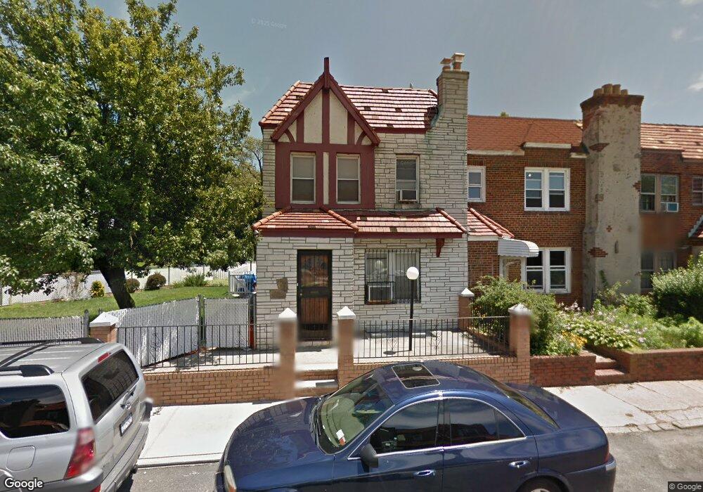
17920 Leslie Rd Jamaica, NY 11434
Saint Albans NeighborhoodEstimated Value: $666,000 - $736,000
--
Bed
--
Bath
1,440
Sq Ft
$486/Sq Ft
Est. Value
About This Home
This home is located at 17920 Leslie Rd, Jamaica, NY 11434 and is currently estimated at $700,510, approximately $486 per square foot. 17920 Leslie Rd is a home located in Queens County with nearby schools including The Jermaine L. Green STEM Institute of Queens, Catherine & Count Basie Middle School 72, and Riverton Street Charter School.
Ownership History
Date
Name
Owned For
Owner Type
Purchase Details
Closed on
Sep 28, 2017
Sold by
Edwards Geoffrey S and Edwards Maureen A
Bought by
Santos Richard
Current Estimated Value
Home Financials for this Owner
Home Financials are based on the most recent Mortgage that was taken out on this home.
Original Mortgage
$424,000
Outstanding Balance
$354,539
Interest Rate
3.86%
Mortgage Type
Purchase Money Mortgage
Estimated Equity
$345,971
Create a Home Valuation Report for This Property
The Home Valuation Report is an in-depth analysis detailing your home's value as well as a comparison with similar homes in the area
Home Values in the Area
Average Home Value in this Area
Purchase History
| Date | Buyer | Sale Price | Title Company |
|---|---|---|---|
| Santos Richard | $480,000 | -- |
Source: Public Records
Mortgage History
| Date | Status | Borrower | Loan Amount |
|---|---|---|---|
| Open | Santos Richard | $424,000 |
Source: Public Records
Tax History Compared to Growth
Tax History
| Year | Tax Paid | Tax Assessment Tax Assessment Total Assessment is a certain percentage of the fair market value that is determined by local assessors to be the total taxable value of land and additions on the property. | Land | Improvement |
|---|---|---|---|---|
| 2025 | $5,362 | $28,298 | $10,656 | $17,642 |
| 2024 | $5,362 | $26,698 | $12,049 | $14,649 |
| 2023 | $5,297 | $26,375 | $11,663 | $14,712 |
| 2022 | $4,967 | $33,060 | $14,460 | $18,600 |
| 2021 | $5,069 | $31,680 | $14,460 | $17,220 |
| 2020 | $4,992 | $27,660 | $14,460 | $13,200 |
| 2019 | $4,654 | $25,980 | $14,460 | $11,520 |
| 2018 | $4,480 | $21,979 | $12,121 | $9,858 |
| 2017 | $3,927 | $20,736 | $13,014 | $7,722 |
| 2016 | $3,702 | $20,736 | $13,014 | $7,722 |
| 2015 | $2,140 | $19,652 | $10,806 | $8,846 |
| 2014 | $2,140 | $18,540 | $12,240 | $6,300 |
Source: Public Records
Map
Nearby Homes
- 179-01 120th Ave
- 17955 Anderson Rd
- 179-50 Anderson Rd
- 179-47 Zoller Rd
- 178-10 Leslie Rd
- 11984 178th Place
- 17918 Selover Rd
- 119-72 178th St
- 119-48 178th St
- 17915 Eveleth Rd
- 17911 Eveleth Rd
- 12811 Harry Douglass Way
- 17720 Leslie Rd
- 17710 Troutville Rd
- 188-51 120th Rd
- 178-20 Selover Rd
- 17715 Troutville Rd
- 11819 179th St
- 176-27 Sunbury Rd
- 18822 119th Ave
- 179-20 Leslie Rd
- 17920 Leslie Rd
- 17918 Leslie Rd
- 17916 Leslie Rd
- 17914 Leslie Rd
- 179-12 Leslie Rd
- 17912 Leslie Rd
- 179-25 Leslie Rd
- 17910 Leslie Rd
- 179-23 Leslie Rd
- 179-23 Leslie Rd
- 17921 Leslie Rd
- 179-27 Leslie Rd
- 17927 Leslie Rd
- 120-15 180th St
- 17925 Leslie Rd
- 17923 Leslie Rd
- 17989 Selover Rd
- 17908 Leslie Rd
- 12015 180th St