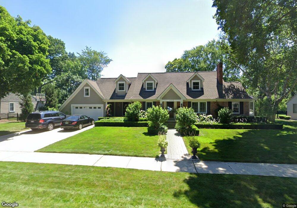
17929 Buckingham Ave Beverly Hills, MI 48025
Estimated Value: $679,000 - $800,000
3
Beds
4
Baths
2,995
Sq Ft
$243/Sq Ft
Est. Value
About This Home
This home is located at 17929 Buckingham Ave, Beverly Hills, MI 48025 and is currently estimated at $728,482, approximately $243 per square foot. 17929 Buckingham Ave is a home located in Oakland County with nearby schools including Beverly Elementary School, Wylie E. Groves High School, and Berkshire Middle School.
Ownership History
Date
Name
Owned For
Owner Type
Purchase Details
Closed on
Jan 26, 2024
Sold by
Ericsson Torbjorn and Ericsson Robin
Bought by
Ericsson Trust
Current Estimated Value
Purchase Details
Closed on
Nov 10, 2003
Sold by
Barlow Margaret
Bought by
Ericsson Torbjorn and Ericsson Robynn
Home Financials for this Owner
Home Financials are based on the most recent Mortgage that was taken out on this home.
Original Mortgage
$224,000
Interest Rate
4%
Mortgage Type
Purchase Money Mortgage
Create a Home Valuation Report for This Property
The Home Valuation Report is an in-depth analysis detailing your home's value as well as a comparison with similar homes in the area
Home Values in the Area
Average Home Value in this Area
Purchase History
| Date | Buyer | Sale Price | Title Company |
|---|---|---|---|
| Ericsson Trust | -- | None Listed On Document | |
| Ericsson Torbjorn | $280,000 | Devon Title Agency |
Source: Public Records
Mortgage History
| Date | Status | Borrower | Loan Amount |
|---|---|---|---|
| Previous Owner | Ericsson Torbjorn | $224,000 |
Source: Public Records
Tax History Compared to Growth
Tax History
| Year | Tax Paid | Tax Assessment Tax Assessment Total Assessment is a certain percentage of the fair market value that is determined by local assessors to be the total taxable value of land and additions on the property. | Land | Improvement |
|---|---|---|---|---|
| 2024 | $6,554 | $344,080 | $0 | $0 |
| 2023 | $6,288 | $320,610 | $0 | $0 |
| 2022 | $6,820 | $304,650 | $0 | $0 |
| 2021 | $6,876 | $295,180 | $0 | $0 |
| 2020 | $5,760 | $289,260 | $0 | $0 |
| 2019 | $4,551 | $275,910 | $0 | $0 |
| 2018 | $6,547 | $226,500 | $0 | $0 |
| 2017 | $6,519 | $226,500 | $0 | $0 |
| 2016 | $6,542 | $209,690 | $0 | $0 |
| 2015 | -- | $195,140 | $0 | $0 |
| 2014 | -- | $171,310 | $0 | $0 |
| 2011 | -- | $144,410 | $0 | $0 |
Source: Public Records
Map
Nearby Homes
- 955 Wakefield St
- 1850 Shipman Blvd
- 1130 Wakefield St
- 1723 Birmingham Blvd
- 1748 Stanley Blvd
- 16950 Kinross Ave
- 16975 W Fourteen Mile Rd
- 1897 Norfolk St
- 32470 Norchester St
- 1626 Maryland Blvd
- 1886 Henrietta St
- 1541 Shipman Blvd
- 16281 Buckingham Ave
- 150 Bird Ave Unit 20
- 16946 Reedmere Ave
- 251 E 14 Mile Rd
- 1395 Northlawn Blvd
- 1053 Canterbury St
- 16207 Wetherby St
- 1300 Northlawn Blvd
- 17869 Buckingham Ave
- 17977 Buckingham Ave
- 17928 Dunblaine Ave
- 17880 Dunblaine Ave
- 17976 Dunblaine Ave
- 17928 Buckingham Ave
- 17827 Buckingham Ave
- 17880 Buckingham Ave
- 17988 Buckingham Ave
- 18025 Buckingham Ave
- 18050 Dunblaine Ave
- 17830 Buckingham Ave
- 18050 Buckingham Ave
- 17941 Birwood Ave Unit Bldg-Unit
- 17941 Birwood Ave
- 17965 Birwood Ave
- 17925 Birwood Ave
- 17929 Dunblaine Ave
- 17869 Dunblaine Ave
- 17869 Birwood Ave