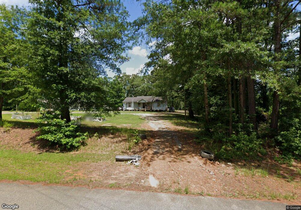
17929 Hallman Rd Northport, AL 35475
Estimated Value: $166,000 - $212,000
3
Beds
1
Bath
1,300
Sq Ft
$149/Sq Ft
Est. Value
About This Home
This home is located at 17929 Hallman Rd, Northport, AL 35475 and is currently estimated at $193,699, approximately $148 per square foot. 17929 Hallman Rd is a home located in Tuscaloosa County with nearby schools including Walker Elementary School, Northside Middle School, and Northside High School.
Ownership History
Date
Name
Owned For
Owner Type
Purchase Details
Closed on
Sep 25, 2020
Sold by
The Bank Of New York Mellon Trustee
Bought by
Herndon Christopher David and Herndon Cynthia Diane
Current Estimated Value
Home Financials for this Owner
Home Financials are based on the most recent Mortgage that was taken out on this home.
Original Mortgage
$41,000
Interest Rate
2.9%
Mortgage Type
New Conventional
Purchase Details
Closed on
Jul 17, 2020
Sold by
Watson Donald W
Bought by
Bank Of New York Trustee
Purchase Details
Closed on
Jul 2, 2013
Sold by
Watson Donald W
Bought by
Watson Becky Faye
Create a Home Valuation Report for This Property
The Home Valuation Report is an in-depth analysis detailing your home's value as well as a comparison with similar homes in the area
Home Values in the Area
Average Home Value in this Area
Purchase History
| Date | Buyer | Sale Price | Title Company |
|---|---|---|---|
| Herndon Christopher David | $41,000 | -- | |
| Bank Of New York Trustee | $40,083 | -- | |
| Watson Becky Faye | $7,000 | -- |
Source: Public Records
Mortgage History
| Date | Status | Borrower | Loan Amount |
|---|---|---|---|
| Previous Owner | Herndon Christopher David | $41,000 |
Source: Public Records
Tax History Compared to Growth
Tax History
| Year | Tax Paid | Tax Assessment Tax Assessment Total Assessment is a certain percentage of the fair market value that is determined by local assessors to be the total taxable value of land and additions on the property. | Land | Improvement |
|---|---|---|---|---|
| 2024 | $786 | $25,040 | $2,980 | $22,060 |
| 2023 | $786 | $25,040 | $2,980 | $22,060 |
| 2022 | $675 | $21,560 | $2,980 | $18,580 |
| 2021 | $675 | $21,560 | $2,980 | $18,580 |
| 2020 | $285 | $18,740 | $2,980 | $15,760 |
| 2019 | $293 | $9,370 | $1,490 | $7,880 |
| 2018 | $285 | $9,370 | $1,490 | $7,880 |
| 2017 | $268 | $0 | $0 | $0 |
| 2016 | $255 | $0 | $0 | $0 |
| 2015 | $255 | $0 | $0 | $0 |
| 2014 | $226 | $7,480 | $400 | $7,080 |
Source: Public Records
Map
Nearby Homes
- 18263 Mormon Rd
- 17505 Mormon Rd
- 0 Brown Rd
- 0 Morman 11 Rd
- 0 Morman 12 Rd
- 0 Morman 10 Rd
- 0 Morman 9 Rd
- 0 Morman 8 Rd
- 0 Morman 7 Rd
- 0 Morman 6 Rd
- 0 Morman 5 Rd
- 0 Morman 2 Rd
- 03 Mormon Rd
- 15498 Northside Rd
- 0 Brownville Rd Unit 24273268
- 7 Tilly Branch Rd
- 1 Tilly Branch Rd
- 16662 Old Fayette Rd
- 16614 Old Fayette Rd
- 16608 Old Fayette Rd
- 17872 Hallman Rd
- 18000 Pine Lake Rd
- 17800 Hallman Rd
- 17793 Hallman Rd
- 17787 Hallman Rd
- 18030 Pine Lake Rd
- 17765 Hallman Rd
- 17991 Pine Lake Rd
- 16281 Pine Lake Rd
- 16000 Rosewood Dr
- 18089 Pine Lake Rd
- 17737 Hallman Rd
- 16271 Pine Lake Rd
- 16105 Rosewood Dr
- 16105 Rosewood Dr
- 18226 Pine Lake Rd
- 17649 Hallman Rd
- 17637 Highway 171
- 17992 Pine Lake Spur
- 17650 Hallman Rd