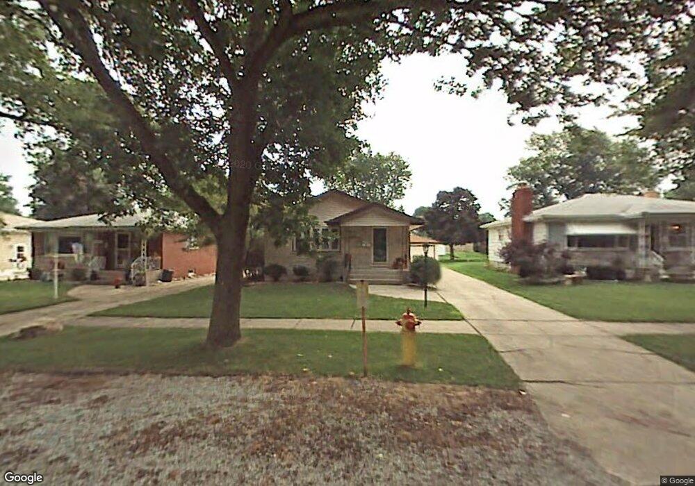
17929 Locust St Lansing, IL 60438
Estimated Value: $194,355 - $268,000
3
Beds
1
Bath
1,285
Sq Ft
$177/Sq Ft
Est. Value
About This Home
This home is located at 17929 Locust St, Lansing, IL 60438 and is currently estimated at $227,589, approximately $177 per square foot. 17929 Locust St is a home located in Cook County with nearby schools including Oak Glen Elementary School, Memorial Jr High School, and Thornton Fractnl So High School.
Ownership History
Date
Name
Owned For
Owner Type
Purchase Details
Closed on
May 25, 2000
Sold by
Mulder Ronald C and Mulder Shirley
Bought by
Couser Jeffrey R and Couser Barbara J
Current Estimated Value
Home Financials for this Owner
Home Financials are based on the most recent Mortgage that was taken out on this home.
Original Mortgage
$111,500
Outstanding Balance
$36,913
Interest Rate
8.18%
Estimated Equity
$190,676
Create a Home Valuation Report for This Property
The Home Valuation Report is an in-depth analysis detailing your home's value as well as a comparison with similar homes in the area
Home Values in the Area
Average Home Value in this Area
Purchase History
| Date | Buyer | Sale Price | Title Company |
|---|---|---|---|
| Couser Jeffrey R | $124,000 | -- |
Source: Public Records
Mortgage History
| Date | Status | Borrower | Loan Amount |
|---|---|---|---|
| Open | Couser Jeffrey R | $111,500 |
Source: Public Records
Tax History
| Year | Tax Paid | Tax Assessment Tax Assessment Total Assessment is a certain percentage of the fair market value that is determined by local assessors to be the total taxable value of land and additions on the property. | Land | Improvement |
|---|---|---|---|---|
| 2025 | $5,266 | $14,201 | $3,103 | $11,098 |
| 2024 | $5,266 | $14,201 | $3,103 | $11,098 |
| 2023 | $4,450 | $14,201 | $3,103 | $11,098 |
| 2022 | $4,450 | $10,269 | $2,738 | $7,531 |
| 2021 | $4,386 | $10,268 | $2,737 | $7,531 |
| 2020 | $4,204 | $10,268 | $2,737 | $7,531 |
| 2019 | $4,635 | $11,570 | $2,555 | $9,015 |
| 2018 | $4,545 | $11,570 | $2,555 | $9,015 |
| 2017 | $4,624 | $11,570 | $2,555 | $9,015 |
| 2016 | $4,220 | $10,214 | $2,372 | $7,842 |
| 2015 | $3,857 | $10,214 | $2,372 | $7,842 |
| 2014 | $3,831 | $10,214 | $2,372 | $7,842 |
| 2013 | $4,197 | $11,951 | $2,372 | $9,579 |
Source: Public Records
Map
Nearby Homes
- 17871 Locust St
- 17902 Locust St
- 17934 Locust St
- 2201 Thornton Lansing Rd
- 17832 Glen Oak Ave
- 17001 Glen Oak Ave
- 2330 177th St
- 2306 Holiday Terrace Unit 144
- 2306 Holiday Terrace Unit 163
- 2306 Holiday Terrace Unit 146
- 18005 Arcadia Ave
- 17750 Clyde Ave
- 2237 175th St Unit 2B
- 2304 Holiday Terrace Unit 505
- 1844 180th Place
- 1943 182nd St
- 18309 Bock Rd
- 17825 Oakley Ave
- 18118 Whitman Ln
- 18035 Oakley Ave
- 17927 Locust St
- 17931 Locust St
- 17925 Locust St
- 17933 Locust St
- 17881 Locust St
- 17935 Locust St
- 17900 Rose St
- 17866 Rose St
- 17862 Rose St
- 17910 Rose St
- 17939 Locust St
- 17858 Rose St
- 17914 Rose St
- 17918 Locust St
- 17918 Locust St
- 17943 Locust St
- 17854 Rose St
- 17861 Locust St
- 17926 Locust St
- 17858 Locust St
Your Personal Tour Guide
Ask me questions while you tour the home.