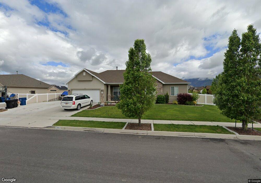
1793 E 130 N Spanish Fork, UT 84660
Estimated Value: $680,000 - $777,000
6
Beds
5
Baths
3,734
Sq Ft
$195/Sq Ft
Est. Value
About This Home
This home is located at 1793 E 130 N, Spanish Fork, UT 84660 and is currently estimated at $728,156, approximately $195 per square foot. 1793 E 130 N is a home located in Utah County with nearby schools including Sierra Bonita Elementary School, Mapleton Junior High School, and Maple Mountain High School.
Ownership History
Date
Name
Owned For
Owner Type
Purchase Details
Closed on
Mar 22, 2019
Sold by
James Grant K
Bought by
Smith Mark T and Smith Michelle B
Current Estimated Value
Home Financials for this Owner
Home Financials are based on the most recent Mortgage that was taken out on this home.
Original Mortgage
$429,875
Outstanding Balance
$377,933
Interest Rate
4.4%
Mortgage Type
New Conventional
Estimated Equity
$350,223
Purchase Details
Closed on
Dec 7, 2010
Sold by
Ferguson Michael and Ferguson Venna
Bought by
James Grant K
Home Financials for this Owner
Home Financials are based on the most recent Mortgage that was taken out on this home.
Original Mortgage
$216,090
Interest Rate
4.5%
Mortgage Type
FHA
Purchase Details
Closed on
Apr 15, 2009
Sold by
Homes By Harmony Inc
Bought by
Ferguson Michael and Ferguson Venna
Home Financials for this Owner
Home Financials are based on the most recent Mortgage that was taken out on this home.
Original Mortgage
$217,227
Interest Rate
5.17%
Mortgage Type
FHA
Purchase Details
Closed on
Feb 25, 2009
Sold by
Kndj Development Llc
Bought by
Homes By Harmony Inc
Home Financials for this Owner
Home Financials are based on the most recent Mortgage that was taken out on this home.
Original Mortgage
$217,227
Interest Rate
5.17%
Mortgage Type
FHA
Create a Home Valuation Report for This Property
The Home Valuation Report is an in-depth analysis detailing your home's value as well as a comparison with similar homes in the area
Home Values in the Area
Average Home Value in this Area
Purchase History
| Date | Buyer | Sale Price | Title Company |
|---|---|---|---|
| Smith Mark T | -- | North Amer Ttl Ut Union Part | |
| James Grant K | -- | Pinnacle Title | |
| Ferguson Michael | -- | Provo Land Title Company | |
| Homes By Harmony Inc | -- | Provo Land Title Company |
Source: Public Records
Mortgage History
| Date | Status | Borrower | Loan Amount |
|---|---|---|---|
| Open | Smith Mark T | $429,875 | |
| Previous Owner | James Grant K | $216,090 | |
| Previous Owner | Ferguson Michael | $217,227 | |
| Previous Owner | Homes By Harmony Inc | $1,283,900 |
Source: Public Records
Tax History
| Year | Tax Paid | Tax Assessment Tax Assessment Total Assessment is a certain percentage of the fair market value that is determined by local assessors to be the total taxable value of land and additions on the property. | Land | Improvement |
|---|---|---|---|---|
| 2025 | $3,134 | $366,520 | -- | -- |
| 2024 | $3,134 | $323,015 | $0 | $0 |
| 2023 | $3,182 | $328,350 | $0 | $0 |
| 2022 | $3,434 | $347,545 | $0 | $0 |
| 2021 | $2,967 | $480,400 | $145,200 | $335,200 |
| 2020 | $2,757 | $434,000 | $132,000 | $302,000 |
| 2019 | $2,554 | $422,900 | $123,700 | $299,200 |
| 2018 | $2,053 | $328,700 | $113,200 | $215,500 |
| 2017 | $2,077 | $178,695 | $0 | $0 |
| 2016 | $1,881 | $159,665 | $0 | $0 |
| 2015 | $1,839 | $154,275 | $0 | $0 |
| 2014 | $1,755 | $147,785 | $0 | $0 |
Source: Public Records
Map
Nearby Homes
- 2137 E 200 N Unit MSF53
- 2138 E 200 N Unit MSF54
- 2163 E 200 N Unit MSF52
- 2117 E 130 N Unit 59
- 53 S 2000 E
- 1815 E 160 S
- 2155 E 130 N Unit 57
- 2131 E 130 N Unit 58
- 1455 E 100 S
- 1005 E 260 N Unit 20
- 1563 E Mountain View Dr
- 1495 E 400 N
- 1884 E 280 S
- 2283 E 400 N Unit 33
- 2271 E 400 N Unit 32
- 1453 S Windy Ridge Dr Unit 1149
- 1025 E 360 N Unit 5
- 1022 E 360 N Unit 27
- 991 E 360 N Unit 8
- 663 N 2040 E
- 1777 E 130 N
- 1792 E 200 N
- 1776 E 200 N Unit 109
- 156 N 1800 E
- 172 N 1800 E
- 1757 E 130 N
- 1757 E 130 N Unit 113
- 127 N 1800 E Unit MM120A
- 172 N 1800 E
- 1778 E 130 N
- 1756 E 200 N
- 198 N 1800 E
- 1758 E 130 N Unit 122a
- 1731 E 130 N
- 1882 E 190 N
- 1775 E 200 N
- 1734 E 200 N
- 1797 E 70 N Unit 217D
- 1777 E 70 N
- 1777 E 70 N Unit 216D
Your Personal Tour Guide
Ask me questions while you tour the home.