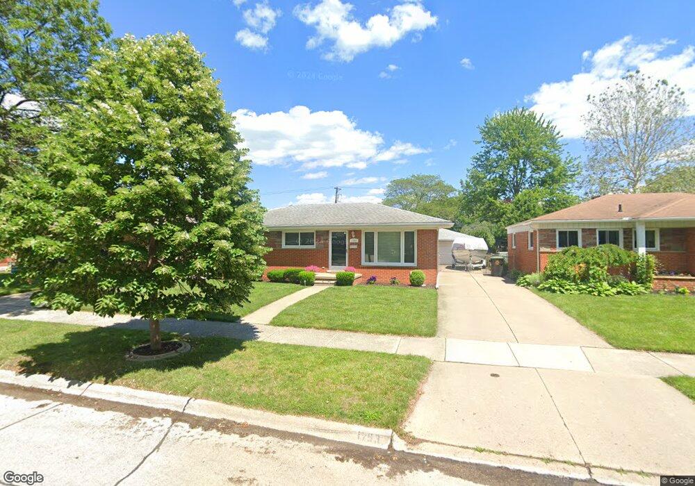
1793 E Longmeadow Rd Trenton, MI 48183
Estimated Value: $234,831 - $275,000
3
Beds
2
Baths
1,100
Sq Ft
$229/Sq Ft
Est. Value
About This Home
This home is located at 1793 E Longmeadow Rd, Trenton, MI 48183 and is currently estimated at $251,958, approximately $229 per square foot. 1793 E Longmeadow Rd is a home located in Wayne County with nearby schools including Jesse L. Anderson Elementary School, Boyd W. Arthurs Middle School, and Trenton High School.
Ownership History
Date
Name
Owned For
Owner Type
Purchase Details
Closed on
Sep 8, 2016
Sold by
Coleman Kelly E and Coleman Paula T
Bought by
Proctor Ryan J
Current Estimated Value
Purchase Details
Closed on
Dec 18, 2009
Sold by
Hunt David and Hunt Arthur J
Bought by
Coleman Kelly E
Purchase Details
Closed on
Oct 4, 2006
Sold by
Hunt David and Hunt Deanne M
Bought by
Hunt David
Home Financials for this Owner
Home Financials are based on the most recent Mortgage that was taken out on this home.
Original Mortgage
$123,375
Interest Rate
9.65%
Mortgage Type
Stand Alone First
Purchase Details
Closed on
Sep 29, 2006
Sold by
Hunt Arthur H and Hunt Jane T
Bought by
Hunt David
Home Financials for this Owner
Home Financials are based on the most recent Mortgage that was taken out on this home.
Original Mortgage
$123,375
Interest Rate
9.65%
Mortgage Type
Stand Alone First
Create a Home Valuation Report for This Property
The Home Valuation Report is an in-depth analysis detailing your home's value as well as a comparison with similar homes in the area
Home Values in the Area
Average Home Value in this Area
Purchase History
| Date | Buyer | Sale Price | Title Company |
|---|---|---|---|
| Proctor Ryan J | $145,000 | Michigan Title Ins Agency In | |
| Coleman Kelly E | $80,000 | Title One Inc | |
| Hunt David | -- | Emerald Title | |
| Hunt David | -- | None Available |
Source: Public Records
Mortgage History
| Date | Status | Borrower | Loan Amount |
|---|---|---|---|
| Previous Owner | Hunt David | $123,375 |
Source: Public Records
Tax History
| Year | Tax Paid | Tax Assessment Tax Assessment Total Assessment is a certain percentage of the fair market value that is determined by local assessors to be the total taxable value of land and additions on the property. | Land | Improvement |
|---|---|---|---|---|
| 2025 | $3,422 | $103,600 | $0 | $0 |
| 2024 | $3,107 | $95,000 | $0 | $0 |
| 2023 | $2,913 | $87,500 | $0 | $0 |
| 2022 | $3,960 | $79,700 | $0 | $0 |
| 2021 | $3,829 | $72,600 | $0 | $0 |
| 2020 | $3,870 | $69,200 | $0 | $0 |
| 2019 | $3,811 | $67,100 | $0 | $0 |
| 2018 | $2,520 | $62,500 | $0 | $0 |
| 2017 | $2,181 | $60,900 | $0 | $0 |
| 2016 | $2,796 | $59,600 | $0 | $0 |
| 2015 | $4,947 | $54,700 | $0 | $0 |
| 2013 | $4,792 | $49,600 | $0 | $0 |
| 2012 | $2,561 | $47,500 | $10,300 | $37,200 |
Source: Public Records
Map
Nearby Homes
- 1799 Grange Rd
- 3804 S Longmeadow Rd
- 000 King Rd
- 2384 Newman St
- 2306 Middlefield Ct
- 2501 King Rd
- 22674 Monterey Dr
- 2880 Lakewood Dr Unit 7
- 20698 Coachwood Rd
- 19345 Allen Rd
- 1982 Ardmore St
- 3158 Lafayette Dr
- 23493 Williamsburg Cir Unit 53
- 23461 Williamsburg Cir Unit 46
- 3125 Patton St
- 1891 Baldwin Dr Unit 4
- 1740 Fort St Unit 36
- 19170 Dawnshire Dr
- 3262 Grange Rd
- 1750 Monticello St Unit 6
- 1805 E Longmeadow Rd
- 1785 E Longmeadow Rd
- 1813 E Longmeadow Rd
- 1773 E Longmeadow Rd
- 1804 Grange Rd
- 1812 Grange Rd
- 1792 Grange Rd
- 1824 Grange Rd
- 1784 Grange Rd
- 1825 E Longmeadow Rd
- 1804 E Longmeadow Rd
- 1792 E Longmeadow Rd
- 3631 N Longmeadow Rd
- 1812 E Longmeadow Rd
- 1784 E Longmeadow Rd
- 1832 Grange Rd
- 1772 Grange Rd
- 1824 E Longmeadow Rd
- 1835 E Longmeadow Rd
- 1772 E Longmeadow Rd
Your Personal Tour Guide
Ask me questions while you tour the home.