Estimated Value: $531,274 - $593,000
5
Beds
4
Baths
4,171
Sq Ft
$135/Sq Ft
Est. Value
About This Home
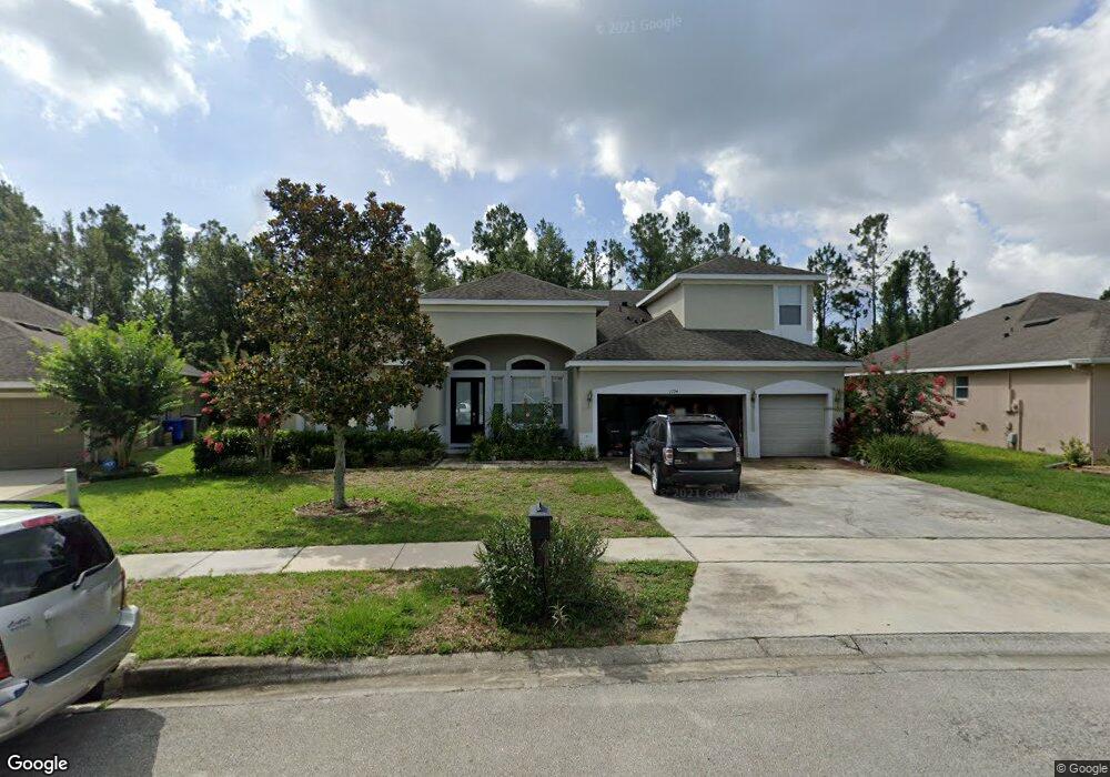
This home is located at 1794 Palmerston Cir, Ocoee, FL 34761 and is currently estimated at $562,069, approximately $134 per square foot. 1794 Palmerston Cir is a home located in Orange County with nearby schools including Prairie Lake Elementary School, Ocoee Middle School, and Wekiva High School.
Ownership History
Date
Name
Owned For
Owner Type
Purchase Details
Closed on
Sep 10, 2015
Sold by
New York Community Bank
Bought by
Palmer
Current Estimated Value
Home Financials for this Owner
Home Financials are based on the most recent Mortgage that was taken out on this home.
Original Mortgage
$253,650
Outstanding Balance
$198,539
Interest Rate
3.97%
Mortgage Type
New Conventional
Estimated Equity
$363,530
Purchase Details
Closed on
Feb 27, 2015
Sold by
Gunraj Victor H and Gunraj Savitiee
Bought by
New York Community Bank
Purchase Details
Closed on
Dec 17, 2012
Sold by
Gunraj Victor H
Bought by
Palmerston Estate Trust
Purchase Details
Closed on
Jun 23, 2006
Sold by
Morrison Homes Inc
Bought by
Gunraj Victor H
Home Financials for this Owner
Home Financials are based on the most recent Mortgage that was taken out on this home.
Original Mortgage
$425,695
Interest Rate
7.62%
Mortgage Type
Purchase Money Mortgage
Create a Home Valuation Report for This Property
The Home Valuation Report is an in-depth analysis detailing your home's value as well as a comparison with similar homes in the area
Home Values in the Area
Average Home Value in this Area
Purchase History
| Date | Buyer | Sale Price | Title Company |
|---|---|---|---|
| Palmer | $267,000 | None Available | |
| New York Community Bank | $254,100 | None Available | |
| Palmerston Estate Trust | -- | None Available | |
| Gunraj Victor H | $448,200 | Universal Land Title Inc |
Source: Public Records
Mortgage History
| Date | Status | Borrower | Loan Amount |
|---|---|---|---|
| Open | Palmer | $253,650 | |
| Previous Owner | Gunraj Victor H | $425,695 |
Source: Public Records
Tax History
| Year | Tax Paid | Tax Assessment Tax Assessment Total Assessment is a certain percentage of the fair market value that is determined by local assessors to be the total taxable value of land and additions on the property. | Land | Improvement |
|---|---|---|---|---|
| 2025 | $4,853 | $318,871 | -- | -- |
| 2024 | $4,694 | $309,884 | -- | -- |
| 2023 | $4,694 | $292,380 | $0 | $0 |
| 2022 | $4,550 | $283,864 | $0 | $0 |
| 2021 | $4,507 | $275,596 | $0 | $0 |
| 2020 | $4,314 | $271,791 | $0 | $0 |
| 2019 | $4,471 | $265,680 | $0 | $0 |
| 2018 | $4,473 | $260,726 | $0 | $0 |
| 2017 | $4,452 | $257,298 | $22,000 | $235,298 |
| 2016 | $4,471 | $250,111 | $22,000 | $228,111 |
| 2015 | $4,988 | $236,388 | $15,000 | $221,388 |
| 2014 | $4,709 | $229,756 | $20,000 | $209,756 |
Source: Public Records
Map
Nearby Homes
- 1730 Palmerston Cir
- 2123 Greenwood Oak Dr
- ARIA Plan at Wynwood
- 2316 Baywood Flower Way
- ROBIE Plan at Wynwood
- ROBINSON - FOLK VICTORIAN Plan at Wynwood
- 3242 Spineywood Dr
- 3250 Spineywood Dr
- 2079 Ashwood Bluff Dr
- 3270 Spineywood Dr
- DESTIN Plan at Wynwood
- CALI Plan at Wynwood
- ALLEX Plan at Wynwood
- CAMDEN Plan at Wynwood
- 3330 Briarwood Grove Dr
- 2327 Ashwood Bluff Dr
- HAYDEN Plan at Wynwood
- 3302 Briarwood Grove Dr
- 3290 Spineywood Dr
- HARPER Plan at Wynwood
- 1798 Palmerston Cir
- 1790 Palmerston Cir
- 1802 Palmerston Cir
- 1786 Palmerston Cir
- 1795 Palmerston Cir
- 1785 Palmerston Cir
- 1801 Palmerston Cir
- 1806 Palmerston Cir
- 1782 Palmerston Cir
- 1809 Palmerston Cir
- 1781 Palmerston Cir
- 1737 Palmerston Cir
- 1778 Palmerston Cir
- 1818 Palmerston Cir
- 1733 Palmerston Cir
- 1821 Palmerston Cir
- 1773 Palmerston Cir
- 1822 Palmerston Cir
- 1751 Palmerston Cir
- 1774 Palmerston Cir