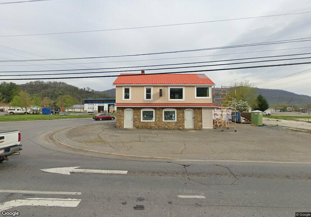
1794 S Main St Waynesville, NC 28786
Estimated Value: $179,272
--
Bed
--
Bath
720
Sq Ft
$249/Sq Ft
Est. Value
About This Home
This home is located at 1794 S Main St, Waynesville, NC 28786 and is currently estimated at $179,272, approximately $248 per square foot. 1794 S Main St is a home located in Haywood County with nearby schools including Hazelwood Elementary, Waynesville Middle, and Tuscola High.
Ownership History
Date
Name
Owned For
Owner Type
Purchase Details
Closed on
Sep 26, 2023
Sold by
Earwood Nathan and Earwood Kristina L
Bought by
1794 South Main Llc
Current Estimated Value
Purchase Details
Closed on
Jul 20, 2023
Sold by
Sawyer Billy Lee
Bought by
Earwood Nathan and Lewis Timothy
Purchase Details
Closed on
Apr 4, 2003
Bought by
Sawyer Billy Lee
Create a Home Valuation Report for This Property
The Home Valuation Report is an in-depth analysis detailing your home's value as well as a comparison with similar homes in the area
Home Values in the Area
Average Home Value in this Area
Purchase History
| Date | Buyer | Sale Price | Title Company |
|---|---|---|---|
| 1794 South Main Llc | $165,000 | None Listed On Document | |
| 1794 South Main Llc | $165,000 | None Listed On Document | |
| Earwood Nathan | $165,000 | None Listed On Document | |
| Sawyer Billy Lee | $100,000 | -- |
Source: Public Records
Tax History Compared to Growth
Tax History
| Year | Tax Paid | Tax Assessment Tax Assessment Total Assessment is a certain percentage of the fair market value that is determined by local assessors to be the total taxable value of land and additions on the property. | Land | Improvement |
|---|---|---|---|---|
| 2025 | -- | $253,200 | $65,300 | $187,900 |
| 2024 | $1,034 | $188,000 | $65,300 | $122,700 |
| 2023 | $1,034 | $188,000 | $65,300 | $122,700 |
| 2022 | $1,006 | $188,000 | $65,300 | $122,700 |
| 2021 | $1,006 | $188,000 | $65,300 | $122,700 |
| 2020 | $602 | $102,900 | $23,000 | $79,900 |
| 2019 | $602 | $103,500 | $23,600 | $79,900 |
| 2018 | $669 | $114,400 | $34,500 | $79,900 |
| 2017 | $669 | $114,400 | $0 | $0 |
| 2016 | $700 | $123,700 | $0 | $0 |
| 2015 | $700 | $123,700 | $0 | $0 |
| 2014 | $670 | $123,700 | $0 | $0 |
Source: Public Records
Map
Nearby Homes
- 72 Raines Blvd
- 55 Polk St
- 55 Scates St
- 142 Country Club Dr
- 165 Country Club Dr
- 271 Brook St
- 90 Camp Branch Rd
- 49 Robinson St
- 00 Longview Dr Unit 6
- 00 Longview Dr Unit 7
- 00 Longview Dr Unit 8
- 35 Essex Rd
- 1193 Brown Ave
- 419 Country Club Dr
- 228 Hyatt St
- 56 Kentucky Ave
- 171 Surrey Rd
- TBD Adams St Unit 1
- 87 Willow Rd Unit C-2
- 87 Willow Rd Unit D-16
- 1780 S Main St
- 9 Lea Plant Rd
- 1699 Brown Ave
- 40 Norman St
- 25 Allens Creek Rd
- 1840 S Main St
- 1737 S Main St
- 1841 S Main St
- 52 Norman St
- 33 Lea Plant Rd
- 45 Allens Creek Rd
- 70 Norman St
- 1720 S Main St
- 1863 S Main St
- 1677 Brown Ave
- 51 Allens Creek Rd
- 1870 S Main St
- 80 Norman St
- 43 Norman St
- 73 Norman St