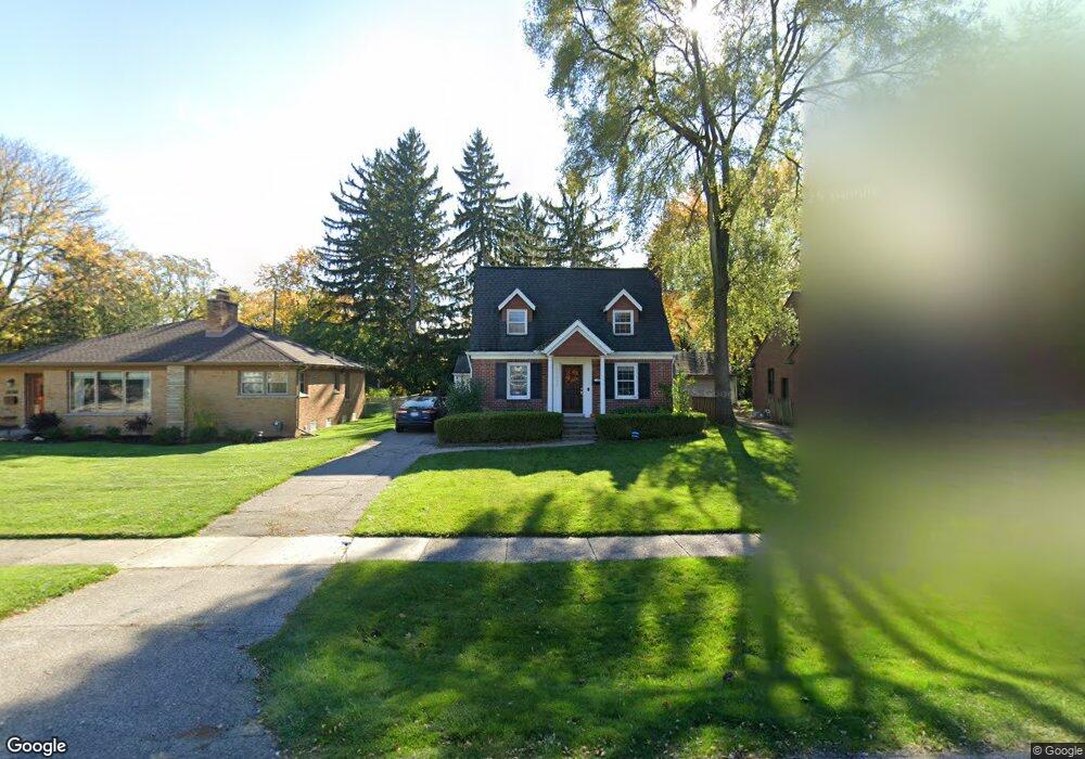
17941 Birwood Ave Unit Bldg-Unit Beverly Hills, MI 48025
Estimated Value: $562,986 - $675,000
4
Beds
3
Baths
2,204
Sq Ft
$282/Sq Ft
Est. Value
About This Home
This home is located at 17941 Birwood Ave Unit Bldg-Unit, Beverly Hills, MI 48025 and is currently estimated at $620,497, approximately $281 per square foot. 17941 Birwood Ave Unit Bldg-Unit is a home located in Oakland County with nearby schools including Beverly Elementary School, Wylie E. Groves High School, and Berkshire Middle School.
Ownership History
Date
Name
Owned For
Owner Type
Purchase Details
Closed on
Apr 19, 2019
Sold by
Carr Collin Joseph and Carr Maria Gill
Bought by
Little Sarah and Little Jeffrey
Current Estimated Value
Home Financials for this Owner
Home Financials are based on the most recent Mortgage that was taken out on this home.
Original Mortgage
$389,000
Outstanding Balance
$342,000
Interest Rate
4.3%
Mortgage Type
New Conventional
Estimated Equity
$278,497
Purchase Details
Closed on
Aug 26, 2016
Sold by
Brady Michael and Brady Rebecca
Bought by
Carr Colin Joseph and Carr Maria Gill
Purchase Details
Closed on
Sep 17, 1999
Sold by
Barone Anne M
Bought by
Brady Michael G
Create a Home Valuation Report for This Property
The Home Valuation Report is an in-depth analysis detailing your home's value as well as a comparison with similar homes in the area
Home Values in the Area
Average Home Value in this Area
Purchase History
| Date | Buyer | Sale Price | Title Company |
|---|---|---|---|
| Little Sarah | $389,000 | Equity Title Agency Llc | |
| Carr Colin Joseph | $367,000 | None Available | |
| Brady Michael G | $182,000 | -- |
Source: Public Records
Mortgage History
| Date | Status | Borrower | Loan Amount |
|---|---|---|---|
| Open | Little Sarah | $389,000 |
Source: Public Records
Tax History Compared to Growth
Tax History
| Year | Tax Paid | Tax Assessment Tax Assessment Total Assessment is a certain percentage of the fair market value that is determined by local assessors to be the total taxable value of land and additions on the property. | Land | Improvement |
|---|---|---|---|---|
| 2024 | $7,365 | $220,640 | $0 | $0 |
| 2023 | $7,066 | $205,440 | $0 | $0 |
| 2022 | $7,664 | $195,240 | $0 | $0 |
| 2021 | $7,727 | $189,000 | $0 | $0 |
| 2020 | $6,473 | $185,250 | $0 | $0 |
| 2019 | $4,827 | $173,920 | $0 | $0 |
| 2018 | $6,937 | $165,340 | $0 | $0 |
| 2017 | $6,956 | $165,340 | $0 | $0 |
| 2016 | $4,586 | $153,070 | $0 | $0 |
| 2015 | -- | $146,650 | $0 | $0 |
| 2014 | -- | $129,020 | $0 | $0 |
| 2011 | -- | $90,900 | $0 | $0 |
Source: Public Records
Map
Nearby Homes
- 955 Wakefield St
- 1850 Shipman Blvd
- 1130 Wakefield St
- 1723 Birmingham Blvd
- 1748 Stanley Blvd
- 1897 Norfolk St
- 16975 W Fourteen Mile Rd
- 1626 Maryland Blvd
- 16950 Kinross Ave
- 1886 Henrietta St
- 1541 Shipman Blvd
- 32470 Norchester St
- 16281 Buckingham Ave
- 150 Bird Ave Unit 20
- 1395 Northlawn Blvd
- 251 E 14 Mile Rd
- 1053 Canterbury St
- 1300 Northlawn Blvd
- 16946 Reedmere Ave
- 1345 Fairway Dr
- 17941 Birwood Ave
- 17965 Birwood Ave
- 17925 Birwood Ave
- 17928 Buckingham Ave
- 17869 Birwood Ave
- 17988 Buckingham Ave
- 17880 Buckingham Ave
- 17934 Birwood Ave
- 17831 Birwood Ave
- 17988 Birwood Ave
- 17995 Birwood Ave
- 17892 Birwood Ave
- 17830 Buckingham Ave
- 18050 Buckingham Ave
- 17856 Birwood Ave
- 18050 Birwood Ave
- 17929 Buckingham Ave
- 17925 Kirkshire Ave
- 17977 Buckingham Ave
- 17869 Buckingham Ave