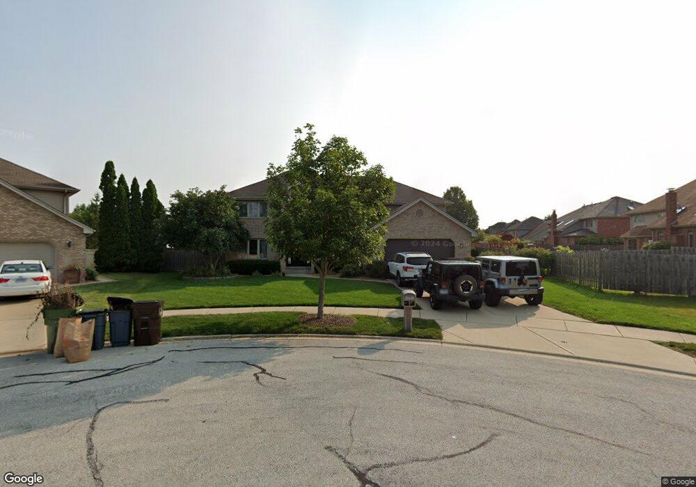
17943 Emily Ct Tinley Park, IL 60477
Central Tinley Park NeighborhoodEstimated Value: $540,000 - $630,000
4
Beds
3
Baths
3,392
Sq Ft
$172/Sq Ft
Est. Value
About This Home
This home is located at 17943 Emily Ct, Tinley Park, IL 60477 and is currently estimated at $583,314, approximately $171 per square foot. 17943 Emily Ct is a home located in Cook County with nearby schools including Millennium Elementary School, Virgil I Grissom Middle School, and Victor J Andrew High School.
Ownership History
Date
Name
Owned For
Owner Type
Purchase Details
Closed on
Sep 8, 1999
Sold by
State Bank Of Countryside
Bought by
George Paul R and George Paula
Current Estimated Value
Home Financials for this Owner
Home Financials are based on the most recent Mortgage that was taken out on this home.
Original Mortgage
$198,000
Outstanding Balance
$60,459
Interest Rate
8.21%
Estimated Equity
$522,855
Create a Home Valuation Report for This Property
The Home Valuation Report is an in-depth analysis detailing your home's value as well as a comparison with similar homes in the area
Home Values in the Area
Average Home Value in this Area
Purchase History
| Date | Buyer | Sale Price | Title Company |
|---|---|---|---|
| George Paul R | $280,000 | -- |
Source: Public Records
Mortgage History
| Date | Status | Borrower | Loan Amount |
|---|---|---|---|
| Open | George Paul R | $198,000 |
Source: Public Records
Tax History Compared to Growth
Tax History
| Year | Tax Paid | Tax Assessment Tax Assessment Total Assessment is a certain percentage of the fair market value that is determined by local assessors to be the total taxable value of land and additions on the property. | Land | Improvement |
|---|---|---|---|---|
| 2024 | $12,684 | $49,000 | $18,059 | $30,941 |
| 2023 | $11,668 | $49,000 | $18,059 | $30,941 |
| 2022 | $11,668 | $36,148 | $7,790 | $28,358 |
| 2021 | $11,323 | $36,148 | $7,790 | $28,358 |
| 2020 | $11,106 | $36,148 | $7,790 | $28,358 |
| 2019 | $11,345 | $38,410 | $7,082 | $31,328 |
| 2018 | $11,100 | $38,410 | $7,082 | $31,328 |
| 2017 | $10,823 | $38,410 | $7,082 | $31,328 |
| 2016 | $10,799 | $35,012 | $6,373 | $28,639 |
| 2015 | $10,642 | $35,012 | $6,373 | $28,639 |
| 2014 | $10,569 | $35,012 | $6,373 | $28,639 |
| 2013 | $11,099 | $39,379 | $6,373 | $33,006 |
Source: Public Records
Map
Nearby Homes
- 8036 Blarney Rd
- 17908 Iroquois Trace
- 8416 Stratford Dr Unit 8416
- 8423 Stratford Dr Unit 8423
- 7783 Bristol Park Dr Unit 1-SW
- 18261 Kirby Dr Unit 2918261
- 7767 Bristol Park Dr Unit 7767
- 7755 Bristol Park Dr Unit 1NE
- 8313 Aster Ln
- 7925 Belle Rive Ct
- 7727 Bristol Park Dr
- 8030 Valley View Dr
- 17631 Dover Ct
- Fremont Plan at Radcliffe Place
- Calysta Plan at Radcliffe Place
- Danbury Plan at Radcliffe Place
- Briarcliffe Plan at Radcliffe Place
- Eden Plan at Radcliffe Place
- Amberwood Plan at Radcliffe Place
- 7517 175th St Unit 331
- 18001 Emily Ct
- 8036 Nielsen Dr
- 17937 Emily Ct
- 8030 Nielsen Dr
- 8101 Blarney Rd
- 8107 Blarney Rd
- 8037 Blarney Rd
- 17936 Emily Ct
- 8024 Nielsen Dr
- 8113 Blarney Rd
- 8118 Nielsen Dr
- 8031 Blarney Rd
- 17942 Emily Ct
- 8119 Blarney Rd
- 8012 Nielsen Dr
- 8025 Blarney Rd
- 8045 Nielsen Dr
- 8045 Nielsen Dr Unit 8045
- 8043 Nielsen Dr
- 8041 Nielsen Dr