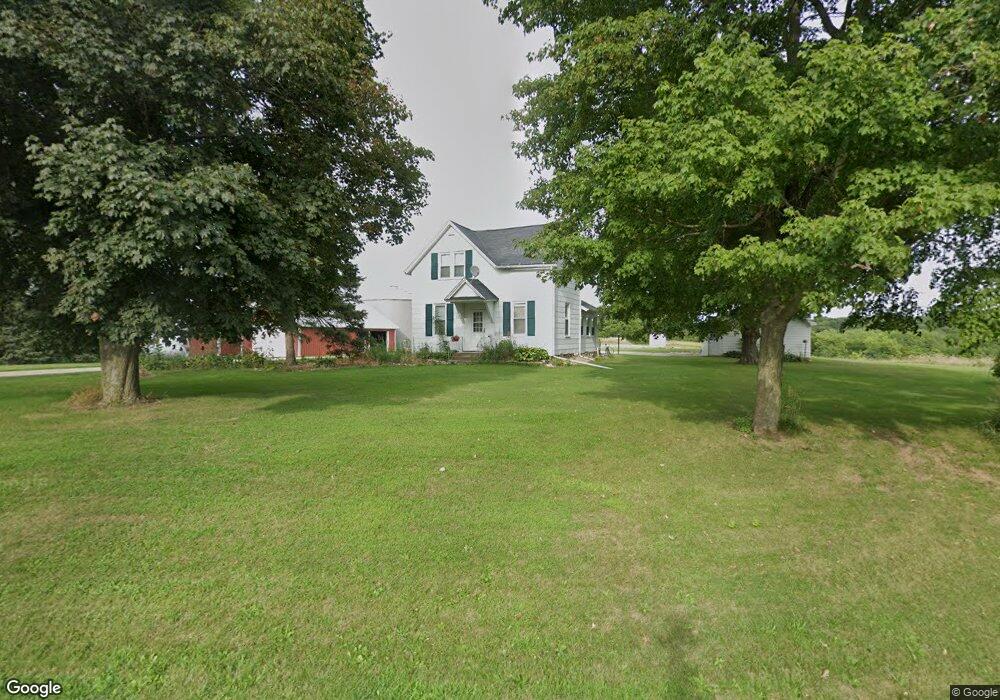
17946 Warner Castle Rd Coal Valley, IL 61240
Estimated Value: $317,000 - $805,970
3
Beds
--
Bath
710
Sq Ft
$699/Sq Ft
Est. Value
About This Home
This home is located at 17946 Warner Castle Rd, Coal Valley, IL 61240 and is currently estimated at $496,323, approximately $699 per square foot. 17946 Warner Castle Rd is a home located in Henry County with nearby schools including C.R. Hanna Elementary School, Orion Middle School, and Orion High School.
Ownership History
Date
Name
Owned For
Owner Type
Purchase Details
Closed on
Mar 1, 2021
Sold by
Vickie S Tennant Revocable Living Trust
Bought by
David W Tennant Revocable Living Trust
Current Estimated Value
Purchase Details
Closed on
Feb 15, 2013
Sold by
Tennant David W and Tennant Vicki J
Bought by
Tennant David W and David W Tennant Revocable Living Trust
Purchase Details
Closed on
Jan 18, 2013
Sold by
Tennant Vickie S
Bought by
Tennant Vicki S
Create a Home Valuation Report for This Property
The Home Valuation Report is an in-depth analysis detailing your home's value as well as a comparison with similar homes in the area
Home Values in the Area
Average Home Value in this Area
Purchase History
| Date | Buyer | Sale Price | Title Company |
|---|---|---|---|
| David W Tennant Revocable Living Trust | -- | Massie & Quick Llc | |
| Tennant David W | -- | None Available | |
| Tennant Vicki S | -- | None Available |
Source: Public Records
Tax History Compared to Growth
Tax History
| Year | Tax Paid | Tax Assessment Tax Assessment Total Assessment is a certain percentage of the fair market value that is determined by local assessors to be the total taxable value of land and additions on the property. | Land | Improvement |
|---|---|---|---|---|
| 2024 | $6,700 | $102,353 | $71,744 | $30,609 |
| 2023 | $6,163 | $92,956 | $64,449 | $28,507 |
| 2022 | $6,080 | $84,517 | $57,808 | $26,709 |
| 2021 | $5,604 | $76,782 | $51,780 | $25,002 |
| 2020 | $5,228 | $70,896 | $46,467 | $24,429 |
| 2019 | $4,856 | $65,794 | $41,675 | $24,119 |
| 2018 | $4,409 | $60,982 | $37,264 | $23,718 |
| 2017 | $3,869 | $56,452 | $33,256 | $23,196 |
| 2016 | $3,945 | $52,922 | $29,822 | $23,100 |
| 2015 | $3,020 | $49,861 | $26,761 | $23,100 |
| 2013 | $3,020 | $46,227 | $22,728 | $23,499 |
Source: Public Records
Map
Nearby Homes
- 13 Deer Run Rd
- 2 Kimberly Dr
- 126 Henry Dr
- 67 Buysse Dr
- 19 Sawgrass Dr
- 1850 Glenwood Heights
- 9821 Route 150
- 7 Autumn Creek Dr
- 711 E 19th Ave
- 1811 E 6th St
- 1815 E 6th Street A
- 1809 E 6th St
- 1903 E 6th St
- 1812 E 6th Street A
- 1810 E 6th Street A
- 1808 E 6th Street A
- 604 E 19th Ave
- 1806 E 6th Street A
- 602 E 19th Ave
- 600 E 19th Ave
- 2385 N 1800th Ave
- 2714 N 1800th Ave
- 17840 Warner Castle Rd
- 2704 N 1800th Ave
- 17794 Warner Castle Rd
- 17810 Warner Castle Rd
- 17765 Warner Castle Rd
- 2710 N 1800th Ave
- 17780 Warner Castle Rd
- 17741 Warner Castle Rd
- 17591 Warner Castle Rd
- 17643 Warner Castle Rd
- 17575 Warner Castle Rd
- 17539 Warner Castle Rd
- 17607 Warner Castle Rd
- 3202 N 1800th Ave
- 17553 Warner Castle Rd
- 2618 N 1700th Ave
- 17659 E 340th St
- 17795 E 340th St