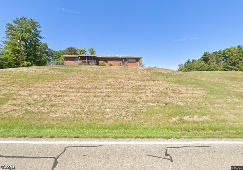
17949 State Route 550 Marietta, OH 45750
Estimated Value: $203,000 - $226,160
2
Beds
2
Baths
1,232
Sq Ft
$174/Sq Ft
Est. Value
About This Home
This home is located at 17949 State Route 550, Marietta, OH 45750 and is currently estimated at $213,790, approximately $173 per square foot. 17949 State Route 550 is a home with nearby schools including Warren High School.
Ownership History
Date
Name
Owned For
Owner Type
Purchase Details
Closed on
Apr 15, 2016
Bought by
John E Meeks and Linda L Meeks
Current Estimated Value
Home Financials for this Owner
Home Financials are based on the most recent Mortgage that was taken out on this home.
Interest Rate
3.58%
Purchase Details
Closed on
Mar 17, 2003
Bought by
Kelly Robert G and Kelly Dora B
Purchase Details
Closed on
Jun 6, 1995
Create a Home Valuation Report for This Property
The Home Valuation Report is an in-depth analysis detailing your home's value as well as a comparison with similar homes in the area
Home Values in the Area
Average Home Value in this Area
Purchase History
| Date | Buyer | Sale Price | Title Company |
|---|---|---|---|
| John E Meeks | $77,450 | -- | |
| Kelly Robert G | $81,800 | -- | |
| -- | -- | -- |
Source: Public Records
Mortgage History
| Date | Status | Borrower | Loan Amount |
|---|---|---|---|
| Closed | John E Meeks | -- |
Source: Public Records
Tax History Compared to Growth
Tax History
| Year | Tax Paid | Tax Assessment Tax Assessment Total Assessment is a certain percentage of the fair market value that is determined by local assessors to be the total taxable value of land and additions on the property. | Land | Improvement |
|---|---|---|---|---|
| 2024 | $2,436 | $64,280 | $11,390 | $52,890 |
| 2023 | $2,436 | $64,280 | $11,390 | $52,890 |
| 2022 | $2,430 | $64,280 | $11,390 | $52,890 |
| 2021 | $1,905 | $48,140 | $7,900 | $40,240 |
| 2020 | $1,897 | $48,140 | $7,900 | $40,240 |
| 2019 | $1,876 | $48,140 | $7,900 | $40,240 |
| 2018 | $1,735 | $43,320 | $6,870 | $36,450 |
| 2017 | $1,726 | $43,320 | $6,870 | $36,450 |
| 2016 | $2,205 | $43,320 | $6,870 | $36,450 |
| 2015 | $1,407 | $38,290 | $6,590 | $31,700 |
| 2014 | $1,971 | $38,290 | $6,590 | $31,700 |
| 2013 | $688 | $38,290 | $6,590 | $31,700 |
Source: Public Records
Map
Nearby Homes
- 65 High Point Dr
- 2021 Robinson Hill Rd
- 375 Belavista Dr
- 20645 Ohio 676
- 254 Riggenbach Hill Rd
- 100 Pineview Dr
- 116 Pineview Dr
- 0 River Rd Unit Lot WP001
- 505 Harbor Point
- 305 Flintwood Dr
- 565 Lang Farm Rd
- 204 Coventry Rd
- 188 Greenbrier Ave
- 0 Orange Dr
- 146 Riverview Dr
- 101 Laramie Rd
- 117 Clark St
- 211 Beaver St
- 9 Henderson Ln
- 53 Central Dr
- 17941 State Route 550
- 17964 Ohio 550
- 17920 State Route 550
- 17920 Ohio 550
- 17990 State Route 550
- 18033 State Route 550
- 17867 State Route 550
- 18097 State Route 550
- 18077 State Route 550
- 17855 State Route 550
- 17830 State Route 550
- 18165 State Route 550
- 17816 State Route 550
- 17790 State Route 550
- 18191 State Route 550
- 18179 State Route 550
- 18173 State Route 550
- 17824 State Route 550
- 690 Coffman Rd
- 18155 State Route 550