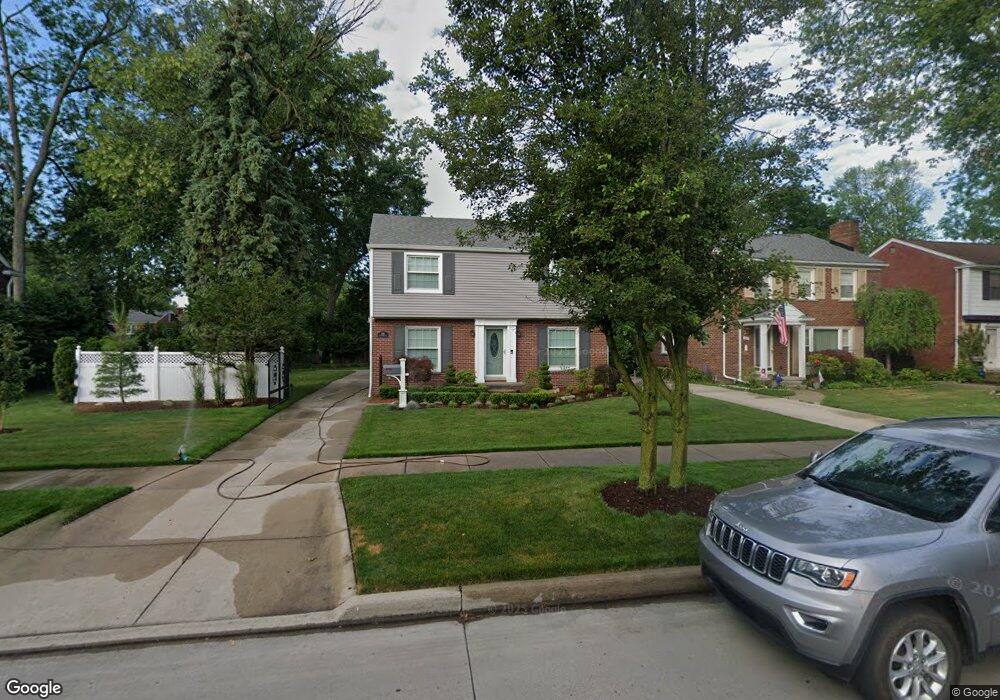
1795 Littlestone Rd Grosse Pointe Woods, MI 48236
Estimated Value: $342,000 - $430,000
3
Beds
3
Baths
1,701
Sq Ft
$218/Sq Ft
Est. Value
About This Home
This home is located at 1795 Littlestone Rd, Grosse Pointe Woods, MI 48236 and is currently estimated at $371,242, approximately $218 per square foot. 1795 Littlestone Rd is a home located in Wayne County with nearby schools including John Monteith Elementary School, Brownell Middle School, and Grosse Pointe North High School.
Ownership History
Date
Name
Owned For
Owner Type
Purchase Details
Closed on
Jun 3, 2024
Sold by
Longua Jeffrey B
Bought by
Longua Jeffrey B and Longua Emily M
Current Estimated Value
Purchase Details
Closed on
Feb 1, 2011
Sold by
Pyenta Kimberly A and Pyenta Michael J
Bought by
Longua Jeffrey B
Home Financials for this Owner
Home Financials are based on the most recent Mortgage that was taken out on this home.
Original Mortgage
$100,000
Interest Rate
4.84%
Mortgage Type
New Conventional
Purchase Details
Closed on
Jul 30, 1998
Sold by
Mollison Mollison H and Mollison J
Bought by
Giannico A A and Giannico Pyenta J
Create a Home Valuation Report for This Property
The Home Valuation Report is an in-depth analysis detailing your home's value as well as a comparison with similar homes in the area
Home Values in the Area
Average Home Value in this Area
Purchase History
| Date | Buyer | Sale Price | Title Company |
|---|---|---|---|
| Longua Jeffrey B | -- | None Listed On Document | |
| Longua Jeffrey B | -- | None Listed On Document | |
| Longua Jeffrey B | $147,000 | Greco | |
| Giannico A A | $234,000 | -- |
Source: Public Records
Mortgage History
| Date | Status | Borrower | Loan Amount |
|---|---|---|---|
| Previous Owner | Longua Jeffrey B | $100,000 |
Source: Public Records
Tax History Compared to Growth
Tax History
| Year | Tax Paid | Tax Assessment Tax Assessment Total Assessment is a certain percentage of the fair market value that is determined by local assessors to be the total taxable value of land and additions on the property. | Land | Improvement |
|---|---|---|---|---|
| 2025 | $3,387 | $172,800 | $0 | $0 |
| 2024 | $3,387 | $164,100 | $0 | $0 |
| 2023 | $3,258 | $152,800 | $0 | $0 |
| 2022 | $5,102 | $137,500 | $0 | $0 |
| 2021 | $4,863 | $130,200 | $0 | $0 |
| 2020 | $5,008 | $138,000 | $0 | $0 |
| 2019 | $2,965 | $123,400 | $0 | $0 |
| 2018 | $2,914 | $112,300 | $0 | $0 |
| 2017 | $3,386 | $107,300 | $0 | $0 |
| 2016 | $4,617 | $105,200 | $0 | $0 |
| 2015 | $8,002 | $93,800 | $0 | $0 |
| 2013 | $7,710 | $82,400 | $0 | $0 |
| 2012 | -- | $75,300 | $24,500 | $50,800 |
Source: Public Records
Map
Nearby Homes
- 1764 Prestwick Rd
- 21602 Newcastle Rd
- 19299 Raymond St
- 19277 Raymond St
- 19242 Eastborne St
- 1597 Newcastle Rd
- 21315 Prestwick Ave
- 19226 Eastborne St
- 21237 Severn Rd
- 21216 Brierstone St
- 463 Colonial Ct
- 21135 Littlestone Rd
- 21248 Newcastle Rd
- 21228 Newcastle Rd
- 21225 Bournemouth St
- 486 Bournemouth Rd
- 21138 Huntington Ave
- 19980 W Clairview Ct
- 410 Roland Ct
- 2371 Allard Ave
- 1803 Littlestone Rd
- 1779 Littlestone Rd
- 1811 Littlestone Rd
- 1788 Broadstone Rd
- 1819 Littlestone Rd
- 1804 Broadstone Rd
- 1812 Broadstone Rd
- 1771 Littlestone Rd
- 1828 Broadstone Rd
- 1827 Littlestone Rd
- 1792 Littlestone Rd
- 1784 Littlestone Rd
- 1800 Littlestone Rd
- 1840 Broadstone Rd
- 1776 Littlestone Rd
- 1808 Littlestone Rd
- 1835 Littlestone Rd
- 1816 Littlestone Rd
- 1766 Littlestone Rd
- 1747 Littlestone Rd