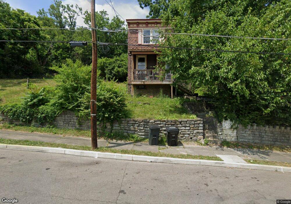
1796 Denham St Cincinnati, OH 45225
North Fairmount NeighborhoodEstimated Value: $74,321 - $188,000
3
Beds
1
Bath
1,632
Sq Ft
$73/Sq Ft
Est. Value
About This Home
This home is located at 1796 Denham St, Cincinnati, OH 45225 and is currently estimated at $119,330, approximately $73 per square foot. 1796 Denham St is a home located in Hamilton County with nearby schools including Ethel M. Taylor Academy, Robert A. Taft Information Technology High School, and Western Hills High School.
Ownership History
Date
Name
Owned For
Owner Type
Purchase Details
Closed on
Apr 9, 2018
Sold by
Ppg Property Management Llc
Bought by
Mof Investors Group Llc
Current Estimated Value
Purchase Details
Closed on
Feb 4, 2014
Sold by
Sg Investment Team Llc
Bought by
Ppg Property Management Llc
Purchase Details
Closed on
Jun 24, 2013
Sold by
Martin Family Capital Investments Llc
Bought by
Sg Investment Team Llc
Purchase Details
Closed on
Aug 31, 2010
Sold by
Martin Bradley D and Martin Julie J
Bought by
Martin Family Capital Investments Llc
Purchase Details
Closed on
Mar 30, 2010
Sold by
Martin Doris L and Martin Doris
Bought by
Martin Bradley D and Martin Julie J
Create a Home Valuation Report for This Property
The Home Valuation Report is an in-depth analysis detailing your home's value as well as a comparison with similar homes in the area
Home Values in the Area
Average Home Value in this Area
Purchase History
| Date | Buyer | Sale Price | Title Company |
|---|---|---|---|
| Mof Investors Group Llc | $16,900 | None Available | |
| Ppg Property Management Llc | $13,900 | None Available | |
| Sg Investment Team Llc | $8,000 | Attorney | |
| Martin Family Capital Investments Llc | -- | None Available | |
| Martin Bradley D | -- | Attorney |
Source: Public Records
Tax History
| Year | Tax Paid | Tax Assessment Tax Assessment Total Assessment is a certain percentage of the fair market value that is determined by local assessors to be the total taxable value of land and additions on the property. | Land | Improvement |
|---|---|---|---|---|
| 2025 | $676 | $10,560 | $1,229 | $9,331 |
| 2024 | $675 | $10,560 | $1,229 | $9,331 |
| 2023 | $676 | $10,560 | $1,229 | $9,331 |
| 2022 | $424 | $5,916 | $1,243 | $4,673 |
| 2021 | $414 | $5,916 | $1,243 | $4,673 |
| 2020 | $416 | $5,916 | $1,243 | $4,673 |
| 2019 | $502 | $6,514 | $1,131 | $5,383 |
| 2018 | $502 | $6,514 | $1,131 | $5,383 |
| 2017 | $483 | $6,514 | $1,131 | $5,383 |
| 2016 | $371 | $4,866 | $1,411 | $3,455 |
| 2015 | $332 | $4,866 | $1,411 | $3,455 |
| 2014 | $334 | $4,866 | $1,411 | $3,455 |
| 2013 | $454 | $6,525 | $1,397 | $5,128 |
Source: Public Records
Map
Nearby Homes
- 1797 Denham St
- 1808 Carll St
- 1793 Baltimore Ave
- 1781 Baltimore Ave
- 2594 Seegar Ave
- 1859 Baltimore Ave
- 1642 Sutter Ave
- 2568 Trevor Place
- 1646 Pulte St
- 1674 Baltimore Ave
- 2911 Moosewood Ct
- 1613 Pulte St
- 1607 Pulte St
- 2658 Linden St
- 2656 Linden St
- 2654 Linden St
- 2652 Linden St
- 2650 Linden St
- 1965 Baltimore Ave
- 1854 Knox St
- 1800 Denham St
- 1797 Pulte St
- 1789 Pulte St
- 1799 Pulte St
- 1784 Denham St
- 1795 Denham St
- 1793 Denham St Unit 1791
- 1793 Denham St
- 1799 Denham St
- 1801 Denham St
- 1782 Denham St
- 1803 Denham St
- 1783 Pulte St
- 1780 Denham St
- 1805 Denham St
- 1787 Denham St
- 1811 Pulte St
- 1807 Denham St
- 1785 Denham St
- 1781 Pulte St
Your Personal Tour Guide
Ask me questions while you tour the home.