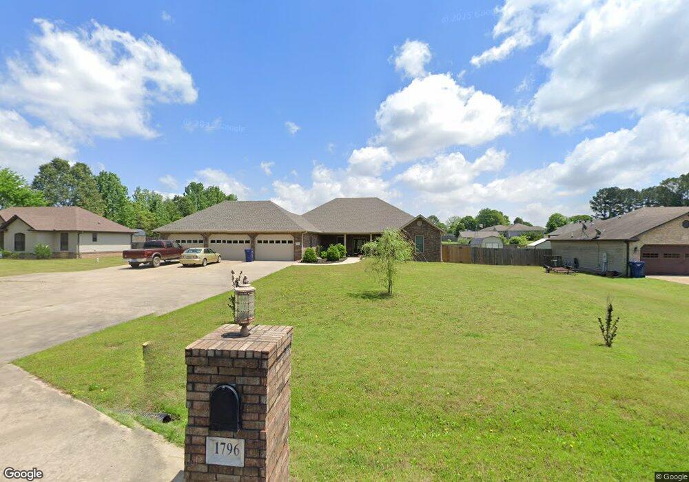
1796 Greene 632 Rd Paragould, AR 72450
Estimated Value: $315,000 - $412,000
--
Bed
1
Bath
2,563
Sq Ft
$143/Sq Ft
Est. Value
About This Home
This home is located at 1796 Greene 632 Rd, Paragould, AR 72450 and is currently estimated at $366,780, approximately $143 per square foot. 1796 Greene 632 Rd is a home with nearby schools including Paragould High School.
Ownership History
Date
Name
Owned For
Owner Type
Purchase Details
Closed on
Apr 10, 2024
Sold by
Smith Betty Jean and Wineland Gregory Allen
Bought by
Walker Clinton and Walker Norma
Current Estimated Value
Home Financials for this Owner
Home Financials are based on the most recent Mortgage that was taken out on this home.
Original Mortgage
$345,061
Interest Rate
6.94%
Mortgage Type
Construction
Purchase Details
Closed on
Aug 23, 2002
Bought by
Gail and Kappelman Robert O
Purchase Details
Closed on
Apr 13, 2000
Bought by
Gail Kappelman
Purchase Details
Closed on
Sep 14, 1999
Bought by
Gail Kappelman
Purchase Details
Closed on
Jan 14, 1987
Bought by
Gail Kappelman
Create a Home Valuation Report for This Property
The Home Valuation Report is an in-depth analysis detailing your home's value as well as a comparison with similar homes in the area
Home Values in the Area
Average Home Value in this Area
Purchase History
| Date | Buyer | Sale Price | Title Company |
|---|---|---|---|
| Walker Clinton | $342,000 | None Listed On Document | |
| Gail | -- | -- | |
| Gail Kappelman | -- | -- | |
| Gail Kappelman | -- | -- | |
| Gail Kappelman | -- | -- |
Source: Public Records
Mortgage History
| Date | Status | Borrower | Loan Amount |
|---|---|---|---|
| Closed | Walker Clinton | $345,061 |
Source: Public Records
Tax History Compared to Growth
Tax History
| Year | Tax Paid | Tax Assessment Tax Assessment Total Assessment is a certain percentage of the fair market value that is determined by local assessors to be the total taxable value of land and additions on the property. | Land | Improvement |
|---|---|---|---|---|
| 2025 | $3,411 | $75,430 | $3,600 | $71,830 |
| 2024 | $2,067 | $75,430 | $3,600 | $71,830 |
| 2023 | $1,894 | $56,250 | $3,300 | $52,950 |
| 2022 | $1,347 | $56,250 | $3,300 | $52,950 |
| 2021 | $1,347 | $56,250 | $3,300 | $52,950 |
| 2020 | $1,722 | $48,220 | $2,500 | $45,720 |
| 2019 | $1,347 | $48,220 | $2,500 | $45,720 |
| 2018 | $1,372 | $48,220 | $2,500 | $45,720 |
| 2017 | $1,684 | $48,220 | $2,500 | $45,720 |
| 2016 | $1,334 | $48,220 | $2,500 | $45,720 |
| 2015 | $1,334 | $1,400 | $1,400 | $0 |
| 2014 | $55 | $1,400 | $1,400 | $0 |
Source: Public Records
Map
Nearby Homes
- 422 Sunset Dr
- 205 Raymond
- 181 Misty Marie
- 522 Vaughn Dr
- 193 Granny Jean Ln
- 233 Lois Ln
- 44 Oak Grove Rd
- 146 Messer Dr
- 3613 Purcell Rd
- Tract 4 Greene 726 Rd
- Tract 3 Greene 726 Rd
- Tract 2 Greene 726 Rd
- 000 Hwy 412 Byp Everett Dr
- 0 Greene 611 Tract A East Rd
- 3505 Purcell Rd
- 5.38 AC Highway 135 N
- 0 Hwy 49s Unit 10124883
- 3407 Sweet Gum St
- 3505 Sweet Gum St
- 0 Acres Highway 49n Unit 10121154
- 1816 Greene 632 Rd
- 1816 Greene 632 Rd
- 1776 Greene Road 632
- 464 Sunset Dr
- 0 Sunset
- 1876 Greene 632 Rd
- 402 Sunset Dr
- 399 Sunset Dr
- 12 Mason Dr
- 12 Mason Dr
- 344 Sunset Dr
- 0 James Devaughn Dr Unit 20004339
- 0 James Devaughn Dr Unit 20004335
- 73 Greene 637 Rd
- 45 James Devaughn Dr
- 310 Sunset Dr
- 55 James Devaughn Dr
- 55 James Devaughn Dr Unit Lot 22 Deer Ridge Su
- 333 Sunset Dr
- 300 Sunset Dr