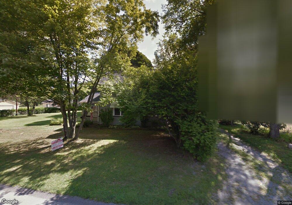
1797 Collar Price Rd Hubbard, OH 44425
Estimated Value: $65,878 - $225,000
--
Bed
--
Bath
--
Sq Ft
0.46
Acres
About This Home
This home is located at 1797 Collar Price Rd, Hubbard, OH 44425 and is currently estimated at $135,220. 1797 Collar Price Rd is a home located in Trumbull County with nearby schools including Hubbard Elementary School, Hubbard Middle School, and Hubbard High School.
Ownership History
Date
Name
Owned For
Owner Type
Purchase Details
Closed on
Mar 15, 2004
Sold by
Mershimer John Joseph
Bought by
Mershimer John Joseph and Mershimer Jean M
Current Estimated Value
Purchase Details
Closed on
Mar 2, 2004
Sold by
Mershimer John Joseph
Bought by
Mershimer John Joseph and Mershimer Jean M
Purchase Details
Closed on
Feb 11, 2003
Sold by
Mershimer Peter V
Bought by
Mershimer John Joseph and Mershimer Peter
Purchase Details
Closed on
Jan 23, 2002
Sold by
Mershimer Peter V
Bought by
Mershimer Peter
Purchase Details
Closed on
Mar 26, 2001
Sold by
Mershimer Mary Ann
Bought by
Mershimer Peter
Purchase Details
Closed on
Jan 1, 1990
Bought by
Mary Ann and Mary Peter
Create a Home Valuation Report for This Property
The Home Valuation Report is an in-depth analysis detailing your home's value as well as a comparison with similar homes in the area
Home Values in the Area
Average Home Value in this Area
Purchase History
| Date | Buyer | Sale Price | Title Company |
|---|---|---|---|
| Mershimer John Joseph | -- | -- | |
| Mershimer John Joseph | -- | -- | |
| Mershimer John Joseph | -- | -- | |
| Mershimer Peter | -- | -- | |
| Mershimer Peter | -- | -- | |
| Mary Ann | -- | -- |
Source: Public Records
Tax History Compared to Growth
Tax History
| Year | Tax Paid | Tax Assessment Tax Assessment Total Assessment is a certain percentage of the fair market value that is determined by local assessors to be the total taxable value of land and additions on the property. | Land | Improvement |
|---|---|---|---|---|
| 2024 | $362 | $6,240 | $3,050 | $3,190 |
| 2023 | $362 | $6,240 | $3,050 | $3,190 |
| 2022 | $354 | $5,430 | $2,800 | $2,630 |
| 2021 | $355 | $5,430 | $2,800 | $2,630 |
| 2020 | $357 | $5,430 | $2,800 | $2,630 |
| 2019 | $338 | $4,870 | $2,590 | $2,280 |
| 2018 | $328 | $4,870 | $2,590 | $2,280 |
| 2017 | $327 | $4,870 | $2,590 | $2,280 |
| 2016 | $337 | $5,250 | $2,590 | $2,660 |
| 2015 | $338 | $5,250 | $2,590 | $2,660 |
| 2014 | $331 | $5,250 | $2,590 | $2,660 |
| 2013 | $331 | $5,250 | $2,590 | $2,660 |
Source: Public Records
Map
Nearby Homes
- 7111 Pine Grove Dr
- 5910 Chestnut Ridge Rd
- 6855 Stewart Sharon Rd
- 1911 Hubbard Thomas Rd
- 5683 Chestnut Ridge Rd
- 5950 Mount Everett Rd
- 1975 Warner Rd
- 132 Drummond Ave
- 1441 Warner Rd
- 1472 Warner Rd
- 2675 Seifert-Lewis Rd
- 1354 Stevenson Rd
- 256 Warner Rd
- 1952 Hubbard Masury Rd
- 248 Myron St
- 764 Jones St
- 138 Moore St
- 395 Elizabeth St
- 462 Elizabeth St
- 784 Elmwood Dr
- 1797 Collar Price Rd
- 1803 Collar Price Rd
- 1811 Collar Price Rd
- 1783 Collar Price Rd
- 1802 Collar Price Rd
- 1790 Collar Price Rd
- 1819 Collar Price Rd
- 1816 Collar Price Rd
- 1835 Collar Price Rd
- 6557 Chestnut Ridge Rd
- 1751 Collar Price Rd
- 1840 Collar Price Rd
- 1735 Collar Price Rd
- 1740 Collar Price Rd
- 1730 Collar Price Rd
- 6585 Chestnut Ridge Rd
- 6603 Chestnut Ridge Rd
- 1717 Collar Price Rd
- 6590 Chestnut Ridge Rd
- 1712 Collar Price Rd