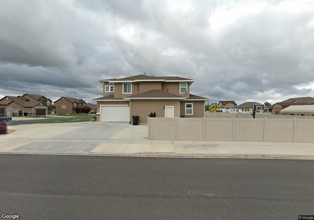
1797 E 70 N Unit 217D Spanish Fork, UT 84660
Estimated Value: $726,000 - $887,066
5
Beds
5
Baths
5,948
Sq Ft
$139/Sq Ft
Est. Value
About This Home
This home is located at 1797 E 70 N Unit 217D, Spanish Fork, UT 84660 and is currently estimated at $826,017, approximately $138 per square foot. 1797 E 70 N Unit 217D is a home located in Utah County with nearby schools including Sierra Bonita Elementary School, Mapleton Junior High School, and Maple Mountain High School.
Ownership History
Date
Name
Owned For
Owner Type
Purchase Details
Closed on
Mar 31, 2014
Sold by
Salisbury Developers Inc
Bought by
Chowdhary Bhupinder S and Chowdhary Kasey
Current Estimated Value
Home Financials for this Owner
Home Financials are based on the most recent Mortgage that was taken out on this home.
Original Mortgage
$250,000
Outstanding Balance
$189,903
Interest Rate
4.32%
Mortgage Type
Purchase Money Mortgage
Estimated Equity
$636,114
Purchase Details
Closed on
Oct 24, 2013
Sold by
Central Bank
Bought by
Salisbury Developers Inc
Home Financials for this Owner
Home Financials are based on the most recent Mortgage that was taken out on this home.
Original Mortgage
$324,600
Interest Rate
4.53%
Mortgage Type
Construction
Create a Home Valuation Report for This Property
The Home Valuation Report is an in-depth analysis detailing your home's value as well as a comparison with similar homes in the area
Home Values in the Area
Average Home Value in this Area
Purchase History
We collect this data history from publicly available records. To have your information removed, we recommend requesting removal directly through your county’s website.
| Date | Buyer | Sale Price | Title Company |
|---|---|---|---|
| Chowdhary Bhupinder S | -- | Provo Land Title Co | |
| Salisbury Developers Inc | -- | Provo Land Title Co |
Source: Public Records
Mortgage History
We collect this data history from publicly available records. To have your information removed, we recommend requesting removal directly through your county’s website.
| Date | Status | Borrower | Loan Amount |
|---|---|---|---|
| Open | Chowdhary Bhupinder S | $250,000 | |
| Previous Owner | Salisbury Developers Inc | $324,600 |
Source: Public Records
Tax History
| Year | Tax Paid | Tax Assessment Tax Assessment Total Assessment is a certain percentage of the fair market value that is determined by local assessors to be the total taxable value of land and additions on the property. | Land | Improvement |
|---|---|---|---|---|
| 2025 | $3,892 | $435,710 | -- | -- |
| 2024 | $3,892 | $401,115 | $0 | $0 |
| 2023 | $4,017 | $414,480 | $0 | $0 |
| 2022 | $3,824 | $387,035 | $0 | $0 |
| 2021 | $3,350 | $542,300 | $146,300 | $396,000 |
| 2020 | $3,112 | $489,800 | $133,000 | $356,800 |
| 2019 | $2,860 | $473,700 | $124,600 | $349,100 |
| 2018 | $2,803 | $448,700 | $114,000 | $334,700 |
| 2017 | $2,844 | $244,695 | $0 | $0 |
| 2016 | $2,784 | $236,335 | $0 | $0 |
| 2015 | $2,556 | $214,390 | $0 | $0 |
| 2014 | $1,128 | $95,000 | $0 | $0 |
Source: Public Records
Map
Nearby Homes
- 1867 E 160 S
- 1891 E 160 S
- 309 N 1980 E
- 2075 E 130 N
- 2138 E 200 N Unit 54M
- 2138 E 200 N Unit 55SFM
- 2162 E 200 N Unit 56
- 1821 E 230 S
- 236 S 1800 E
- 2288 E 390 N Unit 34M
- 2278 E 390 N Unit 35M
- 2302 E 320 N Unit 41
- 2248 E 320 N Unit 44
- 2282 E 320 N Unit 42
- 2264 E 320 N Unit 43
- 2281 E 320 N Unit 39
- 2303 E 320 N Unit 40
- 2265 E 320 N Unit 38M
- 1309 S 3690 E
- 1658 Dover Dr
- 1777 E 70 N
- 1777 E 70 N Unit 216D
- 127 N 1800 E Unit MM120A
- 1778 E 130 N
- 1792 E 70 N Unit 210D
- 1759 E 70 N Unit MM215D
- 1776 E 70 N
- 1758 E 130 N Unit 122a
- 1756 E 70 N
- 1737 E 70 N Unit 214D
- 29 N 1800 E Unit 209C
- 1732 E 130 N
- 1738 E 70 N Unit 213D
- 1738 E 70 N
- 1793 E 130 N
- 1777 E 130 N
- 96 N 1700 E
- 156 N 1800 E
- 13 N 1800 E
- 1757 E 130 N
Your Personal Tour Guide
Ask me questions while you tour the home.