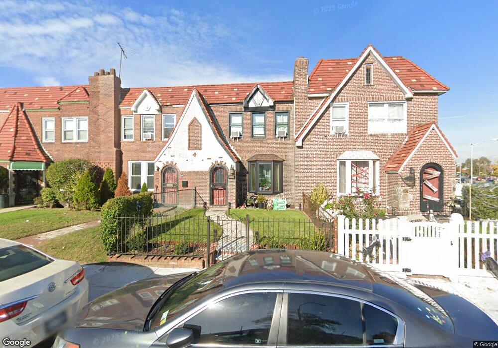
17973 Anderson Rd Jamaica, NY 11434
Saint Albans NeighborhoodEstimated Value: $622,228 - $796,000
--
Bed
--
Bath
1,600
Sq Ft
$440/Sq Ft
Est. Value
About This Home
This home is located at 17973 Anderson Rd, Jamaica, NY 11434 and is currently estimated at $703,807, approximately $439 per square foot. 17973 Anderson Rd is a home located in Queens County with nearby schools including The Jermaine L. Green STEM Institute of Queens, Catherine & Count Basie Middle School 72, and Riverton Street Charter School.
Ownership History
Date
Name
Owned For
Owner Type
Purchase Details
Closed on
Sep 17, 1998
Sold by
Hud
Bought by
James Mark C
Current Estimated Value
Home Financials for this Owner
Home Financials are based on the most recent Mortgage that was taken out on this home.
Original Mortgage
$150,900
Interest Rate
6.7%
Mortgage Type
FHA
Purchase Details
Closed on
Feb 9, 1998
Sold by
Gmac Mtg Corp
Bought by
Hud
Purchase Details
Closed on
Oct 17, 1995
Sold by
Sears John A and Sears Constance
Bought by
Gill Allister
Home Financials for this Owner
Home Financials are based on the most recent Mortgage that was taken out on this home.
Original Mortgage
$122,751
Interest Rate
7.58%
Mortgage Type
FHA
Create a Home Valuation Report for This Property
The Home Valuation Report is an in-depth analysis detailing your home's value as well as a comparison with similar homes in the area
Home Values in the Area
Average Home Value in this Area
Purchase History
| Date | Buyer | Sale Price | Title Company |
|---|---|---|---|
| James Mark C | $132,500 | -- | |
| Hud | -- | -- | |
| Gill Allister | $125,000 | -- |
Source: Public Records
Mortgage History
| Date | Status | Borrower | Loan Amount |
|---|---|---|---|
| Previous Owner | James Mark C | $150,900 | |
| Previous Owner | Gill Allister | $122,751 |
Source: Public Records
Tax History Compared to Growth
Tax History
| Year | Tax Paid | Tax Assessment Tax Assessment Total Assessment is a certain percentage of the fair market value that is determined by local assessors to be the total taxable value of land and additions on the property. | Land | Improvement |
|---|---|---|---|---|
| 2025 | $5,334 | $28,927 | $8,126 | $20,801 |
| 2024 | $4,294 | $27,955 | $8,630 | $19,325 |
| 2023 | $5,016 | $26,375 | $8,184 | $18,191 |
| 2022 | $4,680 | $33,060 | $11,040 | $22,020 |
| 2021 | $4,777 | $32,040 | $11,040 | $21,000 |
| 2020 | $4,807 | $29,400 | $11,040 | $18,360 |
| 2019 | $4,580 | $25,200 | $11,040 | $14,160 |
| 2018 | $4,183 | $21,979 | $10,642 | $11,337 |
| 2017 | $3,927 | $20,736 | $10,340 | $10,396 |
| 2016 | $3,706 | $20,736 | $10,340 | $10,396 |
| 2015 | $2,140 | $20,088 | $10,986 | $9,102 |
| 2014 | $2,140 | $19,414 | $10,287 | $9,127 |
Source: Public Records
Map
Nearby Homes
- 17955 Anderson Rd
- 179-50 Anderson Rd
- 179-47 Zoller Rd
- 17918 Selover Rd
- 178-10 Leslie Rd
- 17915 Eveleth Rd
- 17911 Eveleth Rd
- 12811 Harry Douglass Way
- 179-01 120th Ave
- 178-20 Selover Rd
- 17720 Leslie Rd
- 178-26 Zoller Rd
- 17836 Eveleth Rd
- 11984 178th Place
- 122-22 Nellis St
- 17710 Troutville Rd
- 17715 Troutville Rd
- 119-72 178th St
- 12244 Nellis St
- 176-27 Sunbury Rd
- 179-71 Anderson Rd
- 17971 Anderson Rd
- 17971 Anderson Rd
- 17975 Anderson Rd
- 17969 Anderson Rd
- 17967 Anderson Rd
- 17967 Anderson Rd
- 179-65 Anderson Rd
- 17965 Anderson Rd
- 17965 Anderson Rd
- 17974 Selover Rd
- 179-63 Anderson Rd
- 17963 Anderson Rd
- 17972 Selover Rd
- 17976 Selover Rd
- 17970 Selover Rd
- 17978 Selover Rd
- 17968 Selover Rd
- 179-61 Anderson Rd
- 17980 Selover Rd