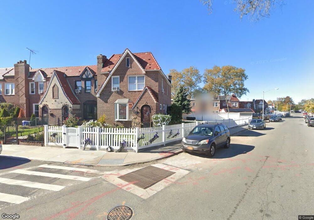
17975 Anderson Rd Jamaica, NY 11434
Saint Albans NeighborhoodEstimated Value: $638,529 - $797,000
--
Bed
--
Bath
1,600
Sq Ft
$453/Sq Ft
Est. Value
About This Home
This home is located at 17975 Anderson Rd, Jamaica, NY 11434 and is currently estimated at $724,882, approximately $453 per square foot. 17975 Anderson Rd is a home located in Queens County with nearby schools including The Jermaine L. Green STEM Institute of Queens, Catherine & Count Basie Middle School 72, and Riverton Street Charter School.
Ownership History
Date
Name
Owned For
Owner Type
Purchase Details
Closed on
Mar 27, 2001
Sold by
Harris Jessica B
Bought by
Bernard Elroy
Current Estimated Value
Home Financials for this Owner
Home Financials are based on the most recent Mortgage that was taken out on this home.
Original Mortgage
$180,000
Outstanding Balance
$66,108
Interest Rate
6.97%
Estimated Equity
$658,774
Purchase Details
Closed on
Mar 13, 1996
Sold by
Harris Rhoda A
Bought by
Harris Rhoda A and Harris Jessica B
Create a Home Valuation Report for This Property
The Home Valuation Report is an in-depth analysis detailing your home's value as well as a comparison with similar homes in the area
Home Values in the Area
Average Home Value in this Area
Purchase History
| Date | Buyer | Sale Price | Title Company |
|---|---|---|---|
| Bernard Elroy | -- | -- | |
| Bernard Elroy | -- | -- | |
| Bernard Elroy | -- | -- | |
| Harris Rhoda A | -- | -- | |
| Harris Rhoda A | -- | -- |
Source: Public Records
Mortgage History
| Date | Status | Borrower | Loan Amount |
|---|---|---|---|
| Open | Bernard Elroy | $180,000 | |
| Closed | Bernard Elroy | $0 |
Source: Public Records
Tax History Compared to Growth
Tax History
| Year | Tax Paid | Tax Assessment Tax Assessment Total Assessment is a certain percentage of the fair market value that is determined by local assessors to be the total taxable value of land and additions on the property. | Land | Improvement |
|---|---|---|---|---|
| 2025 | $5,890 | $31,085 | $10,297 | $20,788 |
| 2024 | $5,890 | $29,327 | $10,724 | $18,603 |
| 2023 | $5,557 | $27,667 | $10,351 | $17,316 |
| 2022 | $5,523 | $32,880 | $12,660 | $20,220 |
| 2021 | $5,697 | $33,360 | $12,660 | $20,700 |
| 2020 | $5,483 | $29,760 | $12,660 | $17,100 |
| 2019 | $5,112 | $25,500 | $12,660 | $12,840 |
| 2018 | $4,700 | $23,056 | $11,808 | $11,248 |
| 2017 | $4,700 | $23,056 | $12,285 | $10,771 |
| 2016 | $4,510 | $23,056 | $12,285 | $10,771 |
| 2015 | $2,623 | $21,587 | $13,258 | $8,329 |
| 2014 | $2,623 | $20,366 | $11,855 | $8,511 |
Source: Public Records
Map
Nearby Homes
- 17955 Anderson Rd
- 179-50 Anderson Rd
- 179-47 Zoller Rd
- 17918 Selover Rd
- 178-10 Leslie Rd
- 17915 Eveleth Rd
- 17911 Eveleth Rd
- 12811 Harry Douglass Way
- 179-01 120th Ave
- 178-20 Selover Rd
- 17720 Leslie Rd
- 178-26 Zoller Rd
- 17836 Eveleth Rd
- 11984 178th Place
- 122-22 Nellis St
- 17710 Troutville Rd
- 17715 Troutville Rd
- 119-72 178th St
- 12244 Nellis St
- 176-27 Sunbury Rd
- 17973 Anderson Rd
- 179-71 Anderson Rd
- 17971 Anderson Rd
- 17971 Anderson Rd
- 17969 Anderson Rd
- 17978 Selover Rd
- 17976 Selover Rd
- 17980 Selover Rd
- 17974 Selover Rd
- 17967 Anderson Rd
- 17967 Anderson Rd
- 17972 Selover Rd
- 179-65 Anderson Rd
- 17965 Anderson Rd
- 17970 Selover Rd
- 17965 Anderson Rd
- 17982 Selover Rd
- 12117 180th St
- 17968 Selover Rd
- 12115 180th St