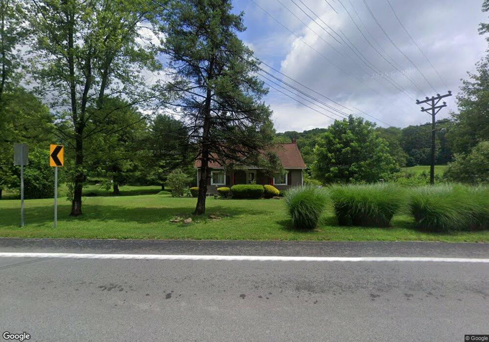
1798 Route 356 Allegheny Township - Wml, PA 15656
Allegheny Township NeighborhoodEstimated Value: $129,088 - $169,000
3
Beds
1
Bath
--
Sq Ft
2.2
Acres
About This Home
This home is located at 1798 Route 356, Allegheny Township - Wml, PA 15656 and is currently estimated at $153,522. 1798 Route 356 is a home located in Westmoreland County with nearby schools including Kiski Area High School and Harvest Baptist Academy.
Ownership History
Date
Name
Owned For
Owner Type
Purchase Details
Closed on
Apr 21, 2018
Sold by
Cornman Troy A
Bought by
Cornman Troy A and Cornman Christie
Current Estimated Value
Home Financials for this Owner
Home Financials are based on the most recent Mortgage that was taken out on this home.
Original Mortgage
$112,433
Outstanding Balance
$97,892
Interest Rate
4.99%
Mortgage Type
FHA
Estimated Equity
$55,630
Purchase Details
Closed on
Jan 14, 2009
Sold by
Sappe Mark D and Sappe Della J
Bought by
Cornman Troy A
Home Financials for this Owner
Home Financials are based on the most recent Mortgage that was taken out on this home.
Original Mortgage
$75,000
Interest Rate
5.52%
Mortgage Type
Purchase Money Mortgage
Create a Home Valuation Report for This Property
The Home Valuation Report is an in-depth analysis detailing your home's value as well as a comparison with similar homes in the area
Home Values in the Area
Average Home Value in this Area
Purchase History
| Date | Buyer | Sale Price | Title Company |
|---|---|---|---|
| Cornman Troy A | -- | None Available | |
| Cornman Troy A | $95,000 | None Available |
Source: Public Records
Mortgage History
| Date | Status | Borrower | Loan Amount |
|---|---|---|---|
| Open | Cornman Troy A | $112,433 | |
| Closed | Cornman Troy A | $75,000 |
Source: Public Records
Tax History Compared to Growth
Tax History
| Year | Tax Paid | Tax Assessment Tax Assessment Total Assessment is a certain percentage of the fair market value that is determined by local assessors to be the total taxable value of land and additions on the property. | Land | Improvement |
|---|---|---|---|---|
| 2025 | $1,730 | $11,410 | $2,360 | $9,050 |
| 2024 | $1,642 | $11,410 | $2,360 | $9,050 |
| 2023 | $1,501 | $11,410 | $2,360 | $9,050 |
| 2022 | $1,467 | $11,410 | $2,360 | $9,050 |
| 2021 | $1,467 | $11,410 | $2,360 | $9,050 |
| 2020 | $1,463 | $11,410 | $2,360 | $9,050 |
| 2019 | $1,458 | $11,410 | $2,360 | $9,050 |
| 2018 | $1,435 | $11,410 | $2,360 | $9,050 |
| 2017 | $1,401 | $11,410 | $2,360 | $9,050 |
| 2016 | $1,380 | $11,410 | $2,360 | $9,050 |
| 2015 | $1,380 | $11,410 | $2,360 | $9,050 |
| 2014 | $1,373 | $11,410 | $2,360 | $9,050 |
Source: Public Records
Map
Nearby Homes
- 1765 State Route 356
- 0 Williams Rd
- Lot 4 Sober Rd
- Lot 3 Sober Rd
- Lot 2 Sober Rd
- Lot 1 Sober Rd
- 0 Ritter Ln
- 118 Washington St
- 255 2nd St
- 0 Sportsman Rd Unit 1719147
- 110 Hickory Ln
- 100 Willow Dr
- 1218 Edgewood Dr
- 50 Wanda Way
- 109 1st Ave
- 307 Sherwood Dr
- 221 Summit Dr
- 987 Beck Rd
- 165 Sunrise Dr
- 767 Evergreen Rd
- 1798 State Route 356
- 1792 State Route 356
- 1816 State Route 356
- 1776 State Route 356
- 1773 State Route 356
- 1771 State Route 356
- 1768 State Route 356
- 1826 State Route 356
- 1767 State Route 356
- 181 Bagdad Rd
- 211 Bagdad Rd
- 199 Bagdad Rd
- 40 Church Rd
- 186 Bagdad Rd
- 217 Bagdad Rd
- 6267 Garvers Ferry Rd
- 92 Church Rd
- 222 Bagdad Rd
- 6261 Garvers Ferry Rd
- 317 Hilltop Ln