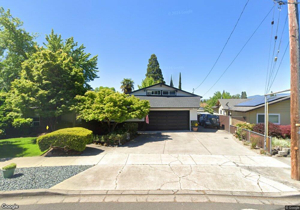
1799 Serenity Dr Medford, OR 97504
Estimated Value: $470,000 - $512,556
3
Beds
3
Baths
1,971
Sq Ft
$249/Sq Ft
Est. Value
About This Home
This home is located at 1799 Serenity Dr, Medford, OR 97504 and is currently estimated at $490,889, approximately $249 per square foot. 1799 Serenity Dr is a home located in Jackson County with nearby schools including Wilson Elementary School, Hedrick Middle School, and North Medford High School.
Ownership History
Date
Name
Owned For
Owner Type
Purchase Details
Closed on
Jul 31, 2025
Sold by
Mullaney Matthew
Bought by
Vallee And Dennis Living Trust and Vallee
Current Estimated Value
Purchase Details
Closed on
Aug 27, 2012
Sold by
Ivers Diane K
Bought by
Ivers F Scott and Ivers Diane K
Purchase Details
Closed on
Oct 25, 2005
Sold by
Wold Troy J and Wold Tami J
Bought by
Ivers F Scott and Ivers Diane K
Purchase Details
Closed on
Feb 9, 2004
Sold by
Ivers Diane F and Green Diane K
Bought by
Ivers F Scott and Ivers Diane K
Create a Home Valuation Report for This Property
The Home Valuation Report is an in-depth analysis detailing your home's value as well as a comparison with similar homes in the area
Home Values in the Area
Average Home Value in this Area
Purchase History
| Date | Buyer | Sale Price | Title Company |
|---|---|---|---|
| Vallee And Dennis Living Trust | $430,000 | First American Title | |
| Ivers F Scott | -- | Ticor Title | |
| Ivers F Scott | $300,000 | Lawyers Title Insurance Corp | |
| Ivers F Scott | -- | -- |
Source: Public Records
Tax History Compared to Growth
Tax History
| Year | Tax Paid | Tax Assessment Tax Assessment Total Assessment is a certain percentage of the fair market value that is determined by local assessors to be the total taxable value of land and additions on the property. | Land | Improvement |
|---|---|---|---|---|
| 2025 | $4,278 | $294,990 | $76,860 | $218,130 |
| 2024 | $4,278 | $286,400 | $74,620 | $211,780 |
| 2023 | $4,147 | $278,060 | $72,440 | $205,620 |
| 2022 | $4,046 | $278,060 | $72,440 | $205,620 |
| 2021 | $3,941 | $269,970 | $70,330 | $199,640 |
| 2020 | $3,858 | $262,110 | $68,280 | $193,830 |
| 2019 | $3,767 | $247,070 | $64,350 | $182,720 |
| 2018 | $3,670 | $239,880 | $62,480 | $177,400 |
| 2017 | $3,604 | $239,880 | $62,480 | $177,400 |
| 2016 | $3,628 | $226,120 | $58,890 | $167,230 |
| 2015 | $3,487 | $226,120 | $58,890 | $167,230 |
| 2014 | $3,426 | $213,150 | $55,500 | $157,650 |
Source: Public Records
Map
Nearby Homes
- 1512 Nordic Ct
- 1588 Nordic Ct
- 1448 Carolyn Cir
- 1744 Concord Way
- 3626 Ford Dr
- 2217 Jubilant Ave
- 1228 Corona Ave
- 1215 Covina Ave
- 1225 Corona Ave
- 1220 Morrow Rd
- 1212 Morrow Rd
- 1202 Morrow Rd Unit A
- 1411 E McAndrews Rd
- 2000 Brookhurst St Unit 2
- 2000 Brookhurst St Unit 1
- 2030 Brookhurst St Unit 28
- 1441 Larkspur Ave
- 2481 Northcrest Cir
- 2010 Crater Lake Ave
- 2058 Roberts Rd
- 1793 Serenity Dr
- 1801 Serenity Dr
- 1531 Miracle Ln
- 1541 Miracle Ln
- 1521 Miracle Ln
- 1809 Serenity Dr
- 1787 Serenity Dr
- 1511 Miracle Ln
- 1551 Miracle Ln
- 1702 Corona Ave
- 1817 Serenity Dr
- 1784 Serenity Dr
- 1561 Miracle Ln
- 1781 Serenity Dr
- 1830 Serenity Dr
- 1501 Miracle Ln
- 1530 Miracle Ln
- 1540 Miracle Ln
- 1520 Miracle Ln Unit 1
- 1822 Corona Ave