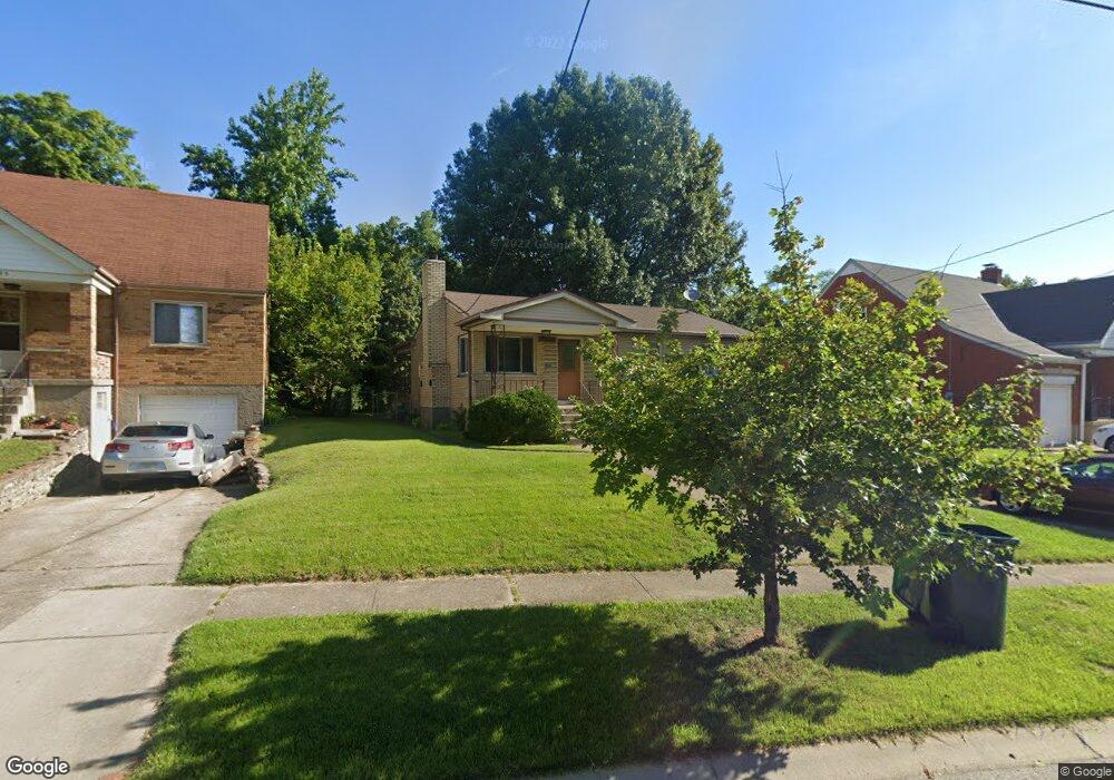
1799 Tuxworth Ave Cincinnati, OH 45238
West Price Hill NeighborhoodEstimated Value: $185,923 - $202,000
3
Beds
1
Bath
1,036
Sq Ft
$184/Sq Ft
Est. Value
About This Home
This home is located at 1799 Tuxworth Ave, Cincinnati, OH 45238 and is currently estimated at $190,981, approximately $184 per square foot. 1799 Tuxworth Ave is a home located in Hamilton County with nearby schools including Carson School, Gilbert A. Dater High School, and Western Hills High School.
Ownership History
Date
Name
Owned For
Owner Type
Purchase Details
Closed on
Jun 24, 1997
Sold by
Halpin Michele E
Bought by
Weber Mark S and Weber Karen M
Current Estimated Value
Home Financials for this Owner
Home Financials are based on the most recent Mortgage that was taken out on this home.
Original Mortgage
$78,885
Outstanding Balance
$11,308
Interest Rate
8%
Mortgage Type
FHA
Estimated Equity
$179,673
Purchase Details
Closed on
May 26, 1994
Sold by
Wilkins Lillian
Bought by
Halpin Michele E
Home Financials for this Owner
Home Financials are based on the most recent Mortgage that was taken out on this home.
Original Mortgage
$71,900
Interest Rate
8.48%
Mortgage Type
FHA
Create a Home Valuation Report for This Property
The Home Valuation Report is an in-depth analysis detailing your home's value as well as a comparison with similar homes in the area
Home Values in the Area
Average Home Value in this Area
Purchase History
| Date | Buyer | Sale Price | Title Company |
|---|---|---|---|
| Weber Mark S | $79,000 | -- | |
| Halpin Michele E | -- | -- |
Source: Public Records
Mortgage History
| Date | Status | Borrower | Loan Amount |
|---|---|---|---|
| Open | Weber Mark S | $78,885 | |
| Previous Owner | Halpin Michele E | $71,900 |
Source: Public Records
Tax History Compared to Growth
Tax History
| Year | Tax Paid | Tax Assessment Tax Assessment Total Assessment is a certain percentage of the fair market value that is determined by local assessors to be the total taxable value of land and additions on the property. | Land | Improvement |
|---|---|---|---|---|
| 2024 | $2,493 | $41,545 | $6,153 | $35,392 |
| 2023 | $2,549 | $41,545 | $6,153 | $35,392 |
| 2022 | $1,764 | $25,715 | $6,115 | $19,600 |
| 2021 | $1,694 | $25,715 | $6,115 | $19,600 |
| 2020 | $1,744 | $25,715 | $6,115 | $19,600 |
| 2019 | $1,733 | $23,377 | $5,558 | $17,819 |
| 2018 | $1,736 | $23,377 | $5,558 | $17,819 |
| 2017 | $1,649 | $23,377 | $5,558 | $17,819 |
| 2016 | $1,825 | $25,537 | $5,940 | $19,597 |
| 2015 | $1,646 | $25,537 | $5,940 | $19,597 |
| 2014 | $1,658 | $25,537 | $5,940 | $19,597 |
| 2013 | $1,915 | $29,019 | $6,748 | $22,271 |
Source: Public Records
Map
Nearby Homes
- 1774 Ashbrook Dr
- 1803 Ashbrook Dr
- 4764 Clevesdale Dr
- 1861 Ashbrook Dr
- 1869 Ashbrook Dr
- 4769 Hardwick Dr
- 4798 Prosperity Place
- 4826 Prosperity Place
- 4885 N Overlook Ave
- 4638 Glenway Ave
- 4965 Glenway Ave
- 4934 Relleum Ave
- 1131 Olivia Ln
- 1225 Amanda Place
- 1205 Amanda Place
- 1226 Rutledge Ave
- 1227 Texas Ave
- 1660 Dewey Ave
- 1617 Dewey Ave
- 1646 Dewey Ave
- 1795 Tuxworth Ave
- 1803 Tuxworth Ave
- 1791 Tuxworth Ave
- 1805 Tuxworth Ave
- 1805 Tuxworth Ave
- 1805 Tuxworth Ave Unit 1
- 1787 Tuxworth Ave
- 1746 Hillfred Ln
- 1807 Tuxworth Ave
- 1807 Tuxworth Ave
- 1740 Hillfred Ln
- 1790 Tuxworth Ave
- 1784 Tuxworth Ave
- 1809 Tuxworth Ave Unit 5
- 1809 Tuxworth Ave Unit 6
- 1809 Tuxworth Ave
- 1809 Tuxworth Ave Unit 2
- 1779 Tuxworth Ave
- 1736 Hillfred Ln
- 1806 Tuxworth Ave