--
Bed
--
Bath
4,915
Sq Ft
5.79
Acres
About This Home
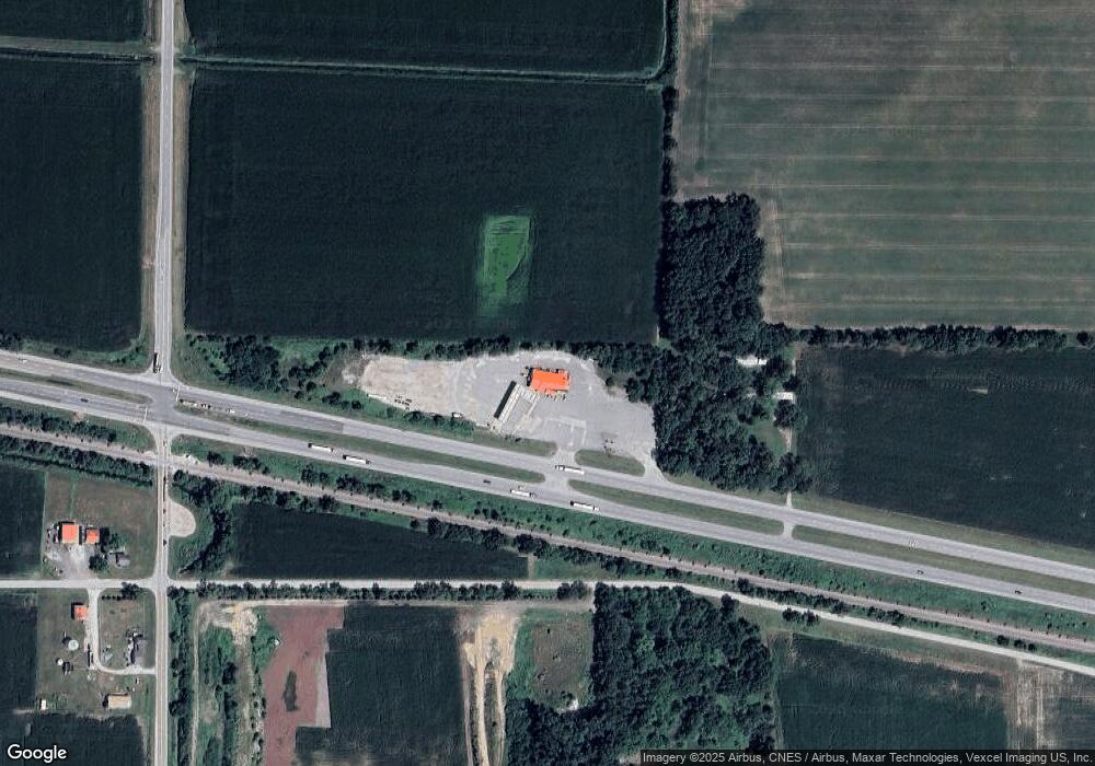
This home is located at 1799 W Us Highway 30, Hanna, IN 46340. 1799 W Us Highway 30 is a home located in LaPorte County with nearby schools including South Central Elementary School and South Central Junior/Senior High School.
Ownership History
Date
Name
Owned For
Owner Type
Purchase Details
Closed on
Aug 30, 2022
Sold by
Supersky Fuels Inc
Bought by
Powerhouse Petroleum Inc
Purchase Details
Closed on
Feb 16, 2022
Sold by
Michael Minix
Bought by
Supersky Fuels Inc
Purchase Details
Closed on
Mar 20, 2013
Sold by
Business Loan Center Llc
Bought by
Minix Michael
Purchase Details
Closed on
May 11, 2007
Sold by
Serene Gas Inc
Bought by
Business Loan Center Llc
Create a Home Valuation Report for This Property
The Home Valuation Report is an in-depth analysis detailing your home's value as well as a comparison with similar homes in the area
Home Values in the Area
Average Home Value in this Area
Purchase History
| Date | Buyer | Sale Price | Title Company |
|---|---|---|---|
| Powerhouse Petroleum Inc | -- | None Listed On Document | |
| Supersky Fuels Inc | $750,000 | Jon A Schmaltz Burke Costanza | |
| Minix Michael | -- | Stewart Title Guaranty Co | |
| Business Loan Center Llc | $175,000 | None Available |
Source: Public Records
Tax History Compared to Growth
Tax History
| Year | Tax Paid | Tax Assessment Tax Assessment Total Assessment is a certain percentage of the fair market value that is determined by local assessors to be the total taxable value of land and additions on the property. | Land | Improvement |
|---|---|---|---|---|
| 2024 | $7,058 | $330,000 | $157,800 | $172,200 |
| 2022 | $7,123 | $335,300 | $157,800 | $177,500 |
| 2021 | $7,193 | $327,900 | $157,800 | $170,100 |
| 2020 | $7,312 | $327,900 | $157,800 | $170,100 |
| 2019 | $7,227 | $327,900 | $157,800 | $170,100 |
| 2018 | $6,772 | $327,900 | $157,800 | $170,100 |
| 2017 | $7,088 | $327,800 | $157,800 | $170,000 |
| 2016 | $6,570 | $346,900 | $157,800 | $189,100 |
| 2014 | $5,087 | $272,000 | $157,800 | $114,200 |
Source: Public Records
Map
Nearby Homes
- 14501 S 400 W
- 114 E Jersey St
- 11 W West St
- 12502 S 50 E
- 11333 S State Road 39
- 10707 Long Ln
- 13956 S 550 W
- ESSEX Plan at Park Place South
- AUBURN Plan at Park Place South
- DUPONT Plan at Park Place South
- 701 Edgemoor Rd
- 706 Edgemoor Rd
- 704 Edgemoor Rd
- 901 Larchmere Rd
- 813 Larchmere Rd
- 817 Larchmere Rd
- 904 Kenilworth Rd
- 814 Kenilworth Rd
- 902 Kenilworth Rd
- 906 Kenilworth Rd