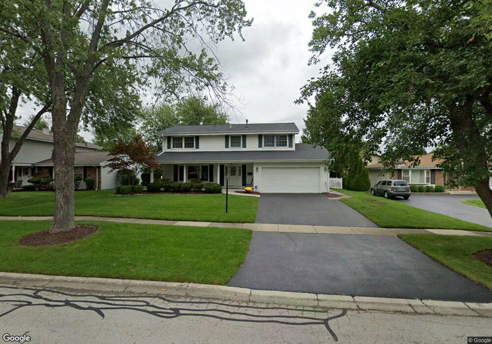
17W484 Sutton Place Unit 1 Darien, IL 60561
Estimated Value: $501,658 - $552,000
4
Beds
3
Baths
2,474
Sq Ft
$214/Sq Ft
Est. Value
About This Home
This home is located at 17W484 Sutton Place Unit 1, Darien, IL 60561 and is currently estimated at $530,415, approximately $214 per square foot. 17W484 Sutton Place Unit 1 is a home located in DuPage County with nearby schools including Mark Delay School, Lace Elementary School, and Eisenhower Jr High School.
Ownership History
Date
Name
Owned For
Owner Type
Purchase Details
Closed on
Apr 27, 2004
Sold by
Weeks John M and Weeks Cecelia T
Bought by
Topf Brian and Britt Joan
Current Estimated Value
Home Financials for this Owner
Home Financials are based on the most recent Mortgage that was taken out on this home.
Original Mortgage
$331,200
Outstanding Balance
$155,286
Interest Rate
5.5%
Mortgage Type
Purchase Money Mortgage
Estimated Equity
$375,129
Create a Home Valuation Report for This Property
The Home Valuation Report is an in-depth analysis detailing your home's value as well as a comparison with similar homes in the area
Home Values in the Area
Average Home Value in this Area
Purchase History
| Date | Buyer | Sale Price | Title Company |
|---|---|---|---|
| Topf Brian | $414,000 | -- |
Source: Public Records
Mortgage History
| Date | Status | Borrower | Loan Amount |
|---|---|---|---|
| Open | Topf Brian | $331,200 |
Source: Public Records
Tax History Compared to Growth
Tax History
| Year | Tax Paid | Tax Assessment Tax Assessment Total Assessment is a certain percentage of the fair market value that is determined by local assessors to be the total taxable value of land and additions on the property. | Land | Improvement |
|---|---|---|---|---|
| 2024 | $8,695 | $154,892 | $49,212 | $105,680 |
| 2023 | $8,365 | $142,390 | $45,240 | $97,150 |
| 2022 | $7,952 | $135,470 | $43,040 | $92,430 |
| 2021 | $7,321 | $133,930 | $42,550 | $91,380 |
| 2020 | $7,213 | $131,280 | $41,710 | $89,570 |
| 2019 | $6,959 | $125,960 | $40,020 | $85,940 |
| 2018 | $6,499 | $121,420 | $39,800 | $81,620 |
| 2017 | $6,425 | $116,840 | $38,300 | $78,540 |
| 2016 | $6,243 | $111,510 | $36,550 | $74,960 |
| 2015 | $6,121 | $104,910 | $34,390 | $70,520 |
| 2014 | $6,012 | $102,010 | $33,440 | $68,570 |
| 2013 | $5,771 | $101,470 | $33,280 | $68,190 |
Source: Public Records
Map
Nearby Homes
- Lot 1, 2, 3, 4 & 5 Nantucket Dr
- 17W455 Concord Place
- 801 79th St Unit 105
- 709 79th St Unit 103
- 709 79th St Unit 307
- 709 79th St Unit 403
- 7817 Mayfair Ln
- 716 Somerset Ln
- 7713 Brookhaven Ave
- 7715 Sussex Creek Dr Unit 1D
- 1018 Bob-O-link Ln
- 7515 Nantucket Dr Unit 404
- 7525 Nantucket Dr Unit 210
- 8081 Tennessee Ave
- 7510 Farmingdale Dr Unit 208
- 8122 Ripple Ridge
- 7930 Grant St
- 8301 Highpoint Cir Unit C
- 1310 Iroquois Ln
- 7976 Clarendon Hills Rd
- 17W474 Sutton Place Unit 1
- 17W504 Sutton Place
- 17W475 Sutton Place
- 17W485 Sutton Place
- 17W464 Sutton Place Unit 1
- 17W514 Sutton Place
- 901 79th St
- 17W505 Sutton Place
- 829 79th St
- 17W515 Sutton Place
- 905 79th St
- 17W465 Sutton Place
- 17W525 Sutton Place
- 909 79th St
- 825 79th St
- 17W524 Sutton Place
- 17W454 Sutton Place
- 821 79th St
- 17W455 Sutton Place
- 913 79th St