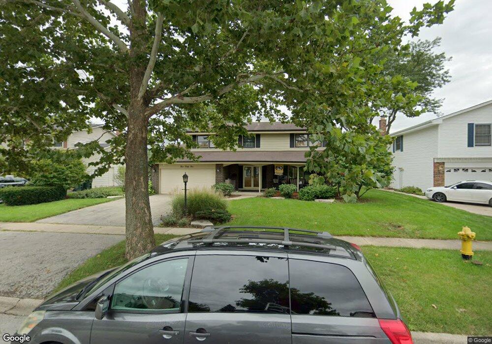
17W545 Sutton Place Darien, IL 60561
Estimated Value: $460,301 - $532,000
Studio
1
Bath
2,288
Sq Ft
$219/Sq Ft
Est. Value
About This Home
This home is located at 17W545 Sutton Place, Darien, IL 60561 and is currently estimated at $502,075, approximately $219 per square foot. 17W545 Sutton Place is a home located in DuPage County with nearby schools including Concord Elementary School, Cass Jr High School, and Hinsdale South High School.
Ownership History
Date
Name
Owned For
Owner Type
Purchase Details
Closed on
Feb 3, 1999
Sold by
Zeno David J and Zeno Patricia L
Bought by
Schwass Richard and Schwass Christie
Current Estimated Value
Home Financials for this Owner
Home Financials are based on the most recent Mortgage that was taken out on this home.
Original Mortgage
$198,671
Interest Rate
6.88%
Mortgage Type
FHA
Create a Home Valuation Report for This Property
The Home Valuation Report is an in-depth analysis detailing your home's value as well as a comparison with similar homes in the area
Home Values in the Area
Average Home Value in this Area
Purchase History
| Date | Buyer | Sale Price | Title Company |
|---|---|---|---|
| Schwass Richard | $200,500 | First American Title Ins |
Source: Public Records
Mortgage History
| Date | Status | Borrower | Loan Amount |
|---|---|---|---|
| Previous Owner | Schwass Richard | $198,671 |
Source: Public Records
Tax History
| Year | Tax Paid | Tax Assessment Tax Assessment Total Assessment is a certain percentage of the fair market value that is determined by local assessors to be the total taxable value of land and additions on the property. | Land | Improvement |
|---|---|---|---|---|
| 2024 | $8,325 | $148,637 | $49,212 | $99,425 |
| 2023 | $8,007 | $136,640 | $45,240 | $91,400 |
| 2022 | $7,616 | $130,000 | $43,040 | $86,960 |
| 2021 | $7,012 | $128,520 | $42,550 | $85,970 |
| 2020 | $6,908 | $125,980 | $41,710 | $84,270 |
| 2019 | $6,664 | $120,880 | $40,020 | $80,860 |
| 2018 | $6,198 | $116,080 | $39,800 | $76,280 |
| 2017 | $6,127 | $111,700 | $38,300 | $73,400 |
| 2016 | $5,953 | $106,600 | $36,550 | $70,050 |
| 2015 | $5,835 | $100,290 | $34,390 | $65,900 |
| 2014 | $5,730 | $97,510 | $33,440 | $64,070 |
| 2013 | $5,504 | $97,050 | $33,280 | $63,770 |
Source: Public Records
Map
Nearby Homes
- Lot 1, 2, 3, 4 & 5 Nantucket Dr
- 17W435 Concord Place
- 709 79th St Unit 408
- 7802 Warwick Ave
- 7816 Dorchester Ln
- 7800 Dorchester Ln
- 7706 Warwick Ave
- 1204 Sleepy Hollow Ln
- 7725 Sawyer Rd
- 8167 Ripple Ridge Unit 8167
- 8169 Ripple Ridge
- 7525 Nantucket Dr Unit 210
- 714 Walnut Dr Unit 205
- 7700 Apple Tree Ln
- 8313 Highpoint Cir Unit F
- 1370 Marco Ct
- 1390 Marco Ct
- 1501 Darien Lake Dr Unit A201
- 310 Sheridan Dr Unit 1D
- 1518 Pine View Ct
- 17W555 Sutton Place
- 17W535 Sutton Place
- 17W544 Earl Ct
- 17W554 Earl Ct
- 17W565 Sutton Place
- 17W534 Earl Ct
- 17W544 Sutton Place
- 17W554 Sutton Place
- 17W534 Sutton Place
- 17W564 Earl Ct
- 17W525 Sutton Place
- 17W564 Sutton Place
- 17w Sutton Place
- 17W524 Sutton Place
- 17W515 Sutton Place
- 17W524 Earl Ct Unit 1
- 17W514 Sutton Place
- 17W514 Earl Ct
- 921 79th St
- 9S026 Stratford Place
Your Personal Tour Guide
Ask me questions while you tour the home.