
Landlord's Agent in 2025
Glenn McDonald
The Firm
(781) 929-4774
6 in this area
38 Total Sales
Estimated Value: $622,000 - $789,000
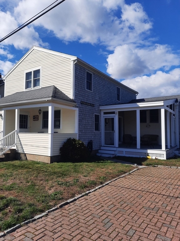
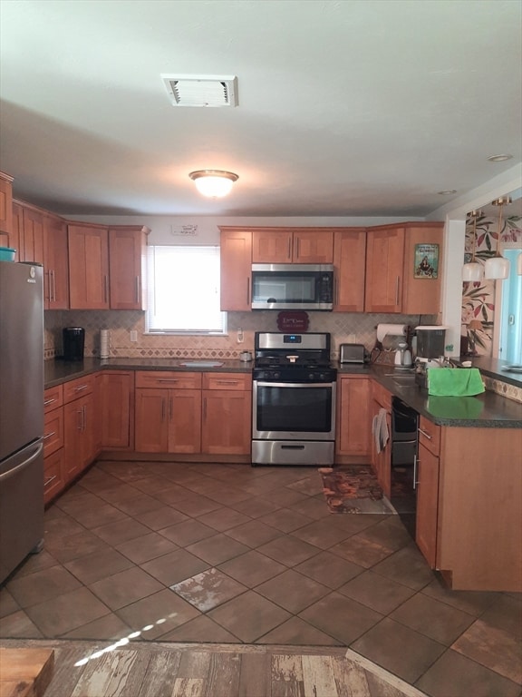
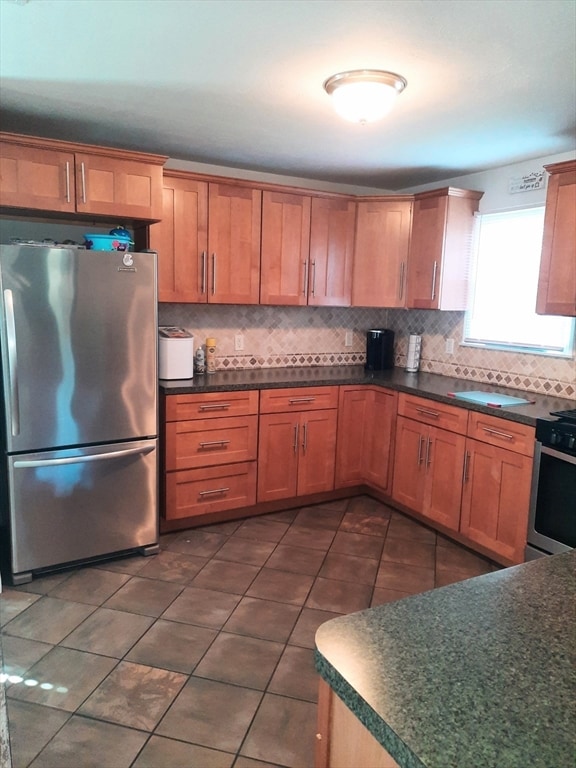
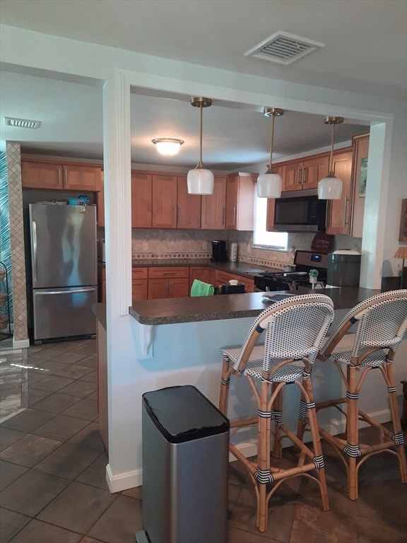
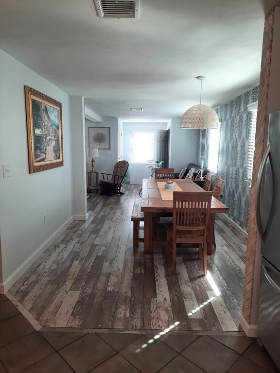
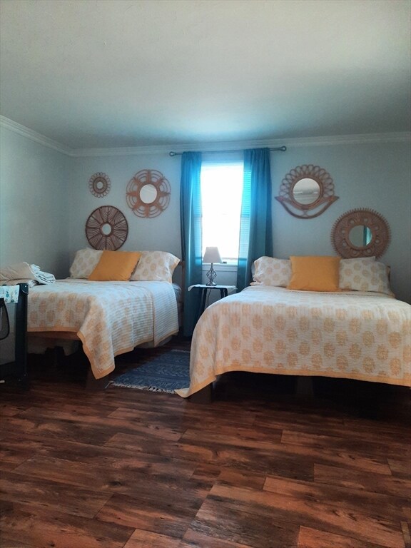
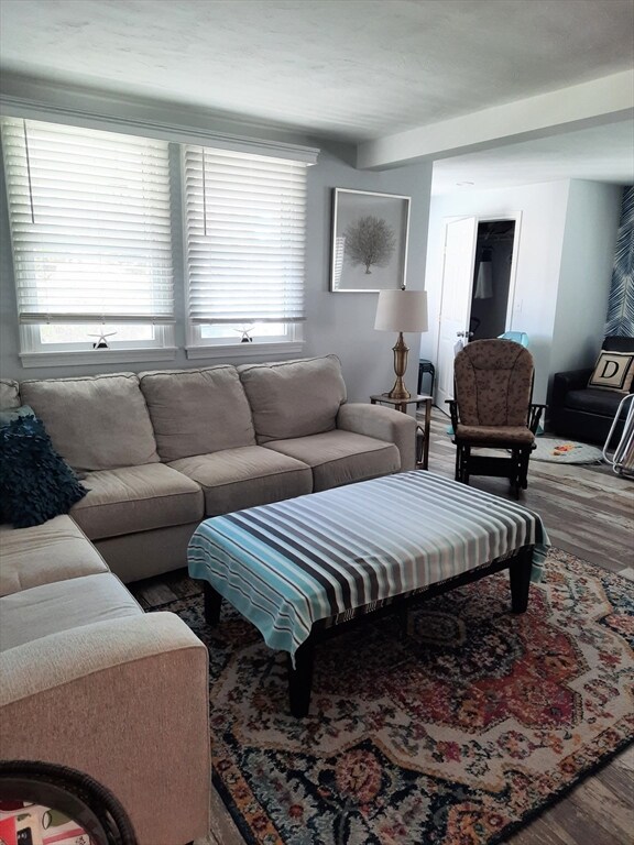
WINTER RENTAL- Available now through May 15. In between Homes? Job Transfer? Work Assignment? Furnished Home near the Beach in the Fieldston Section of Marshfield. Very nice home with 4 bedrooms and 2 full bathrooms. First floor Bedroom. Gas Utilities , Laundry in home. Lots of Parking. Updated Kitchen and Bathrooms. A great place for a short term rental!
| Date | Buyer | Sale Price | Title Company |
|---|---|---|---|
| Doherty John | $326,100 | -- | |
| Deutsche Bk Natl T Co | $394,000 | -- | |
| Johnson Kimberly A | $360,000 | -- | |
| Chandler Carleton E | $188,000 | -- |
| Date | Status | Borrower | Loan Amount |
|---|---|---|---|
| Previous Owner | Chandler Carleton E | $376,000 | |
| Previous Owner | Chandler Carleton E | $288,000 |
| Date | Event | Price | List to Sale | Price per Sq Ft |
|---|---|---|---|---|
| 12/15/2025 12/15/25 | Rented | $2,500 | 0.0% | -- |
| 12/07/2025 12/07/25 | Under Contract | -- | -- | -- |
| 11/22/2025 11/22/25 | For Rent | $2,500 | -- | -- |
| Year | Tax Paid | Tax Assessment Tax Assessment Total Assessment is a certain percentage of the fair market value that is determined by local assessors to be the total taxable value of land and additions on the property. | Land | Improvement |
|---|---|---|---|---|
| 2025 | $6,057 | $611,800 | $321,000 | $290,800 |
| 2024 | $5,779 | $556,200 | $300,900 | $255,300 |
| 2023 | $5,220 | $485,000 | $270,800 | $214,200 |
| 2022 | $5,220 | $403,100 | $230,700 | $172,400 |
| 2021 | $5,079 | $385,100 | $220,700 | $164,400 |
| 2020 | $4,627 | $347,100 | $190,600 | $156,500 |
| 2019 | $4,538 | $339,200 | $190,600 | $148,600 |
| 2018 | $5,161 | $386,000 | $190,600 | $195,400 |
| 2017 | $4,931 | $359,400 | $180,500 | $178,900 |
| 2016 | $4,733 | $341,000 | $170,500 | $170,500 |
| 2015 | $4,532 | $341,000 | $170,500 | $170,500 |
| 2014 | $4,213 | $317,000 | $170,500 | $146,500 |
Landlord's Agent in 2025
Glenn McDonald
The Firm
(781) 929-4774
6 in this area
38 Total Sales
Source: MLS Property Information Network (MLS PIN)
MLS Number: 73457245
APN: MARS-000010L-000008-000003
Disclaimer: Certain information contained herein is derived from information provided by parties other than Homes.com. All information provided is deemed reliable, but is not guaranteed to be accurate and should be independently verified.
![]() The property listing data and information, or the Images, set forth herein were provided to MLS Property Information Network, Inc. from third party sources, including sellers, lessors and public records, and were compiled by MLS Property Information Network, Inc. The property listing data and information, and the Images, are for the personal, non-commercial use of consumers having a good faith interest in purchasing or leasing listed properties of the type displayed to them and may not be used for any purpose other than to identify prospective properties which such consumers may have a good faith interest in purchasing or leasing. MLS Property Information Network, Inc. and its subscribers disclaim any and all representations and warranties as to the accuracy of the property listing data and information, or as to the accuracy of any of the Images, set forth herein.
The property listing data and information, or the Images, set forth herein were provided to MLS Property Information Network, Inc. from third party sources, including sellers, lessors and public records, and were compiled by MLS Property Information Network, Inc. The property listing data and information, and the Images, are for the personal, non-commercial use of consumers having a good faith interest in purchasing or leasing listed properties of the type displayed to them and may not be used for any purpose other than to identify prospective properties which such consumers may have a good faith interest in purchasing or leasing. MLS Property Information Network, Inc. and its subscribers disclaim any and all representations and warranties as to the accuracy of the property listing data and information, or as to the accuracy of any of the Images, set forth herein.
Ask me questions while you tour the home.