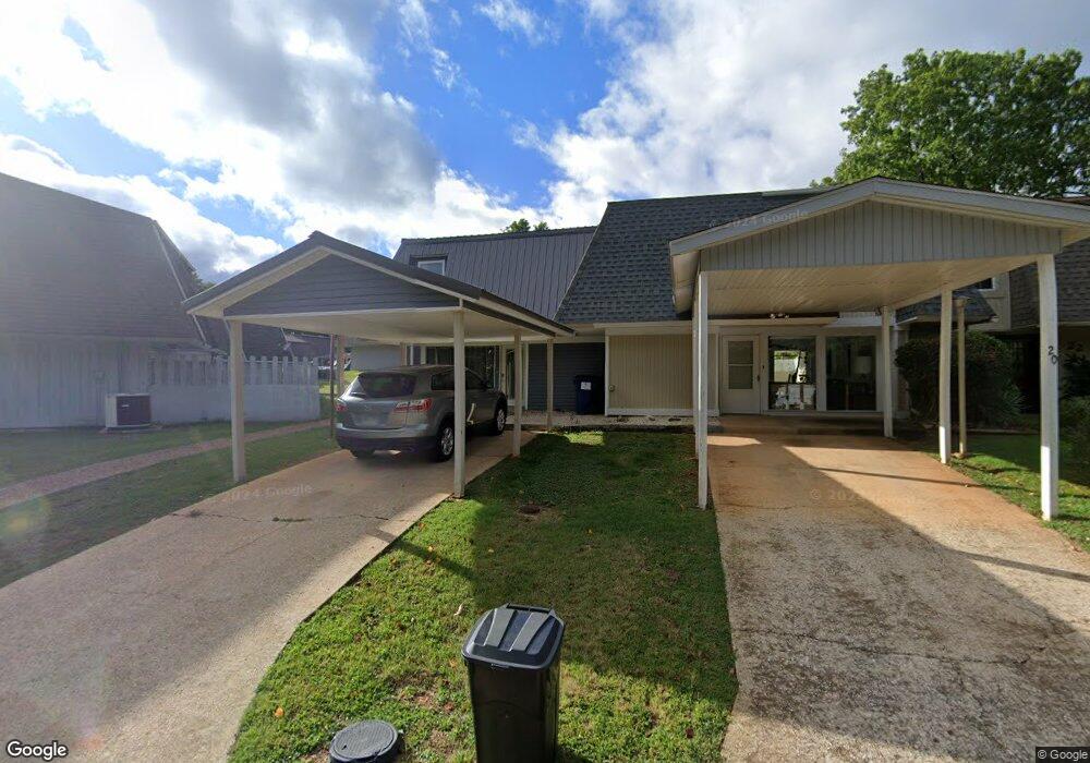
18 Annette Rd Cherokee Village, AR 72529
Estimated Value: $92,900 - $106,000
2
Beds
3
Baths
1,496
Sq Ft
$66/Sq Ft
Est. Value
About This Home
This home is located at 18 Annette Rd, Cherokee Village, AR 72529 and is currently estimated at $99,475, approximately $66 per square foot. 18 Annette Rd is a home located in Sharp County with nearby schools including Cherokee Elementary School, Highland Middle School, and Highland High School.
Ownership History
Date
Name
Owned For
Owner Type
Purchase Details
Closed on
May 10, 2024
Sold by
Thompson William J and Bausch Starla
Bought by
Thompson William J and Thompson Andrea
Current Estimated Value
Home Financials for this Owner
Home Financials are based on the most recent Mortgage that was taken out on this home.
Original Mortgage
$65,000
Outstanding Balance
$64,029
Interest Rate
6.88%
Mortgage Type
New Conventional
Estimated Equity
$35,446
Purchase Details
Closed on
Oct 19, 2020
Sold by
Mullins Holly
Bought by
Mullins Holly
Purchase Details
Closed on
Oct 14, 2020
Sold by
Mullins Holly and Mullins Samuel
Bought by
Thompson William J and Bausch Starla
Purchase Details
Closed on
Oct 7, 2011
Sold by
Hodson Gayla Louise
Bought by
Charles William and Charles Alicia
Create a Home Valuation Report for This Property
The Home Valuation Report is an in-depth analysis detailing your home's value as well as a comparison with similar homes in the area
Home Values in the Area
Average Home Value in this Area
Purchase History
| Date | Buyer | Sale Price | Title Company |
|---|---|---|---|
| Thompson William J | -- | None Listed On Document | |
| Thompson William J | -- | None Listed On Document | |
| Mullins Holly | -- | None Available | |
| Thompson William J | $27,000 | None Available | |
| Charles William | $15,000 | None Available |
Source: Public Records
Mortgage History
| Date | Status | Borrower | Loan Amount |
|---|---|---|---|
| Open | Thompson William J | $65,000 | |
| Closed | Thompson William J | $65,000 |
Source: Public Records
Tax History Compared to Growth
Tax History
| Year | Tax Paid | Tax Assessment Tax Assessment Total Assessment is a certain percentage of the fair market value that is determined by local assessors to be the total taxable value of land and additions on the property. | Land | Improvement |
|---|---|---|---|---|
| 2025 | $620 | $15,170 | $1,500 | $13,670 |
| 2024 | $377 | $15,170 | $1,500 | $13,670 |
| 2023 | $346 | $15,170 | $1,500 | $13,670 |
| 2022 | $584 | $7,690 | $1,500 | $6,190 |
| 2021 | $584 | $7,690 | $1,500 | $6,190 |
| 2020 | $647 | $7,690 | $1,500 | $6,190 |
| 2019 | $788 | $11,140 | $1,500 | $9,640 |
| 2018 | $788 | $11,140 | $1,500 | $9,640 |
| 2017 | $422 | $11,140 | $1,500 | $9,640 |
| 2016 | $573 | $11,140 | $1,500 | $9,640 |
| 2015 | -- | $11,140 | $1,500 | $9,640 |
| 2014 | -- | $13,240 | $1,500 | $11,740 |
| 2013 | -- | $13,240 | $1,500 | $11,740 |
Source: Public Records
Map
Nearby Homes
- 16 Annette Rd
- 12 Annette Rd
- 8 Annette Rd
- 6 Annette Rd
- 7 Annette Rd
- 11 Whispering Winds Trace
- 3 Akokisa Dr
- 29 W Lakeshore Dr
- 7 Owego Cir
- 4 Tenkiller Trail
- 8 Spring River Ln
- 10 Spring River Ln
- 45 W Lakeshore Dr
- 20 Tenkiller Ln
- 28 Skyline Dr
- 78 Altakima Cir
- L-17, B-2 W Lakeshore Dr
- 4 Cisco Cir
- 0 W Lakeshore Dr Unit 25010979
- L-6, B-4 Tomahawk Dr
- 18 Annette Dr
- 20 Annette Dr
- 20 Annette Rd
- 22 Annette Dr
- 22 Annette Rd
- 0 Annette Rd Unit 16029345
- 0 Annette Rd Unit 16029343
- 0 Annette Rd Unit 16029341
- 0 Annette Rd Unit 16005344
- 0 Annette Rd Unit 16011678
- 0 Annette Rd Unit 16018937
- 0 Annette Rd Unit 17001450
- 0 Annette Rd Unit 16000038
- 0 Annette Rd Unit 19023006
- 16 Annette Dr
- 24 Annette Rd
- 24 Annette Dr
- 14 Annette Dr
- 10 Annette Rd
- 12 Annette Dr