Estimated Value: $178,744 - $295,000
Studio
--
Bath
2,141
Sq Ft
$117/Sq Ft
Est. Value
About This Home
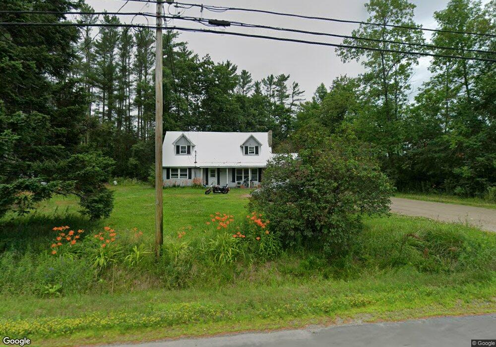
This home is located at 18 Bangor Rd, Unity, ME 04988 and is currently estimated at $249,936, approximately $116 per square foot. 18 Bangor Rd is a home with nearby schools including Mt. View Middle School, Mt. View High School, and Ecology Learning Center.
Ownership History
Date
Name
Owned For
Owner Type
Purchase Details
Closed on
Aug 12, 2025
Sold by
Nason Ralph W and Nason Nancy H
Bought by
Ralph W Nason Lt and Nason
Current Estimated Value
Purchase Details
Closed on
Mar 9, 2016
Sold by
Nason Nancy H and Nason Ralph W
Bought by
Johnson Stacey A and Badger Thomas F
Home Financials for this Owner
Home Financials are based on the most recent Mortgage that was taken out on this home.
Original Mortgage
$125,000
Interest Rate
3.79%
Mortgage Type
New Conventional
Create a Home Valuation Report for This Property
The Home Valuation Report is an in-depth analysis detailing your home's value as well as a comparison with similar homes in the area
Purchase History
| Date | Buyer | Sale Price | Title Company |
|---|---|---|---|
| Ralph W Nason Lt | -- | -- | |
| Ralph W Nason Lt | -- | -- | |
| Johnson Stacey A | -- | -- | |
| Johnson Stacey A | -- | -- | |
| Johnson Stacey A | -- | -- | |
| Johnson Stacey A | -- | -- | |
| Johnson Stacey A | -- | -- |
Source: Public Records
Mortgage History
| Date | Status | Borrower | Loan Amount |
|---|---|---|---|
| Previous Owner | Johnson Stacey A | $125,000 | |
| Previous Owner | Johnson Stacey A | $0 |
Source: Public Records
Tax History
| Year | Tax Paid | Tax Assessment Tax Assessment Total Assessment is a certain percentage of the fair market value that is determined by local assessors to be the total taxable value of land and additions on the property. | Land | Improvement |
|---|---|---|---|---|
| 2024 | $1,800 | $118,800 | $27,000 | $91,800 |
| 2022 | $1,512 | $95,100 | $21,600 | $73,500 |
| 2021 | $1,536 | $95,100 | $21,600 | $73,500 |
| 2020 | $1,659 | $95,100 | $21,600 | $73,500 |
| 2019 | $1,659 | $95,100 | $21,600 | $73,500 |
| 2018 | $1,593 | $95,100 | $21,600 | $73,500 |
| 2017 | $1,583 | $95,100 | $21,600 | $73,500 |
| 2016 | $1,602 | $95,100 | $21,600 | $73,500 |
| 2014 | $2,261 | $152,800 | $21,600 | $131,200 |
| 2013 | $2,048 | $152,800 | $21,600 | $131,200 |
Source: Public Records
Map
Nearby Homes
- 23 Bangor Rd
- Pond View Subdivision Us-202
- Lot 45-1 Maine 220
- M12 L31-3 Stage Coach Rd
- Lot # 5 Locust Ln
- 5 Chestnut St
- 13 Chestnut St
- 126 Newell Ct
- 391 School St
- 12-03 Horseback Rd
- 44 Charles Taylor Ln
- 106 & 108 Ward Hill Rd
- 126 Rancourt Ln
- 141 Albion Rd
- 309 Pond Rd
- Lot 4A Off Morgan Rd
- M 5 Lot 41 Morgan Rd
- M 5 Lot 40 Morgan Rd
- M5 Lot 43 Morgan Rd
- 473 Mount View Rd
Your Personal Tour Guide
Ask me questions while you tour the home.