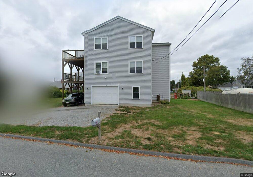
18 Bernese St Fairhaven, MA 02719
Sconticut Neck NeighborhoodEstimated Value: $612,000 - $758,000
3
Beds
1
Bath
1,676
Sq Ft
$400/Sq Ft
Est. Value
About This Home
This home is located at 18 Bernese St, Fairhaven, MA 02719 and is currently estimated at $670,978, approximately $400 per square foot. 18 Bernese St is a home located in Bristol County with nearby schools including Fairhaven High School, City On A Hill Charter Public School New Bedford, and St. Joseph School.
Ownership History
Date
Name
Owned For
Owner Type
Purchase Details
Closed on
Jun 20, 2019
Sold by
Pasquill Richard R and Pasquill Ann M
Bought by
Snprap Llc
Current Estimated Value
Purchase Details
Closed on
Sep 4, 2009
Sold by
Deutsche Bank Natl T C
Bought by
Pasquill Richard R and Pasquill Ann
Purchase Details
Closed on
Aug 28, 2009
Sold by
Ouimette Michelle
Bought by
Deutsche Bank Natl T C
Purchase Details
Closed on
Jul 21, 2004
Sold by
Ouimette Michelle
Bought by
Ouimette Michelle
Purchase Details
Closed on
Mar 30, 1995
Sold by
Silvia Robert L and Silvia Sandra
Bought by
Cote Anthony and Ouimette Michelle
Create a Home Valuation Report for This Property
The Home Valuation Report is an in-depth analysis detailing your home's value as well as a comparison with similar homes in the area
Home Values in the Area
Average Home Value in this Area
Purchase History
| Date | Buyer | Sale Price | Title Company |
|---|---|---|---|
| Snprap Llc | -- | -- | |
| Pasquill Richard R | $107,000 | -- | |
| Deutsche Bank Natl T C | $145,652 | -- | |
| Ouimette Michelle | -- | -- | |
| Cote Anthony | $79,900 | -- |
Source: Public Records
Mortgage History
| Date | Status | Borrower | Loan Amount |
|---|---|---|---|
| Previous Owner | Cote Anthony | $175,000 | |
| Previous Owner | Cote Anthony | $159,000 |
Source: Public Records
Tax History
| Year | Tax Paid | Tax Assessment Tax Assessment Total Assessment is a certain percentage of the fair market value that is determined by local assessors to be the total taxable value of land and additions on the property. | Land | Improvement |
|---|---|---|---|---|
| 2025 | $56 | $604,200 | $293,100 | $311,100 |
| 2024 | $5,432 | $588,500 | $293,100 | $295,400 |
| 2023 | $5,256 | $528,200 | $249,200 | $279,000 |
| 2022 | $5,051 | $494,200 | $226,500 | $267,700 |
| 2021 | $5,202 | $460,800 | $226,500 | $234,300 |
| 2020 | $5,096 | $460,800 | $226,500 | $234,300 |
| 2019 | $4,932 | $422,600 | $206,500 | $216,100 |
| 2018 | $5,831 | $412,600 | $206,500 | $206,100 |
| 2017 | $4,822 | $400,500 | $206,500 | $194,000 |
| 2016 | $4,680 | $384,200 | $206,500 | $177,700 |
| 2015 | $4,387 | $361,100 | $186,500 | $174,600 |
Source: Public Records
Map
Nearby Homes
- 5 Reservation Rd
- 8 Sunset Beach Rd
- 190 Sconticut Neck Rd
- 3.5 Golf St
- 15 Bayview Ave
- 27 Bayview Ave
- 123 Sconticut Neck Rd
- 58 Bayview Ave
- 00 Huttleston Ave
- 00 Copeland St
- 2 Washburn Ave
- 11 Lawton St
- 8 Manor Dr
- 33 Narragansett Blvd
- 32 Cedar St
- 181 Washington St
- 28 Brant Beach Ave
- 32 Green St
- 20 Nantucket Dr
- 145 Pleasant St
Your Personal Tour Guide
Ask me questions while you tour the home.