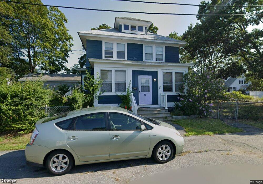
18 Bernice Ave Lowell, MA 01852
Sacred Heart NeighborhoodEstimated Value: $583,000 - $627,000
4
Beds
2
Baths
1,915
Sq Ft
$313/Sq Ft
Est. Value
About This Home
This home is located at 18 Bernice Ave, Lowell, MA 01852 and is currently estimated at $598,487, approximately $312 per square foot. 18 Bernice Ave is a home located in Middlesex County with nearby schools including Abraham Lincoln Elementary School, Moody Elementary School, and Greenhalge Elementary School.
Ownership History
Date
Name
Owned For
Owner Type
Purchase Details
Closed on
May 30, 1991
Sold by
Scondras Charles and Scondras Eileen M
Bought by
Lutz Mark Joseph and Lutz Joanne D
Current Estimated Value
Home Financials for this Owner
Home Financials are based on the most recent Mortgage that was taken out on this home.
Original Mortgage
$96,800
Interest Rate
9.35%
Mortgage Type
Purchase Money Mortgage
Create a Home Valuation Report for This Property
The Home Valuation Report is an in-depth analysis detailing your home's value as well as a comparison with similar homes in the area
Home Values in the Area
Average Home Value in this Area
Purchase History
| Date | Buyer | Sale Price | Title Company |
|---|---|---|---|
| Lutz Mark Joseph | $121,000 | -- | |
| Lutz Mark Joseph | $121,000 | -- |
Source: Public Records
Mortgage History
| Date | Status | Borrower | Loan Amount |
|---|---|---|---|
| Closed | Lutz Mark Joseph | $100,000 | |
| Closed | Lutz Mark Joseph | $96,800 |
Source: Public Records
Tax History Compared to Growth
Tax History
| Year | Tax Paid | Tax Assessment Tax Assessment Total Assessment is a certain percentage of the fair market value that is determined by local assessors to be the total taxable value of land and additions on the property. | Land | Improvement |
|---|---|---|---|---|
| 2025 | $5,949 | $518,200 | $184,900 | $333,300 |
| 2024 | $5,805 | $487,400 | $172,800 | $314,600 |
| 2023 | $5,471 | $440,500 | $150,300 | $290,200 |
| 2022 | $5,157 | $406,400 | $136,600 | $269,800 |
| 2021 | $4,821 | $358,200 | $118,800 | $239,400 |
| 2020 | $4,554 | $340,900 | $113,000 | $227,900 |
| 2019 | $4,322 | $307,800 | $104,600 | $203,200 |
| 2018 | $4,231 | $294,000 | $99,600 | $194,400 |
| 2017 | $4,061 | $272,200 | $90,600 | $181,600 |
| 2016 | $3,731 | $246,100 | $79,200 | $166,900 |
| 2015 | $3,627 | $234,300 | $79,200 | $155,100 |
| 2013 | $2,921 | $194,600 | $88,400 | $106,200 |
Source: Public Records
Map
Nearby Homes
- 7 Gorham St Unit 36
- 1514 Gorham St Unit 3
- 1514 Gorham St Unit 4
- 1514 Gorham St Unit 2
- 1514 Gorham St Unit 5
- 1400 Gorham St Unit 32
- 1400 Gorham St Unit 30
- 29 Gorham St
- 20 Woodland Dr Unit 330
- 20 Woodland Dr Unit 379
- 53 Gorham St
- 18 Clancy St
- 4 Donald Ave
- 34 Manning Rd
- 59 Fay St
- 106 Lundberg St Unit 6
- 108 Marshall Rd
- 117 Gorham St
- 16 Court St
- 64 Bolton St
- 44 Devine Ave
- 122 Carlisle St
- 126 Carlisle St
- 25 Bernice Ave
- 11 Bernice Ave
- 18 Pineview Ave
- 14 Pineview Ave
- 142 Carlisle St
- 28 Pineview Ave
- 112 Carlisle St
- 39 Pineview Ave
- 148 Carlisle St
- 30 Devine Ave
- 108 Carlisle St
- 36 Pineview Ave
- 154 Carlisle St
- 1521 Gorham St
- 100 Carlisle St
- 1517 Gorham St
- 28 Suttle Ave