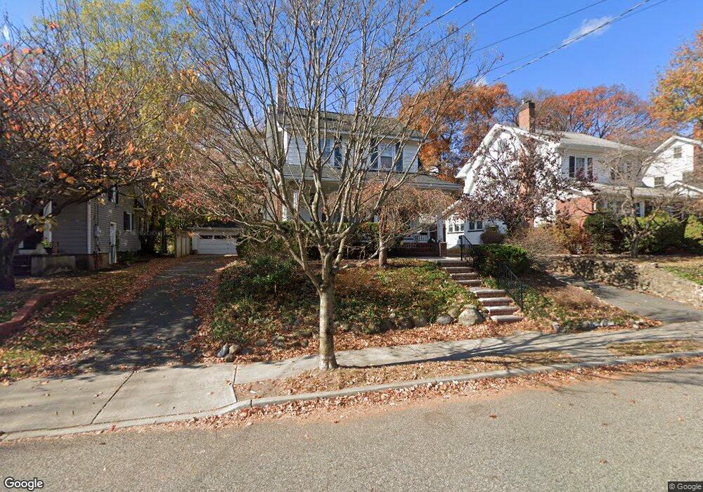
18 Brookside Ave Hawthorne, NJ 07506
Estimated Value: $674,000 - $759,000
3
Beds
4
Baths
1,616
Sq Ft
$434/Sq Ft
Est. Value
About This Home
This home is located at 18 Brookside Ave, Hawthorne, NJ 07506 and is currently estimated at $701,401, approximately $434 per square foot. 18 Brookside Ave is a home located in Passaic County with nearby schools including Hawthorne High School, St Anthony School, and Al-Hikmah Elementary School.
Ownership History
Date
Name
Owned For
Owner Type
Purchase Details
Closed on
Jun 22, 2022
Sold by
Downey and Susan
Bought by
Myer Melissa
Current Estimated Value
Purchase Details
Closed on
Sep 30, 2008
Sold by
Lawson Randy and Lawson Rachel
Bought by
Township Of Wayne
Purchase Details
Closed on
Jun 27, 2006
Sold by
Sardinas Anthony
Bought by
Downey William and Downey Susan
Home Financials for this Owner
Home Financials are based on the most recent Mortgage that was taken out on this home.
Original Mortgage
$200,000
Interest Rate
6.6%
Mortgage Type
New Conventional
Purchase Details
Closed on
Jun 24, 2002
Sold by
Bogert Frank
Bought by
Sardinas Anthony and Sardinas Denise
Home Financials for this Owner
Home Financials are based on the most recent Mortgage that was taken out on this home.
Original Mortgage
$264,000
Interest Rate
6.92%
Create a Home Valuation Report for This Property
The Home Valuation Report is an in-depth analysis detailing your home's value as well as a comparison with similar homes in the area
Home Values in the Area
Average Home Value in this Area
Purchase History
| Date | Buyer | Sale Price | Title Company |
|---|---|---|---|
| Myer Melissa | $599,000 | Foundation Title | |
| Myer Melissa | $599,000 | Foundation Title | |
| Township Of Wayne | $175,322 | -- | |
| Downey William | $539,000 | -- | |
| Sardinas Anthony | $330,000 | -- |
Source: Public Records
Mortgage History
| Date | Status | Borrower | Loan Amount |
|---|---|---|---|
| Previous Owner | Downey William | $200,000 | |
| Previous Owner | Sardinas Anthony | $264,000 |
Source: Public Records
Tax History
| Year | Tax Paid | Tax Assessment Tax Assessment Total Assessment is a certain percentage of the fair market value that is determined by local assessors to be the total taxable value of land and additions on the property. | Land | Improvement |
|---|---|---|---|---|
| 2025 | $11,000 | $361,600 | $165,800 | $195,800 |
| 2024 | $10,848 | $361,600 | $165,800 | $195,800 |
Source: Public Records
Map
Nearby Homes
- 10 Brookside Ave
- 75 Mazur Place
- 137 Cedar Ave
- 87 Buena Vista Ave
- 117 Maitland Ave
- 93 May St
- 80 Elberon Ave
- 45 Dietrich Ln
- 45 Royal Ave Unit 46
- 20 Forest Ave
- 5 Prospect St
- 155 Washington Ave
- 55 N 15th St
- 15 N 16th St
- 26 Birchwood Ln
- 18 Birchwood Ln
- 140 Westervelt Ave
- 316 N 15th Place
- 110 3rd Ave
- 764 Goffle Rd
- 20 Brookside Ave
- 22 Brookside Ave
- 14 Brookside Ave
- 10 Brookside Ave Unit 2
- 26 Brookside Ave
- 47 Diamond Bridge Ave
- 13 Brookside Ave
- 17 Brookside Ave
- 30 Brookside Ave
- 21 Brookside Ave
- 9 Brookside Ave
- 25 Brookside Ave
- 43 Diamond Bridge Ave
- 55 Diamond Bridge Ave
- 39 Diamond Bridge Ave
- 45 Diamond Bridge Ave
- 31 Brookside Ave
- 29 Brookside Ave
- 59 Diamond Bridge Ave
- 38 Brookside Ave
Your Personal Tour Guide
Ask me questions while you tour the home.