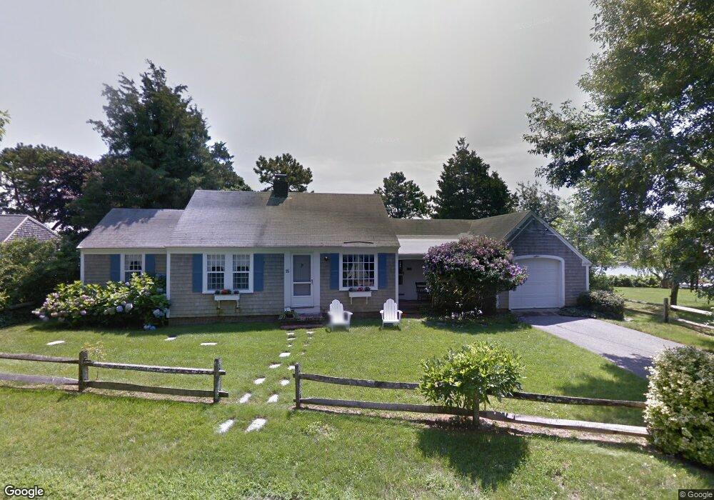
18 Captain Donald Path West Dennis, MA 02670
West Dennis NeighborhoodEstimated Value: $1,143,000 - $1,881,069
3
Beds
4
Baths
2,397
Sq Ft
$645/Sq Ft
Est. Value
About This Home
This home is located at 18 Captain Donald Path, West Dennis, MA 02670 and is currently estimated at $1,547,017, approximately $645 per square foot. 18 Captain Donald Path is a home located in Barnstable County with nearby schools including Dennis-Yarmouth Regional High School and St. Pius X. School.
Ownership History
Date
Name
Owned For
Owner Type
Purchase Details
Closed on
Nov 5, 2014
Sold by
Mccall Barbara P and Mccall Ronald E
Bought by
Parkhurst Jonathan T and Parkhurst Judy S
Current Estimated Value
Purchase Details
Closed on
Jul 2, 2014
Sold by
V Burns Parkhurst Irt and Mccall Barbara P
Bought by
Mccall Barbara P and Parkhurst Jonathan T
Create a Home Valuation Report for This Property
The Home Valuation Report is an in-depth analysis detailing your home's value as well as a comparison with similar homes in the area
Home Values in the Area
Average Home Value in this Area
Purchase History
| Date | Buyer | Sale Price | Title Company |
|---|---|---|---|
| Parkhurst Jonathan T | $324,667 | -- | |
| Mccall Barbara P | -- | -- |
Source: Public Records
Tax History Compared to Growth
Tax History
| Year | Tax Paid | Tax Assessment Tax Assessment Total Assessment is a certain percentage of the fair market value that is determined by local assessors to be the total taxable value of land and additions on the property. | Land | Improvement |
|---|---|---|---|---|
| 2025 | $7,425 | $1,714,700 | $661,300 | $1,053,400 |
| 2024 | $7,374 | $1,679,700 | $636,000 | $1,043,700 |
| 2023 | $7,234 | $1,549,000 | $584,900 | $964,100 |
| 2022 | $7,068 | $1,262,200 | $526,900 | $735,300 |
| 2021 | $5,640 | $1,130,500 | $516,600 | $613,900 |
| 2020 | $6,516 | $1,068,200 | $480,500 | $587,700 |
| 2019 | $5,502 | $1,006,700 | $471,100 | $535,600 |
| 2018 | $0 | $962,100 | $448,500 | $513,600 |
| 2017 | $4,403 | $448,500 | $448,500 | $0 |
| 2016 | $4,006 | $613,400 | $454,100 | $159,300 |
| 2015 | $3,926 | $613,400 | $454,100 | $159,300 |
| 2014 | $3,895 | $613,400 | $454,100 | $159,300 |
Source: Public Records
Map
Nearby Homes
- 428 Main St Unit 1-11
- 467 Main St
- 401 Main St Unit 201
- 401 Main St Unit 101
- 23 Doric Ave
- 209 Main St Unit 3
- 209 Main St Unit 6
- 209 Main St Unit 1
- 209 Main St Unit 2
- 209 Main St Unit 4
- 209 Main St Unit 5
- 14 Schoolhouse Ln
- 178 School St
- 3 Pinefield Ln
- 45 Seth Ln
- 29 Bass River Rd
- 18 Turner Ln
- 61 Trotters Ln
- 15 Woodside Park Rd
- 40 Kelley Rd
- 12 Captain Donald Path
- 22 Captain Donald Path
- 11 Capt Donald Point
- 11 Captain Donald Path
- 9 Captain Donald Path
- 8 Capt Donalds
- 8 Captain Donald Path
- 3 Captain Donald Path
- 15 Captain Donald Path
- 4 Stephen Ln
- 30 Capt Donalds Path
- 30 Captain Donald Path
- 3 Stephen Ln
- 114 Cove Rd
- 114 Cove Rd
- 130 Cove Rd
- 11 Cove Ln
- 112 Cove Rd
- 112 Cove Rd
- 117 Cove Rd