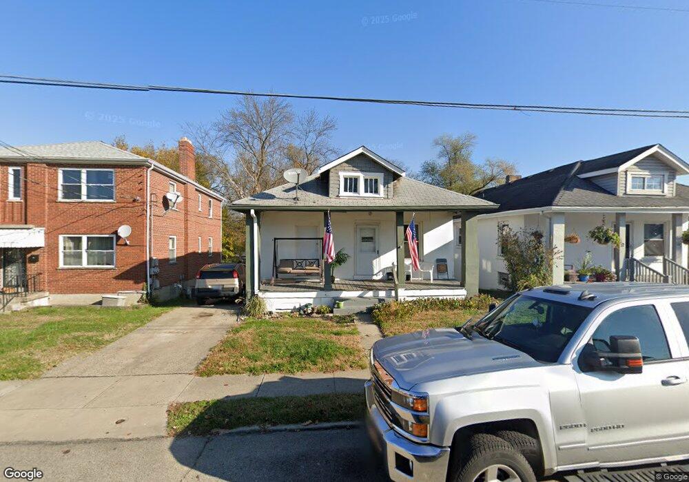
18 Clark Rd Cincinnati, OH 45215
Roselawn NeighborhoodEstimated Value: $138,597 - $163,000
3
Beds
1
Bath
975
Sq Ft
$151/Sq Ft
Est. Value
About This Home
This home is located at 18 Clark Rd, Cincinnati, OH 45215 and is currently estimated at $147,399, approximately $151 per square foot. 18 Clark Rd is a home located in Hamilton County with nearby schools including Reading Community High School and Saints Peter and Paul Academy.
Ownership History
Date
Name
Owned For
Owner Type
Purchase Details
Closed on
Dec 28, 2006
Sold by
Taylor Balbina
Bought by
Taylor Mark
Current Estimated Value
Home Financials for this Owner
Home Financials are based on the most recent Mortgage that was taken out on this home.
Original Mortgage
$185,000
Outstanding Balance
$111,583
Interest Rate
6.75%
Mortgage Type
Unknown
Estimated Equity
$35,816
Purchase Details
Closed on
Nov 13, 1993
Sold by
Brandenburg Hyman and Brandenburg Joyce E
Bought by
Bolte Barbara
Home Financials for this Owner
Home Financials are based on the most recent Mortgage that was taken out on this home.
Original Mortgage
$58,298
Interest Rate
6.88%
Mortgage Type
FHA
Create a Home Valuation Report for This Property
The Home Valuation Report is an in-depth analysis detailing your home's value as well as a comparison with similar homes in the area
Home Values in the Area
Average Home Value in this Area
Purchase History
| Date | Buyer | Sale Price | Title Company |
|---|---|---|---|
| Taylor Mark | -- | Attorney | |
| Bolte Barbara | -- | -- |
Source: Public Records
Mortgage History
| Date | Status | Borrower | Loan Amount |
|---|---|---|---|
| Open | Taylor Mark | $185,000 | |
| Previous Owner | Bolte Barbara | $58,298 |
Source: Public Records
Tax History
| Year | Tax Paid | Tax Assessment Tax Assessment Total Assessment is a certain percentage of the fair market value that is determined by local assessors to be the total taxable value of land and additions on the property. | Land | Improvement |
|---|---|---|---|---|
| 2025 | $1,508 | $27,776 | $8,582 | $19,194 |
| 2023 | $1,505 | $27,776 | $8,582 | $19,194 |
| 2022 | $1,209 | $17,329 | $6,902 | $10,427 |
| 2021 | $1,035 | $17,329 | $6,902 | $10,427 |
| 2020 | $1,020 | $17,329 | $6,902 | $10,427 |
| 2019 | $994 | $15,334 | $6,108 | $9,226 |
| 2018 | $995 | $15,334 | $6,108 | $9,226 |
| 2017 | $950 | $15,334 | $6,108 | $9,226 |
| 2016 | $1,241 | $19,866 | $6,468 | $13,398 |
| 2015 | $1,235 | $19,866 | $6,468 | $13,398 |
| 2014 | $1,085 | $19,866 | $6,468 | $13,398 |
| 2013 | $1,099 | $20,272 | $6,601 | $13,671 |
Source: Public Records
Map
Nearby Homes
- 20 Clark Rd
- 321 Southern Ave
- 311 Southern Ave
- 2281 E Galbraith Rd
- 529 Elliott Ave
- 415 Arlington Ave
- 314 Elm St
- 654 3rd St
- 0 Hill St Unit 1616370
- 129 Pike St
- 2465 E Galbraith Rd
- 435 Pearl St
- 1808 Crest Hill Ave
- 306 Pearl St
- 310 E Vine St
- 8338 Anthony Wayne Ave
- 329 Walnut St
- 7833 Dawn Rd
- 217 W Wyoming Ave
- 1401 Jefferson Ave
- 12 Clark Rd
- 22 Clark Rd
- 8507 Reading Rd
- 26 Clark Rd
- 8509 Reading Rd
- 8511 Reading Rd
- 17 Illinois Ave
- 17 Illinois Ave Unit 17
- 21 Illinois Ave
- 200 Clark Rd
- 25 Illinois Ave
- 11 Clark Rd
- 202 Clark Rd
- 103 Illinois Ave
- 103 Illinois Ave Unit 2
- 8439 Reading Rd
- 19 Illinois Ave Unit 19 Illinois avenue
- 19 Illinois Ave
- 201 Clark Rd
- 270 Burkhart Ave
Your Personal Tour Guide
Ask me questions while you tour the home.