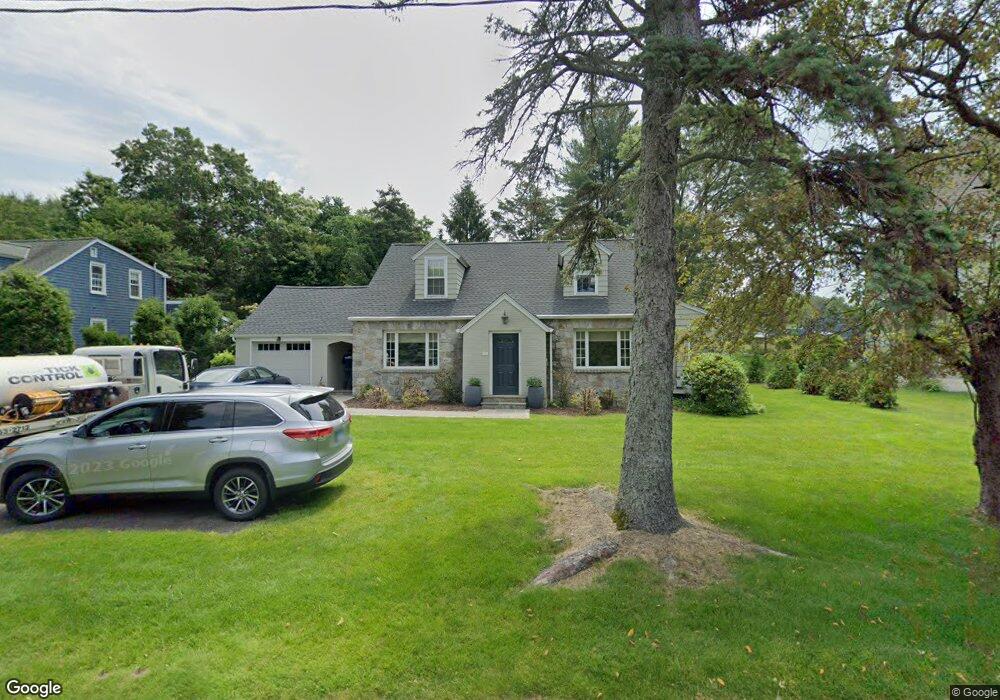
18 Compo Rd N Westport, CT 06880
Staples NeighborhoodEstimated Value: $1,015,000 - $1,642,000
3
Beds
3
Baths
1,774
Sq Ft
$790/Sq Ft
Est. Value
About This Home
This home is located at 18 Compo Rd N, Westport, CT 06880 and is currently estimated at $1,400,749, approximately $789 per square foot. 18 Compo Rd N is a home located in Fairfield County with nearby schools including Saugatuck Elementary School, Bedford Middle School, and Staples High School.
Ownership History
Date
Name
Owned For
Owner Type
Purchase Details
Closed on
Nov 10, 2015
Sold by
Christe Margaret M
Bought by
Meyer Stephen J and Christe Margaret M
Current Estimated Value
Purchase Details
Closed on
Jun 21, 2006
Sold by
Paprotna John C and Paprotna Catherine A
Bought by
Allen Marcaret
Purchase Details
Closed on
Jul 3, 1990
Sold by
Coffee Meg
Bought by
Leib Jo Ann
Create a Home Valuation Report for This Property
The Home Valuation Report is an in-depth analysis detailing your home's value as well as a comparison with similar homes in the area
Home Values in the Area
Average Home Value in this Area
Purchase History
| Date | Buyer | Sale Price | Title Company |
|---|---|---|---|
| Meyer Stephen J | -- | -- | |
| Meyer Stephen J | -- | -- | |
| Allen Marcaret | $860,000 | -- | |
| Allen Marcaret | $860,000 | -- | |
| Leib Jo Ann | $280,000 | -- |
Source: Public Records
Mortgage History
| Date | Status | Borrower | Loan Amount |
|---|---|---|---|
| Previous Owner | Leib Jo Ann | $525,000 | |
| Previous Owner | Leib Jo Ann | $500,000 |
Source: Public Records
Tax History
| Year | Tax Paid | Tax Assessment Tax Assessment Total Assessment is a certain percentage of the fair market value that is determined by local assessors to be the total taxable value of land and additions on the property. | Land | Improvement |
|---|---|---|---|---|
| 2025 | $10,017 | $531,100 | $359,800 | $171,300 |
| 2024 | $9,889 | $531,100 | $359,800 | $171,300 |
| 2023 | $9,746 | $531,100 | $359,800 | $171,300 |
| 2022 | $9,597 | $531,100 | $359,800 | $171,300 |
| 2021 | $9,597 | $531,100 | $359,800 | $171,300 |
| 2020 | $9,209 | $551,100 | $370,300 | $180,800 |
| 2019 | $9,292 | $551,100 | $370,300 | $180,800 |
| 2018 | $13,250 | $551,100 | $370,300 | $180,800 |
| 2017 | $13,005 | $551,100 | $370,300 | $180,800 |
| 2016 | $9,292 | $551,100 | $370,300 | $180,800 |
| 2015 | $8,678 | $479,700 | $299,200 | $180,500 |
| 2014 | $8,606 | $479,700 | $299,200 | $180,500 |
Source: Public Records
Map
Nearby Homes
- 9 Crescent Park Rd
- 26 Crescent Park Rd
- 21 Rayfield Rd
- 32 Webb Rd
- 11 Dogwood Ln
- 80 Compo Rd N
- 23 Harborview Rd
- 102 Compo Rd S
- 15 Gorham Ave
- 60 Wilton Rd Unit 2C
- 79 Riverside Ave
- 781 Post Rd E Unit 104
- 783 Post Rd E Unit 201
- 785 Post Rd E Unit 303
- 785 Post Rd E Unit 302
- 785 Post Rd E Unit 304
- 785 Post Rd E Unit 102
- 118 Roseville Rd
- 116 Roseville Rd
- 49 Hillspoint Rd
- 20 Compo Rd N
- 16 Compo Rd N
- 6 Whitney Street Extension
- 22 Compo Rd N
- 4 Whitney St
- 4 Whitney Street Extension Unit UNO
- 7 Whitney Street Extension
- 7 Whitney Street Extension Unit 2
- 7 Whitney Street Exd
- 24 Compo Rd N
- 36 E Main St
- 34 E Main St
- 38 E Main St
- 3 Whitney St
- 49 Whitney Glen
- 49 Whitney Glen Unit 49
- 20 Whitney Glen
- 51 Whitney Glen
- 17 Whitney Glen
- 51 Whitney Glen Unit 51
Your Personal Tour Guide
Ask me questions while you tour the home.