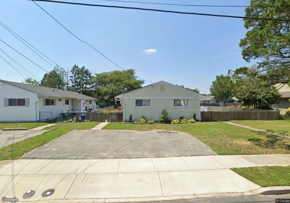
18 Cooper Dr Unit A Somers Point, NJ 08244
Estimated Value: $396,000 - $451,000
2
Beds
--
Bath
900
Sq Ft
$464/Sq Ft
Est. Value
About This Home
This home is located at 18 Cooper Dr Unit A, Somers Point, NJ 08244 and is currently estimated at $417,429, approximately $463 per square foot. 18 Cooper Dr Unit A is a home located in Atlantic County with nearby schools including Mainland Regional High School, ChARTer TECH High School for the Performing Arts, and Saint Joseph Regional School.
Ownership History
Date
Name
Owned For
Owner Type
Purchase Details
Closed on
Jul 18, 2025
Sold by
Randazzo Giuseppe and Randazzo Marianna
Bought by
Lepard Frank
Current Estimated Value
Home Financials for this Owner
Home Financials are based on the most recent Mortgage that was taken out on this home.
Original Mortgage
$303,000
Interest Rate
6.26%
Mortgage Type
New Conventional
Purchase Details
Closed on
May 17, 2022
Sold by
Kershbaumer Jeremy and Kershbaumer Danielle
Bought by
Randazzo Giuseppe
Home Financials for this Owner
Home Financials are based on the most recent Mortgage that was taken out on this home.
Original Mortgage
$255,000
Interest Rate
6.02%
Mortgage Type
New Conventional
Purchase Details
Closed on
Jan 24, 2020
Sold by
Ghattas Sameh R and Ghattas Bernadette
Bought by
Kershbaumer Jeremy E and Kershbaumer Danielle C
Home Financials for this Owner
Home Financials are based on the most recent Mortgage that was taken out on this home.
Original Mortgage
$135,000
Interest Rate
3.74%
Mortgage Type
New Conventional
Purchase Details
Closed on
Jun 2, 1988
Bought by
Ghattas Sameh R
Create a Home Valuation Report for This Property
The Home Valuation Report is an in-depth analysis detailing your home's value as well as a comparison with similar homes in the area
Home Values in the Area
Average Home Value in this Area
Purchase History
| Date | Buyer | Sale Price | Title Company |
|---|---|---|---|
| Lepard Frank | $404,000 | Innovation Title | |
| Randazzo Giuseppe | $350,000 | None Listed On Document | |
| Kershbaumer Jeremy E | $180,000 | First American Mortgage Sln | |
| Ghattas Sameh R | $119,000 | -- |
Source: Public Records
Mortgage History
| Date | Status | Borrower | Loan Amount |
|---|---|---|---|
| Previous Owner | Lepard Frank | $303,000 | |
| Previous Owner | Randazzo Giuseppe | $255,000 | |
| Previous Owner | Kershbaumer Jeremy E | $135,000 |
Source: Public Records
Tax History Compared to Growth
Tax History
| Year | Tax Paid | Tax Assessment Tax Assessment Total Assessment is a certain percentage of the fair market value that is determined by local assessors to be the total taxable value of land and additions on the property. | Land | Improvement |
|---|---|---|---|---|
| 2025 | $7,524 | $210,400 | $103,100 | $107,300 |
| 2024 | $7,524 | $210,400 | $103,100 | $107,300 |
| 2023 | $7,029 | $210,400 | $103,100 | $107,300 |
| 2022 | $7,029 | $210,400 | $103,100 | $107,300 |
| 2021 | $6,924 | $210,400 | $103,100 | $107,300 |
| 2020 | $6,783 | $210,400 | $103,100 | $107,300 |
| 2019 | $6,592 | $210,400 | $103,100 | $107,300 |
| 2018 | $6,453 | $210,400 | $103,100 | $107,300 |
| 2017 | $6,222 | $210,400 | $103,100 | $107,300 |
| 2016 | $5,940 | $210,400 | $103,100 | $107,300 |
| 2015 | $5,879 | $210,400 | $103,100 | $107,300 |
| 2014 | $5,681 | $210,400 | $103,100 | $107,300 |
Source: Public Records
Map
Nearby Homes
- 18 Cooper Dr
- 20 Cooper Dr
- 16A Cooper Dr Unit C016A
- 16 Cooper Dr Unit C0016
- 17 Hamilton Dr
- 19 Hamilton Dr
- 15 Hamilton Dr
- 22 Cooper Dr
- 14 Cooper Dr
- 17 Cooper Dr
- 15 Cooper Dr
- 21 Hamilton Dr
- 19 Cooper Dr
- 13 Hamilton Dr
- 12 Cooper Dr
- 21 Cooper Dr
- 1019 W Groveland Ave
- 1021 W Groveland Ave
- 11 Hamilton Dr
- 11 Cooper Dr