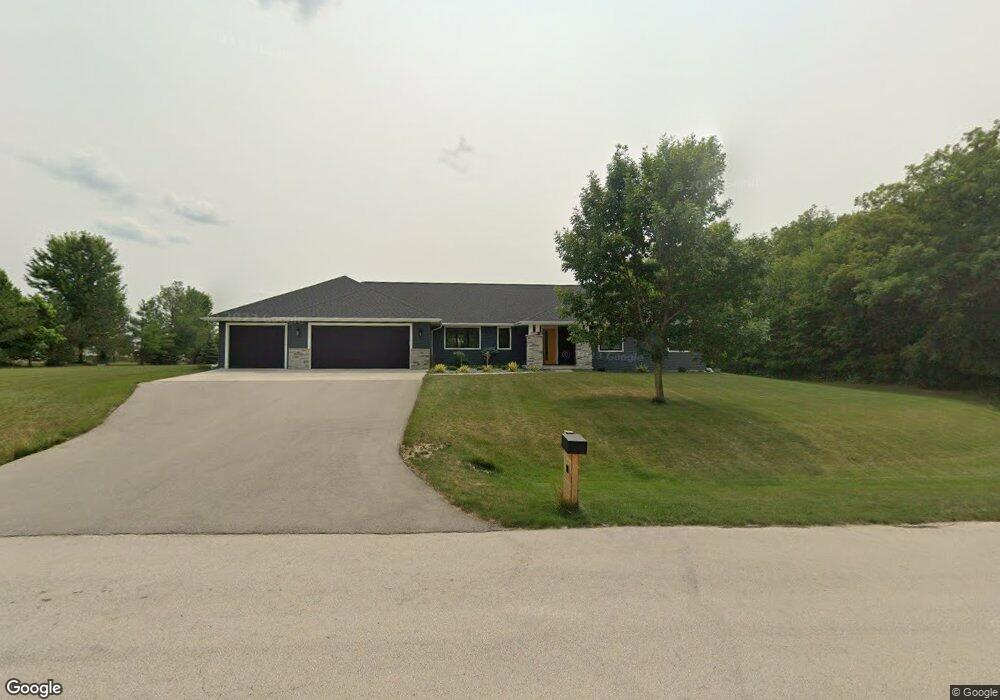
18 Corn Silk Ct Wrightstown, WI 54180
Estimated Value: $655,570 - $717,000
Studio
--
Bath
--
Sq Ft
43,996
Sq Ft Lot
About This Home
This home is located at 18 Corn Silk Ct, Wrightstown, WI 54180 and is currently estimated at $692,893. 18 Corn Silk Ct is a home located in Brown County with nearby schools including Wrightstown Elementary School, Wrightstown Middle School, and Wrightstown High School.
Ownership History
Date
Name
Owned For
Owner Type
Purchase Details
Closed on
Dec 6, 2016
Sold by
Bartoszek John
Bought by
Moua Joe and Moua Merietta Lee
Current Estimated Value
Home Financials for this Owner
Home Financials are based on the most recent Mortgage that was taken out on this home.
Original Mortgage
$55,000
Outstanding Balance
$24,791
Interest Rate
3.75%
Mortgage Type
Adjustable Rate Mortgage/ARM
Estimated Equity
$668,102
Purchase Details
Closed on
Jun 17, 2014
Sold by
Vandenhogen Robert S and Vandenhogen Kathryn A
Bought by
Bartoszek John
Purchase Details
Closed on
Aug 30, 2011
Sold by
Tyczkowski Jay P and Tyczkowski Jennifer L
Bought by
Vandenhogen Robert S and Vandenhogen Kathryn A
Purchase Details
Closed on
Mar 30, 2001
Sold by
Dorner Stahl Inc
Bought by
Tyczkowski Jay P and Tyczkowski Jennifer L
Create a Home Valuation Report for This Property
The Home Valuation Report is an in-depth analysis detailing your home's value as well as a comparison with similar homes in the area
Home Values in the Area
Average Home Value in this Area
Purchase History
| Date | Buyer | Sale Price | Title Company |
|---|---|---|---|
| Moua Joe | $69,000 | Bay Title & Abstract Inc | |
| Bartoszek John | $65,000 | Evans Title | |
| Vandenhogen Robert S | $67,500 | Title Revolution Llc | |
| Tyczkowski Jay P | $61,000 | Brown County Title & Abstrac |
Source: Public Records
Mortgage History
| Date | Status | Borrower | Loan Amount |
|---|---|---|---|
| Open | Moua Joe | $55,000 |
Source: Public Records
Tax History
| Year | Tax Paid | Tax Assessment Tax Assessment Total Assessment is a certain percentage of the fair market value that is determined by local assessors to be the total taxable value of land and additions on the property. | Land | Improvement |
|---|---|---|---|---|
| 2025 | $9,447 | $580,600 | $83,600 | $497,000 |
| 2024 | $8,310 | $580,600 | $83,600 | $497,000 |
| 2023 | $9,048 | $580,600 | $83,600 | $497,000 |
| 2022 | $8,997 | $365,600 | $62,800 | $302,800 |
| 2021 | $8,684 | $365,600 | $62,800 | $302,800 |
| 2020 | $8,369 | $365,600 | $62,800 | $302,800 |
| 2019 | $1,372 | $62,800 | $62,800 | $0 |
| 2018 | $1,281 | $62,800 | $62,800 | $0 |
| 2017 | $1,155 | $54,400 | $54,400 | $0 |
| 2016 | $1,209 | $54,400 | $54,400 | $0 |
| 2015 | $1,213 | $54,400 | $54,400 | $0 |
| 2014 | $1,187 | $54,400 | $54,400 | $0 |
| 2013 | $1,187 | $54,400 | $54,400 | $0 |
Source: Public Records
Map
Nearby Homes
- 30 Golden Wheat Ln
- 735 Park St
- 544 Nicole Ln
- 548 Nicole Ln
- 361 Main St
- 309 Louise Dr
- 119 Main St
- 4207 Lost Dauphin Rd
- 113 Beckerae Ct
- 248 Kerrigan Dr
- 269 Kerrigan Dr
- 278 Kerrigan Dr
- 4079 Lost Dauphin Rd
- 308 Kerrigan Dr
- 263 Kerrigan Dr
- 302 Kerrigan Dr
- 230 Kerrigan Dr
- 563 Royal Saint Pats Dr
- 581 Royal Saint Pats Dr
- 713 Royal Saint Pats Dr
- 10 Corn Silk Ct
- 2 Corn Silk Ct
- 22 Corn Silk Ct
- 23 Corn Silk Ct
- 19 Corn Silk Ct
- 34 Golden Wheat Ln
- 15 Corn Silk Ct
- 7 Corn Silk Ct
- 31 Golden Wheat Ln
- 3 Corn Silk Ct
- 38 Golden Wheat Ln
- 11 Corn Silk Ct
- 39 Golden Wheat Ln
- 18 Golden Wheat Ln
- 6 Golden Wheat Ct
- 6 Red Clover Ln
- 10 Golden Wheat Ct
- 43 Golden Wheat Ln
- 23 Golden Wheat Ln
- 100 Norman Ln Unit BLOCK
Your Personal Tour Guide
Ask me questions while you tour the home.