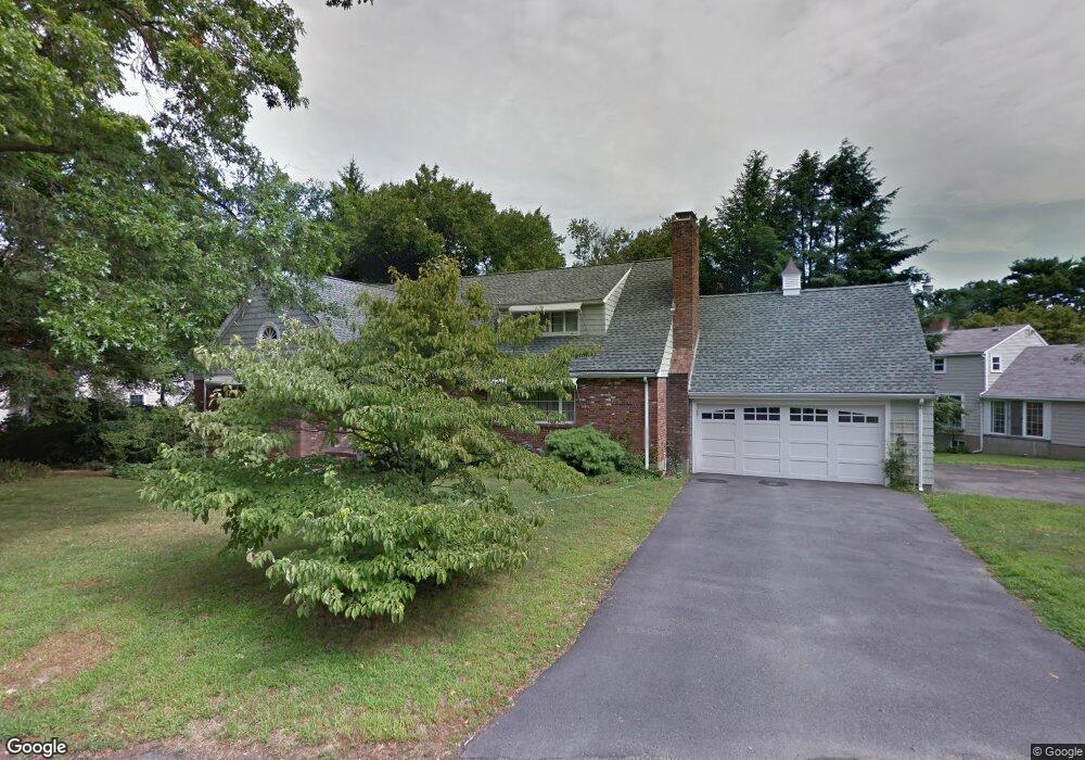
18 Dartmouth St Winchester, MA 01890
The Flats NeighborhoodEstimated Value: $2,810,000 - $3,072,000
3
Beds
5
Baths
5,611
Sq Ft
$517/Sq Ft
Est. Value
About This Home
This home is located at 18 Dartmouth St, Winchester, MA 01890 and is currently estimated at $2,901,851, approximately $517 per square foot. 18 Dartmouth St is a home located in Middlesex County with nearby schools including Vinson-Owen Elementary School, McCall Middle School, and Winchester High School.
Ownership History
Date
Name
Owned For
Owner Type
Purchase Details
Closed on
Feb 22, 2020
Sold by
Bing Oscar H
Bought by
Oscar H L Bing T
Current Estimated Value
Purchase Details
Closed on
May 23, 2013
Sold by
Bing Oscar H
Bought by
Bing Oscar H and Bing Barbara N
Purchase Details
Closed on
Nov 21, 1985
Bought by
Bing Oscar H and Bing Barbara N
Create a Home Valuation Report for This Property
The Home Valuation Report is an in-depth analysis detailing your home's value as well as a comparison with similar homes in the area
Home Values in the Area
Average Home Value in this Area
Purchase History
| Date | Buyer | Sale Price | Title Company |
|---|---|---|---|
| Oscar H L Bing T | -- | None Available | |
| Barbara Nelson Bing T | -- | None Available | |
| Bing Barbara N | -- | None Available | |
| Bing Oscar H | -- | None Available | |
| Bing Oscar H | -- | -- | |
| Bing Oscar H | $315,000 | -- |
Source: Public Records
Tax History Compared to Growth
Tax History
| Year | Tax Paid | Tax Assessment Tax Assessment Total Assessment is a certain percentage of the fair market value that is determined by local assessors to be the total taxable value of land and additions on the property. | Land | Improvement |
|---|---|---|---|---|
| 2025 | $252 | $2,272,800 | $1,526,000 | $746,800 |
| 2024 | $25,206 | $2,224,700 | $1,481,100 | $743,600 |
| 2023 | $24,791 | $2,100,900 | $1,391,300 | $709,600 |
| 2022 | $23,536 | $1,881,400 | $1,206,400 | $675,000 |
| 2021 | $22,204 | $1,730,600 | $1,055,600 | $675,000 |
| 2020 | $20,851 | $1,682,900 | $1,055,600 | $627,300 |
| 2019 | $17,506 | $1,445,600 | $926,400 | $519,200 |
| 2018 | $17,159 | $1,407,600 | $904,800 | $502,800 |
| 2017 | $16,342 | $1,330,800 | $860,600 | $470,200 |
| 2016 | $15,352 | $1,314,400 | $860,600 | $453,800 |
| 2015 | $14,404 | $1,186,500 | $782,000 | $404,500 |
| 2014 | $13,949 | $1,101,800 | $710,900 | $390,900 |
Source: Public Records
Map
Nearby Homes
- 44 Cabot St
- 32 Woodside Rd
- 89 Wildwood St
- 6 Ivy Cir
- 9 Norfolk Rd
- 1 Copley St
- 15 Wildwood St
- 6 Wyman Ct Unit 6
- 4 Wyman Ct Unit 4
- 149 Horn Pond Brook Rd
- 104 Church St
- 19 Glengarry Rd
- 10 Sheffield Rd
- 62 Richardson St
- 46 Church St
- 2 Everett Ave
- 666 Main St Unit 312
- 666 Main St Unit 305
- 7 Wainwright Rd Unit 118
- 36 Elmwood Ave Unit 2