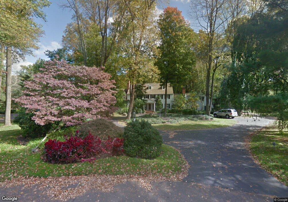
18 Devon Dr New Hope, PA 18938
Estimated Value: $1,625,471 - $2,628,000
5
Beds
3
Baths
5,876
Sq Ft
$370/Sq Ft
Est. Value
About This Home
This home is located at 18 Devon Dr, New Hope, PA 18938 and is currently estimated at $2,171,824, approximately $369 per square foot. 18 Devon Dr is a home located in Bucks County with nearby schools including Sol Feinstone Elementary School, Newtown Middle School, and Council Rock High School North.
Ownership History
Date
Name
Owned For
Owner Type
Purchase Details
Closed on
Apr 3, 2014
Sold by
Francht Joseph E and Francht Marjorie J
Bought by
Webster Charles F and Webster Susan
Current Estimated Value
Home Financials for this Owner
Home Financials are based on the most recent Mortgage that was taken out on this home.
Original Mortgage
$880,000
Outstanding Balance
$669,468
Interest Rate
4.36%
Mortgage Type
New Conventional
Estimated Equity
$1,502,356
Purchase Details
Closed on
Jul 10, 1998
Sold by
Fass Barry D and Fass Diana M
Bought by
Francht Joseph E and Francht Marjorie J
Create a Home Valuation Report for This Property
The Home Valuation Report is an in-depth analysis detailing your home's value as well as a comparison with similar homes in the area
Home Values in the Area
Average Home Value in this Area
Purchase History
| Date | Buyer | Sale Price | Title Company |
|---|---|---|---|
| Webster Charles F | $1,100,000 | None Available | |
| Francht Joseph E | $800,000 | -- |
Source: Public Records
Mortgage History
| Date | Status | Borrower | Loan Amount |
|---|---|---|---|
| Open | Webster Charles F | $880,000 |
Source: Public Records
Tax History
| Year | Tax Paid | Tax Assessment Tax Assessment Total Assessment is a certain percentage of the fair market value that is determined by local assessors to be the total taxable value of land and additions on the property. | Land | Improvement |
|---|---|---|---|---|
| 2025 | $21,911 | $128,090 | $15,480 | $112,610 |
| 2024 | $21,911 | $128,090 | $15,480 | $112,610 |
| 2023 | $21,310 | $128,090 | $15,480 | $112,610 |
| 2022 | $21,200 | $128,090 | $15,480 | $112,610 |
| 2021 | $20,913 | $128,090 | $15,480 | $112,610 |
| 2020 | $20,412 | $128,090 | $15,480 | $112,610 |
| 2019 | $19,938 | $128,090 | $15,480 | $112,610 |
| 2018 | $19,567 | $128,090 | $15,480 | $112,610 |
| 2017 | $19,031 | $128,090 | $15,480 | $112,610 |
| 2016 | $19,319 | $128,090 | $15,480 | $112,610 |
| 2015 | -- | $128,090 | $15,480 | $112,610 |
| 2014 | -- | $128,090 | $15,480 | $112,610 |
Source: Public Records
Map
Nearby Homes
- 14 Devon Dr
- 1324 River Rd
- 1556- 1556A River Rd
- 1556 River Rd
- 10 Bailey Dr
- 1486 River Rd
- 38 Lenape Dr
- 1470 River Rd
- 62 Woodside Ln
- 63 Woodside Ln
- 108 Beaumont Dr
- 1596 River Rd
- 47 Bowmans Dr Unit W
- 98 Mcconkey Dr
- 104 Dispatch Dr Unit 28A
- 1789 Wrightstown Rd
- 1112 General Saint Claire Rd
- 1659 Wrightstown Rd
- 6 Mount View Ct
- 1066 Washington Crossing Rd
- 11 Devon Dr
- 12 Devon Dr
- 9 Devon Dr
- 0 Jonathan Way Unit 1007575144
- 0 Jonathan Way Unit 1007412610
- 0 Jonathan Way Unit 1004439263
- 0 Jonathan Way
- 0 Jonathan Way Unit 1000243051
- 7 Devon Dr
- 10 Devon Dr
- 1291 River Rd
- 36 Jericho Run
- 10 W Bridlewood Dr
- 8 Devon Dr
- 5 Devon Dr
- 1295 River Rd
- 35 Jonathan Way
- 1312 River Rd
- 1299 River Rd
- 1279 River Rd
Your Personal Tour Guide
Ask me questions while you tour the home.