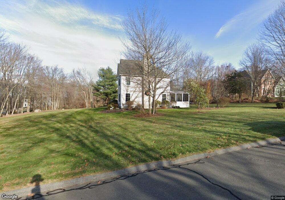
18 Farmstead Ln Coventry, CT 06238
Estimated Value: $649,000 - $873,000
3
Beds
3
Baths
2,865
Sq Ft
$251/Sq Ft
Est. Value
About This Home
This home is located at 18 Farmstead Ln, Coventry, CT 06238 and is currently estimated at $720,432, approximately $251 per square foot. 18 Farmstead Ln is a home located in Tolland County with nearby schools including George Hersey Robertson School, Coventry Grammar School, and Capt. Nathan Hale School.
Ownership History
Date
Name
Owned For
Owner Type
Purchase Details
Closed on
Jul 12, 2013
Sold by
Hattan Brian S
Bought by
Hattan Sarah J
Current Estimated Value
Home Financials for this Owner
Home Financials are based on the most recent Mortgage that was taken out on this home.
Original Mortgage
$245,000
Outstanding Balance
$175,053
Interest Rate
3.59%
Mortgage Type
New Conventional
Estimated Equity
$545,379
Purchase Details
Closed on
Jul 9, 2013
Sold by
Hattan Sarah J
Bought by
Hattan Sarah J and Hattan Brian S
Home Financials for this Owner
Home Financials are based on the most recent Mortgage that was taken out on this home.
Original Mortgage
$245,000
Outstanding Balance
$175,053
Interest Rate
3.59%
Mortgage Type
New Conventional
Estimated Equity
$545,379
Purchase Details
Closed on
Jul 24, 2012
Sold by
Hattan Brian S
Bought by
Hattan Sarah J
Purchase Details
Closed on
May 17, 2004
Sold by
Nordic Bldrs Tolland L
Bought by
Hattan Brian and Hattan Sarah
Create a Home Valuation Report for This Property
The Home Valuation Report is an in-depth analysis detailing your home's value as well as a comparison with similar homes in the area
Home Values in the Area
Average Home Value in this Area
Purchase History
| Date | Buyer | Sale Price | Title Company |
|---|---|---|---|
| Hattan Sarah J | -- | -- | |
| Hattan Sarah J | -- | -- | |
| Hattan Sarah J | -- | -- | |
| Hattan Brian | $379,000 | -- | |
| Hattan Sarah J | -- | -- | |
| Hattan Sarah J | -- | -- | |
| Hattan Sarah J | -- | -- | |
| Hattan Brian | $379,000 | -- |
Source: Public Records
Mortgage History
| Date | Status | Borrower | Loan Amount |
|---|---|---|---|
| Open | Hattan Brian | $245,000 | |
| Closed | Hattan Brian | $245,000 |
Source: Public Records
Tax History Compared to Growth
Tax History
| Year | Tax Paid | Tax Assessment Tax Assessment Total Assessment is a certain percentage of the fair market value that is determined by local assessors to be the total taxable value of land and additions on the property. | Land | Improvement |
|---|---|---|---|---|
| 2025 | $10,184 | $428,600 | $86,300 | $342,300 |
| 2024 | $8,777 | $263,500 | $70,100 | $193,400 |
| 2023 | $8,363 | $263,500 | $70,100 | $193,400 |
| 2022 | $8,208 | $263,500 | $70,100 | $193,400 |
| 2021 | $8,208 | $263,500 | $70,100 | $193,400 |
| 2020 | $8,213 | $263,500 | $70,100 | $193,400 |
| 2019 | $8,494 | $263,800 | $70,100 | $193,700 |
| 2018 | $8,736 | $271,300 | $77,400 | $193,900 |
| 2017 | $8,582 | $268,200 | $77,400 | $190,800 |
| 2016 | $8,368 | $268,200 | $77,400 | $190,800 |
| 2015 | $8,368 | $268,200 | $77,400 | $190,800 |
| 2014 | $8,068 | $283,400 | $76,400 | $207,000 |
Source: Public Records
Map
Nearby Homes
- 262 Cooper Ln
- 152 Cheney Ln
- 36 Cooper Ln
- 220 Buena Vista Rd
- 141 Brigham Tavern Rd
- 360 Sam Green Rd
- 59 Woodland Rd
- 1365 Main St
- 94 Stonehouse Rd Unit 10
- 30 Knollwood Dr
- 367 Riley Mountain Rd
- 131 Lakewood Dr
- 48 Lakeview Dr
- 198 Forest Rd
- 39 Wood Trail
- 122 High St
- 83 Morin Ave
- 864 Boston Turnpike
- 1902 South St
- 35 Birch Trail
- 22 Farmstead Ln
- 17 Farmstead Ln
- 89 Windswept Way
- 103 Windswept Way
- 75 Windswept Way
- 34 Farmstead Ln
- 39 Farmstead Ln
- 59 Windswept Way
- 50 Windswept Way
- 115 Windswept Way
- 127 Windswept Way
- 47 Windswept Way
- 36 Windswept Way
- 37 Windswept Way
- 85 Lewis Hill Rd
- 99 Lewis Hill Rd
- 93 Lewis Hill Rd
- 51 Lewis Hill Rd
- 81 Lewis Hill Rd
- 22 Windswept Way