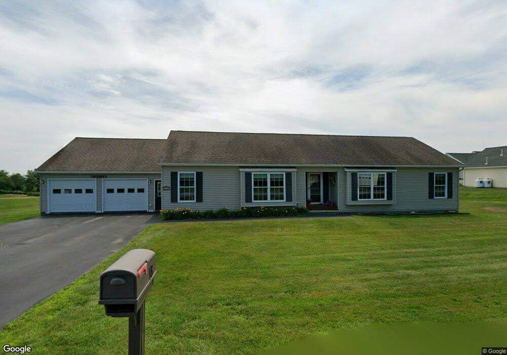
18 Fieldstone Dr Oakland, ME 04963
Estimated Value: $352,970 - $469,000
3
Beds
3
Baths
1,736
Sq Ft
$243/Sq Ft
Est. Value
About This Home
This home is located at 18 Fieldstone Dr, Oakland, ME 04963 and is currently estimated at $420,993, approximately $242 per square foot. 18 Fieldstone Dr is a home with nearby schools including Ralph M. Atwood Primary School, China Primary School, and Williams Elementary School.
Ownership History
Date
Name
Owned For
Owner Type
Purchase Details
Closed on
Sep 2, 2008
Sold by
Fieldstone Landing Llc
Bought by
Lacount Donald M and Lacount Barbara G
Current Estimated Value
Home Financials for this Owner
Home Financials are based on the most recent Mortgage that was taken out on this home.
Original Mortgage
$135,000
Outstanding Balance
$88,799
Interest Rate
6.29%
Mortgage Type
Commercial
Estimated Equity
$332,194
Create a Home Valuation Report for This Property
The Home Valuation Report is an in-depth analysis detailing your home's value as well as a comparison with similar homes in the area
Home Values in the Area
Average Home Value in this Area
Purchase History
| Date | Buyer | Sale Price | Title Company |
|---|---|---|---|
| Lacount Donald M | -- | -- |
Source: Public Records
Mortgage History
| Date | Status | Borrower | Loan Amount |
|---|---|---|---|
| Open | Lacount Donald M | $135,000 |
Source: Public Records
Tax History Compared to Growth
Tax History
| Year | Tax Paid | Tax Assessment Tax Assessment Total Assessment is a certain percentage of the fair market value that is determined by local assessors to be the total taxable value of land and additions on the property. | Land | Improvement |
|---|---|---|---|---|
| 2024 | $4,116 | $281,500 | $44,800 | $236,700 |
| 2023 | $3,609 | $250,600 | $44,800 | $205,800 |
| 2022 | $3,650 | $212,200 | $40,700 | $171,500 |
| 2021 | $3,480 | $212,200 | $40,700 | $171,500 |
| 2020 | $3,480 | $212,200 | $40,700 | $171,500 |
| 2019 | $3,480 | $212,200 | $40,700 | $171,500 |
| 2018 | $3,480 | $212,200 | $40,700 | $171,500 |
| 2017 | $3,480 | $212,200 | $40,700 | $171,500 |
| 2016 | $3,289 | $212,200 | $40,700 | $171,500 |
| 2015 | $3,204 | $212,200 | $40,700 | $171,500 |
| 2013 | $2,928 | $212,200 | $40,700 | $171,500 |
Source: Public Records
Map
Nearby Homes
- 35 Meadow Dr
- Lot 5 Oak Forest Dr
- Lot 2 Oak Forest Dr
- Lot 10 Brodies Path
- 115 Airport Rd
- Lot 9 Brodies Path
- Lot 8 Brodies Path
- 18 Village Green Cir
- 13 Junipers Ln Unit 6
- 851 Lincoln St
- 103 S Alpine St
- 27 Water St
- 1 Bowie Ln
- 13 Lincoln Woods Ln
- 38 Webb Rd
- 11 Church St
- 28 Webb Rd
- 111 Evergreen Dr
- 18 Belgrade Rd
- 30 Village Green Rd
- 16 Fieldstone Dr
- 20 Fieldstone Dr
- 17 Fieldstone Dr
- 15 Fieldstone Dr
- 13 Fieldstone Dr
- 19 Fieldstone Dr
- 22 Fieldstone Dr
- 21 Fieldstone Dr
- 14 Fieldstone Dr
- 24 Fieldstone Dr
- 11 Fieldstone Dr
- 12 Fieldstone Dr
- 12 Fieldstone Dr
- 3 Fieldstone Dr
- 23 Fieldstone Dr
- 9 Fieldstone Dr
- 25 Fieldstone Dr
- 10 Fieldstone Dr
- 26 Fieldstone Dr
- 7 Fieldstone Dr