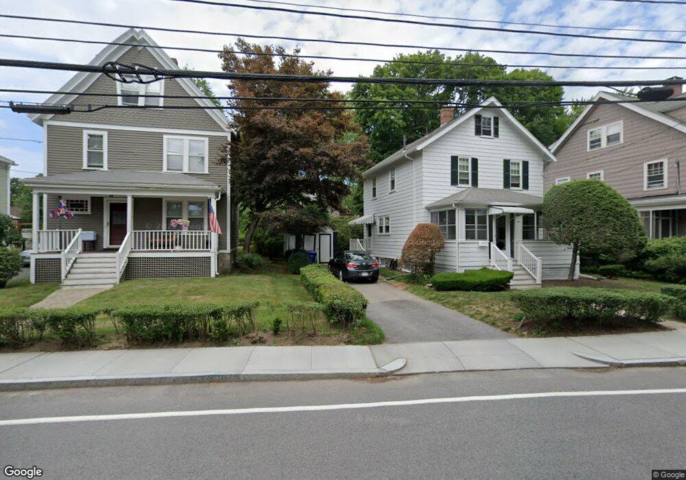
18 Glenland Rd Unit 2 Chestnut Hill, MA 02467
Chestnut Hill NeighborhoodEstimated Value: $842,934 - $956,000
2
Beds
2
Baths
1,050
Sq Ft
$877/Sq Ft
Est. Value
About This Home
This home is located at 18 Glenland Rd Unit 2, Chestnut Hill, MA 02467 and is currently estimated at $920,734, approximately $876 per square foot. 18 Glenland Rd Unit 2 is a home located in Norfolk County with nearby schools including Baker School, Brimmer & May School, and The Chestnut Hill School.
Ownership History
Date
Name
Owned For
Owner Type
Purchase Details
Closed on
Aug 1, 2000
Sold by
Downey Nancy E
Bought by
Rupert Timothy
Current Estimated Value
Home Financials for this Owner
Home Financials are based on the most recent Mortgage that was taken out on this home.
Original Mortgage
$252,700
Outstanding Balance
$91,367
Interest Rate
8.18%
Mortgage Type
Purchase Money Mortgage
Estimated Equity
$829,367
Purchase Details
Closed on
Apr 16, 1998
Sold by
Schwulst Carolyn
Bought by
Downey Nancy E
Home Financials for this Owner
Home Financials are based on the most recent Mortgage that was taken out on this home.
Original Mortgage
$75,200
Interest Rate
7.11%
Mortgage Type
Purchase Money Mortgage
Purchase Details
Closed on
Sep 22, 1997
Sold by
Bernstein Leonard
Bought by
Schwulst Carolyn
Create a Home Valuation Report for This Property
The Home Valuation Report is an in-depth analysis detailing your home's value as well as a comparison with similar homes in the area
Home Values in the Area
Average Home Value in this Area
Purchase History
| Date | Buyer | Sale Price | Title Company |
|---|---|---|---|
| Rupert Timothy | $322,000 | -- | |
| Downey Nancy E | $230,000 | -- | |
| Schwulst Carolyn | $215,000 | -- |
Source: Public Records
Mortgage History
| Date | Status | Borrower | Loan Amount |
|---|---|---|---|
| Open | Schwulst Carolyn | $252,700 | |
| Previous Owner | Schwulst Carolyn | $50,000 | |
| Previous Owner | Schwulst Carolyn | $75,200 |
Source: Public Records
Tax History Compared to Growth
Tax History
| Year | Tax Paid | Tax Assessment Tax Assessment Total Assessment is a certain percentage of the fair market value that is determined by local assessors to be the total taxable value of land and additions on the property. | Land | Improvement |
|---|---|---|---|---|
| 2025 | $8,375 | $848,500 | $0 | $848,500 |
| 2024 | $8,128 | $831,900 | $0 | $831,900 |
| 2023 | $7,816 | $784,000 | $0 | $784,000 |
| 2022 | $7,757 | $761,200 | $0 | $761,200 |
| 2021 | $7,386 | $753,700 | $0 | $753,700 |
| 2020 | $7,052 | $746,200 | $0 | $746,200 |
| 2019 | $6,659 | $710,700 | $0 | $710,700 |
| 2018 | $6,403 | $676,900 | $0 | $676,900 |
| 2017 | $6,192 | $626,700 | $0 | $626,700 |
| 2016 | $5,936 | $569,700 | $0 | $569,700 |
| 2015 | $5,531 | $517,900 | $0 | $517,900 |
| 2014 | $5,545 | $486,800 | $0 | $486,800 |
Source: Public Records
Map
Nearby Homes
- 15 Glenland Rd
- 11 Hammond Pond Pkwy Unit 3
- 321 Hammond Pond Pkwy Unit 103
- 321 Hammond Pond Pkwy Unit 301
- 33 Hammond Pond Pkwy Unit 2
- 771 Heath St Unit 771
- 809-811 Heath St Unit 811
- 799 Heath St Unit 2
- 811 Heath St
- 5 Heathwood Ln
- 3 Glenoe Rd
- 280 Boylston St Unit 203
- 280 Boylston St Unit 905
- 280 Boylston St Unit 710
- 280 Boylston St Unit 908
- 280 Boylston St Unit 415
- 280 Boylston St Unit 511
- 0 Glenoe Rd
- 80 Louise Rd Unit 82
- 250 Hammond Pond Pkwy Unit 1604N
- 18 Glenland Rd Unit 3
- 18 Glenland Rd Unit 1
- 18 Glenland Rd
- 12 Glenland Rd
- 12 Glenland Rd
- 12 Glenland Rd Unit 1
- 25 Glenland Rd
- 33 Glenland Rd
- 33 Glenland Rd Unit 2
- 33 Glenland Rd Unit 1
- 33 Glenland Rd
- 21 Glenland Rd
- 21 Glenland Rd Unit B
- 21 Glenland Rd Unit 2
- 21 Glenland Rd Unit 1
- 709 Heath St
- 711 Heath St
- 36 Glenland Rd
- 717 Heath St
- 721 Heath St