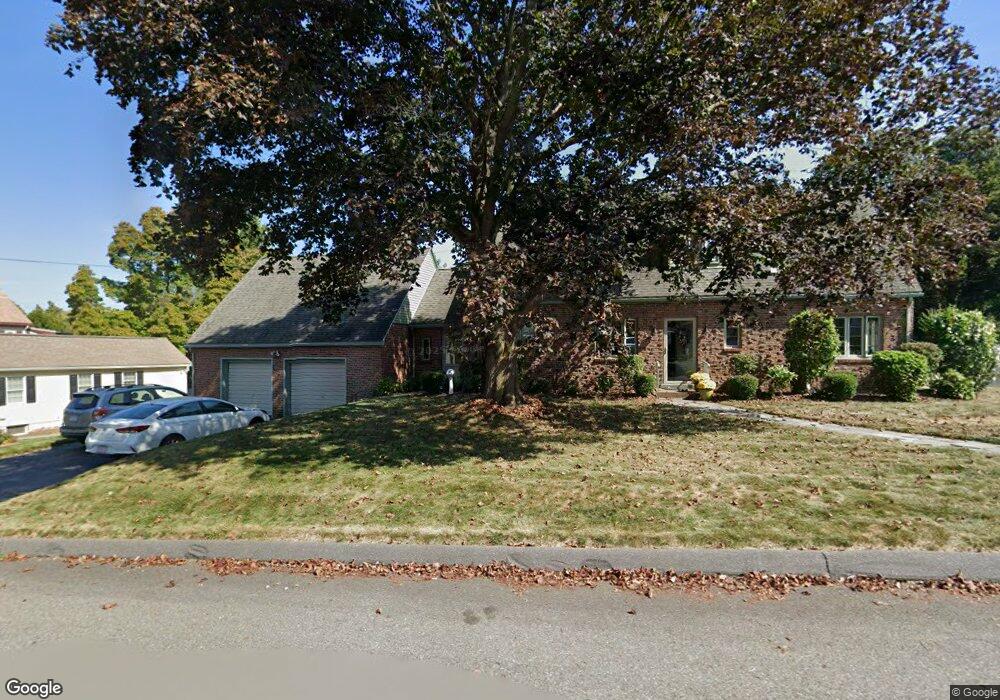
18 Granville St Holyoke, MA 01040
Estimated Value: $343,000 - $385,000
4
Beds
2
Baths
1,746
Sq Ft
$212/Sq Ft
Est. Value
About This Home
This home is located at 18 Granville St, Holyoke, MA 01040 and is currently estimated at $369,689, approximately $211 per square foot. 18 Granville St is a home located in Hampden County with nearby schools including Lt. Elmer J. McMahon Elementary School, Holyoke High School, and First Lutheran Christian School.
Ownership History
Date
Name
Owned For
Owner Type
Purchase Details
Closed on
Jan 29, 2019
Sold by
Lafrennie Martin W and Lafrennie Pamela
Bought by
Digiovanni Nicolle and Poteran Natalie
Current Estimated Value
Purchase Details
Closed on
Apr 8, 1987
Sold by
Eichhorn Clara H
Bought by
Lafrennie Martin W
Create a Home Valuation Report for This Property
The Home Valuation Report is an in-depth analysis detailing your home's value as well as a comparison with similar homes in the area
Home Values in the Area
Average Home Value in this Area
Purchase History
| Date | Buyer | Sale Price | Title Company |
|---|---|---|---|
| Digiovanni Nicolle | -- | -- | |
| Lafrennie Martin W | $149,900 | -- |
Source: Public Records
Mortgage History
| Date | Status | Borrower | Loan Amount |
|---|---|---|---|
| Previous Owner | Lafrennie Martin W | $10,000 | |
| Previous Owner | Lafrennie Martin W | $55,000 | |
| Previous Owner | Lafrennie Martin W | $30,000 | |
| Previous Owner | Lafrennie Martin W | $70,000 |
Source: Public Records
Tax History Compared to Growth
Tax History
| Year | Tax Paid | Tax Assessment Tax Assessment Total Assessment is a certain percentage of the fair market value that is determined by local assessors to be the total taxable value of land and additions on the property. | Land | Improvement |
|---|---|---|---|---|
| 2025 | $6,176 | $353,700 | $62,100 | $291,600 |
| 2024 | $5,890 | $310,800 | $59,200 | $251,600 |
| 2023 | $5,609 | $299,000 | $59,200 | $239,800 |
| 2022 | $5,410 | $280,900 | $59,200 | $221,700 |
| 2021 | $5,141 | $266,800 | $56,700 | $210,100 |
| 2020 | $6,555 | $251,400 | $56,700 | $194,700 |
| 2019 | $4,782 | $247,900 | $56,700 | $191,200 |
| 2018 | $4,553 | $238,000 | $56,700 | $181,300 |
| 2017 | $4,562 | $238,000 | $56,700 | $181,300 |
| 2016 | $4,478 | $234,200 | $58,500 | $175,700 |
| 2015 | $4,459 | $234,200 | $58,500 | $175,700 |
Source: Public Records
Map
Nearby Homes
- 128 Ontario Ave
- 155 Huron Ave
- 34 Maple Crest Cir Unit D
- 15 Maple Crest Cir Unit D
- 33 Maple Crest Cir Unit D
- 244 Ontario Ave
- 286 Westfield Rd
- 7 Vermont St
- 43 King St
- 78 Hitchcock St
- 85 Woodland St
- 84 Woodland St
- 70-72 Westfield Rd
- 46 Cherry Hill
- 9-11 Oakwood Ave
- Lot A Homestead Ave
- 25 W Glen St
- 695 Homestead Ave
- 1793 Northampton St
- 56 Laurel St
- 32 Granville St
- 8 Granville St
- 25 Granville St
- 11 Granville St
- 4 Granville St
- 3 Granville St
- 35 Granville St
- 224 Homestead Ave
- Lots 1 & 2 Granville St
- 42 Granville St
- 216 Homestead Ave
- 0 Granville St
- 8 Ogden St
- 8 Ogden St Unit D
- 41 Elmore St
- 41 Granville St
- 24 Fenton St
- 11 Rugby St
- 206 Homestead Ave
- 35 Fenton St